Property Record
2405 Westfield St, West Springfield, MA 01089


NEARBY LISTINGS FOR SALE OR LEASE
Property Detail
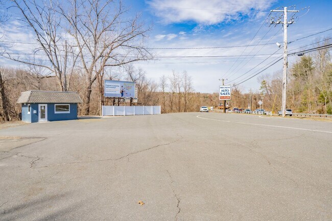
2405 Westfield St
WSPR-000394-015860-V000000
Hampden
Autorepair
Massachusetts
AE
v
25013C0381E
0.43 AC
2025
Hampden County
2025
Hartford
812401
Springfield, MA
342 SF
DEMOGRAPHICS near 2405 Westfield St
1 Mile
3 Mile
5 Mile
2024 Total Population
3,240
37,268
113,550
2029 Population
3,186
36,654
111,338
Pop Growth 2024-2029
(1.67%)
(1.65%)
(1.95%)
Average Age
43
42
41
2024 Total Households
1,251
15,025
47,312
HH Growth 2024-2029
(1.68%)
(1.71%)
(1.98%)
Median Household Inc
$111,590
$87,507
$63,066
Avg Household Size
2.50
2.40
2.30
2024 Avg HH Vehicles
2.00
2.00
2.00
Median Home Value
$276,593
$284,143
$270,196
Median Year Built
1957
1962
1960
Nearby Places
Map Layers
Map Styles
 Street
 Aerial
- Restaurants
- Banks
- Shops
- Fitness
- Groceries
PUBLIC TRANSPORTATION
COMMUTER RAIL
Springfield (Amtrak Hartford Line - Amtrak, Hartford Line - Amtrak, Lake Shore Limited - Amtrak, Northeast Regional - Amtrak, Valley Flyer - Amtrak, Vermonter - Amtrak)
DRIVE
WALK
Distance
Springfield (Amtrak Hartford Line - Amtrak, Hartford Line - Amtrak, Lake Shore Limited - Amtrak, Northeast Regional - Amtrak, Valley Flyer - Amtrak, Vermonter - Amtrak)
10 min
5.2 mi
Holyoke Amtrak (Valley Flyer - Amtrak, Vermonter - Amtrak)
DRIVE
WALK
Distance
Holyoke Amtrak (Valley Flyer - Amtrak, Vermonter - Amtrak)
19 min
9.9 mi
AIRPORT
Bradley International
DRIVE
WALK
Distance
Bradley International
36 min
15.2 mi
Freight Ports
Port of New Haven
DRIVE
WALK
Distance
Port of New Haven
92 min
69.4 mi
SALE & LEASE HISTORY
LISTING DATE
SALE/LEASE

May 20, 2020
For Sale
Aug 13, 2019
For Sale
Apr 12, 2019
For Lease
Nearby Properties
Address
Land Use
TOTAL SIZE
Lot Size
Zoning
Address
Land Use
TOTAL SIZE
Lot Size
Zoning
257,525 SF
64.03 AC
Address
Land Use
TOTAL SIZE
Lot Size
Zoning
236,032 SF
41.65 AC
RA2
Address
Land Use
TOTAL SIZE
Lot Size
Zoning
16.48 AC
Address
Land Use
TOTAL SIZE
Lot Size
Zoning
128,877 SF
28.75 AC
Address
Land Use
TOTAL SIZE
Lot Size
Zoning
133,822 SF
40.51 AC
RA2
Address
Land Use
TOTAL SIZE
Lot Size
Zoning
2,022 SF
33.70 AC
AG
Address
Land Use
TOTAL SIZE
Lot Size
Zoning
180,130 SF
90.75 AC
Address
Land Use
TOTAL SIZE
Lot Size
Zoning
1,992 SF
185 AC
Address
Land Use
TOTAL SIZE
Lot Size
Zoning
15,696 SF
0.47 AC
Address
Land Use
TOTAL SIZE
Lot Size
Zoning
Address
Land Use
TOTAL SIZE
Lot Size
Zoning
91,224 SF
4.54 AC
Address
Land Use
TOTAL SIZE
Lot Size
Zoning
811.20 AC
RA2
Address
Land Use
TOTAL SIZE
Lot Size
Zoning
63,770 SF
18.22 AC
Address
Land Use
TOTAL SIZE
Lot Size
Zoning
63,580 SF
4.90 AC
Address
Land Use
TOTAL SIZE
Lot Size
Zoning
2.60 AC
Address
Land Use
TOTAL SIZE
Lot Size
Zoning
77,453 SF
1.86 AC
Address
Land Use
TOTAL SIZE
Lot Size
Zoning
113,406 SF
23.30 AC
Address
Land Use
TOTAL SIZE
Lot Size
Zoning
14.78 AC
Address
Land Use
TOTAL SIZE
Lot Size
Zoning
6.73 AC
BA
Address
Land Use
TOTAL SIZE
Lot Size
Zoning
18,582 SF
3.60 AC
Address
Land Use
TOTAL SIZE
Lot Size
Zoning
67,046 SF
11.63 AC
BA
Address
Land Use
TOTAL SIZE
Lot Size
Zoning
43,582 SF
4.39 AC
BA
Address
Land Use
TOTAL SIZE
Lot Size
Zoning
38.59 AC
RA2
Address
Land Use
TOTAL SIZE
Lot Size
Zoning
2.70 AC
RB
Address
Land Use
TOTAL SIZE
Lot Size
Zoning
26,724 SF
1.34 AC
Address
Land Use
TOTAL SIZE
Lot Size
Zoning
8.85 AC
RA2
Address
Land Use
TOTAL SIZE
Lot Size
Zoning
5,396 SF
329.20 AC
Address
Land Use
TOTAL SIZE
Lot Size
Zoning
5,400 SF
0.04 AC
Address
Land Use
TOTAL SIZE
Lot Size
Zoning
50,374 SF
15.89 AC
Address
Land Use
TOTAL SIZE
Lot Size
Zoning
4,615 SF
4.59 AC
BA
The World's #1 Commercial Real Estate Marketplace
Connect with us
© 2025 CoStar Group
The information above has been obtained from sources believed reliable. While we do not doubt its accuracy we have not verified it and make no guarantee, warranty or representation about it. It is your responsibility to independently confirm its accuracy and completeness. Any projections, opinions, assumptions, or estimates used are for example only and do not represent the current or future performance of the property. The value of this transaction to you depends on tax and other factors which should be evaluated by your tax, financial, and legal advisors. You and your advisors should conduct a careful, independent investigation of the property to determine to your satisfaction the suitability of the property for your needs.