Property Record
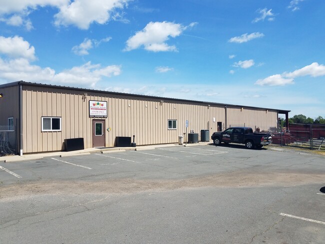
24050 Youngwood Ln, Aldie, VA 20105


NEARBY LISTINGS FOR SALE OR LEASE
Property Detail
24050 Youngwood Ln
Washington-Arlington-Alexandria, DC-VA-MD-WV
Evergreen
203-47-9574
EVERGREEN MEADOWS SEC.4 LOT 27 202310190041997/8P ST.DEDD 200402100012414
Warehouse
Loudoun
X
Virginia
51107C0360E
27
2025
11.19 AC
2025
Outlying Loudoun
611812
Washington, DC
7,500 SF
DEMOGRAPHICS near 24050 Youngwood Ln
1 Mile
3 Mile
5 Mile
2024 Total Population
3,676
77,512
139,771
2029 Population
4,015
84,233
151,329
Pop Growth 2024-2029
+ 9.22%
+ 8.67%
+ 8.27%
Average Age
32
34
34
2024 Total Households
1,052
23,436
42,567
HH Growth 2024-2029
+ 9.41%
+ 8.78%
+ 8.46%
Median Household Inc
$198,445
$190,177
$185,425
Avg Household Size
3.40
3.30
3.30
2024 Avg HH Vehicles
2.00
2.00
2.00
Median Home Value
$827,629
$737,323
$736,298
Median Year Built
2011
2010
2010
Nearby Places
Map Layers
Map Styles
 Street
 Aerial
- Restaurants
- Banks
- Shops
- Fitness
- Groceries
PUBLIC TRANSPORTATION
AIRPORT
Washington Dulles International
DRIVE
WALK
Distance
Washington Dulles International
25 min
11.4 mi
Ronald Reagan Washington Ntl
DRIVE
WALK
Distance
Ronald Reagan Washington Ntl
56 min
34.8 mi
SALE & LEASE HISTORY
LISTING DATE
SALE/LEASE

Jun 01, 2020
For Lease
Nearby Properties
Address
Land Use
TOTAL SIZE
Lot Size
Zoning
Address
Land Use
TOTAL SIZE
Lot Size
Zoning
536,602 SF
117.49 AC
TR3UBF
Address
Land Use
TOTAL SIZE
Lot Size
Zoning
415,477 SF
97.76 AC
TR1UBF
Address
Land Use
TOTAL SIZE
Lot Size
Zoning
222,313 SF
36.21 AC
PDOP
Address
Land Use
TOTAL SIZE
Lot Size
Zoning
422,597 SF
85.43 AC
TR3UBF
Address
Land Use
TOTAL SIZE
Lot Size
Zoning
48.30 AC
PDIP
Address
Land Use
TOTAL SIZE
Lot Size
Zoning
59.20 AC
IP
Address
Land Use
TOTAL SIZE
Lot Size
Zoning
181,718 SF
10.23 AC
R16
Address
Land Use
TOTAL SIZE
Lot Size
Zoning
303,168 SF
41.95 AC
PDCCRC
Address
Land Use
TOTAL SIZE
Lot Size
Zoning
259,361 SF
65.01 AC
PDH4
Address
Land Use
TOTAL SIZE
Lot Size
Zoning
264,902 SF
60.25 AC
PDH4
Address
Land Use
TOTAL SIZE
Lot Size
Zoning
54 AC
PDTC
Address
Land Use
TOTAL SIZE
Lot Size
Zoning
192,413 SF
30.38 AC
TR3UBF
Address
Land Use
TOTAL SIZE
Lot Size
Zoning
39.89 AC
PDGI
Address
Land Use
TOTAL SIZE
Lot Size
Zoning
128,948 SF
11.16 AC
PDH4
Address
Land Use
TOTAL SIZE
Lot Size
Zoning
126,263 SF
9.09 AC
PDH4
Address
Land Use
TOTAL SIZE
Lot Size
Zoning
107,378 SF
16.86 AC
PDH4
Address
Land Use
TOTAL SIZE
Lot Size
Zoning
169,872 SF
33.51 AC
PDH4
Address
Land Use
TOTAL SIZE
Lot Size
Zoning
72.66 AC
PDAAAR
Address
Land Use
TOTAL SIZE
Lot Size
Zoning
108,231 SF
26.10 AC
PDH4
Address
Land Use
TOTAL SIZE
Lot Size
Zoning
108,037 SF
18.49 AC
PDCCSC
Address
Land Use
TOTAL SIZE
Lot Size
Zoning
241,429 SF
9.03 AC
PDH4
Address
Land Use
TOTAL SIZE
Lot Size
Zoning
157,520 SF
29.91 AC
PDH4
Address
Land Use
TOTAL SIZE
Lot Size
Zoning
83,185 SF
10.03 AC
PDH4
Address
Land Use
TOTAL SIZE
Lot Size
Zoning
20,578 SF
256.12 AC
TR3UBF
Address
Land Use
TOTAL SIZE
Lot Size
Zoning
94,856 SF
21.29 AC
PDH4
Address
Land Use
TOTAL SIZE
Lot Size
Zoning
167,044 SF
6.54 AC
R16
Address
Land Use
TOTAL SIZE
Lot Size
Zoning
98,876 SF
83.08 AC
PDGI
The World's #1 Commercial Real Estate Marketplace
Connect with us
© 2026 CoStar Group
The information above has been obtained from sources believed reliable. While we do not doubt its accuracy we have not verified it and make no guarantee, warranty or representation about it. It is your responsibility to independently confirm its accuracy and completeness. Any projections, opinions, assumptions, or estimates used are for example only and do not represent the current or future performance of the property. The value of this transaction to you depends on tax and other factors which should be evaluated by your tax, financial, and legal advisors. You and your advisors should conduct a careful, independent investigation of the property to determine to your satisfaction the suitability of the property for your needs.