Property Record
2406 S Ingram Mill Rd, Springfield, MO 65804
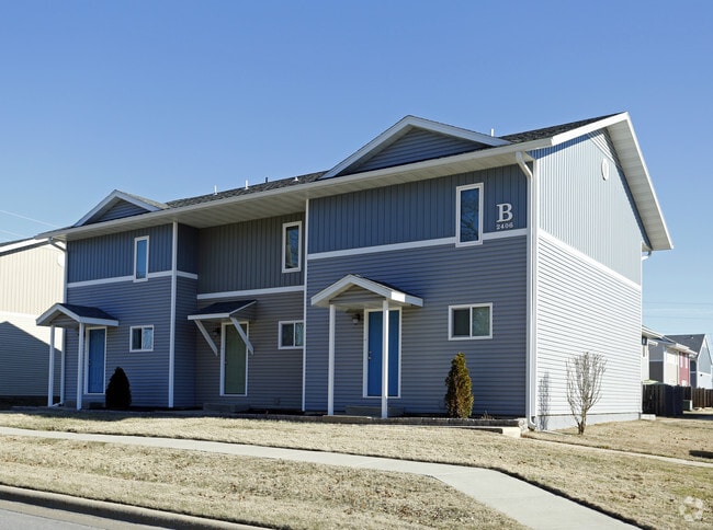

Property Detail
2406 S Ingram Mill Rd
12-34-302-008
5A M/L BEG 30 FT E NW COR SW1/4 SW1/4 34/29/21 E 358.19 FT S 581 FT W 117.67 FTS 85 FT W 123 FT N 140 FT W 119 FT N TO B EG
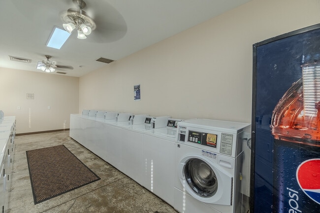
Apartment
Greene
INC
Missouri
B and X Area of moderate flood hazard, usually the area between the limits of the 100-year and 500-year floods.
5 AC
2025
Southern Hills
2025
Springfield
002502
Springfield, MO
95,896 SF
NEARBY LISTINGS FOR SALE OR LEASE
DEMOGRAPHICS near 2406 S Ingram Mill Rd
1 mile
3 mile
5 mile
2025 Total Population
7,528
47,418
120,503
2030 Population
7,640
48,427
123,356
Pop Growth 2025-2030
+ 1.49%
+ 2.13%
+ 2.37%
Average Age
41
42
40
2025 Total Households
3,528
21,769
54,621
HH Growth 2025-2030
+ 1.59%
+ 2.26%
+ 2.54%
Median Household Inc
$54,400
$62,909
$55,391
Avg Household Size
2.10
2.10
2.00
2025 Avg HH Vehicles
2.00
2.00
2.00
Median Home Value
$311,514
$268,794
$248,996
Median Year Built
1980
1976
1977
Nearby Places
Map Layers
Map Styles
 Street
 Aerial
Transit
 Traffic
 Biking
Places
Listings with unknown addresses are not visible on the map
- Restaurants
- Banks
- Shops
- Fitness
- Groceries
PUBLIC TRANSPORTATION
AIRPORT
Springfield-Branson Ntl
Drive
Walk
Distance
Springfield-Branson Ntl
30 min
18.8 mi
Freight Ports
Tulsa Port of Inola
Drive
Walk
Distance
Tulsa Port of Inola
201 min
179.2 mi
Nearby Properties
Address
Land Use
TOTAL SIZE
Lot Size
Zoning
Address
Land Use
TOTAL SIZE
Lot Size
Zoning
2,981,315 SF
76.43 AC
INC
Address
Land Use
TOTAL SIZE
Lot Size
Zoning
343,758 SF
29.81 AC
INC
Address
Land Use
TOTAL SIZE
Lot Size
Zoning
15.46 AC
Address
Land Use
TOTAL SIZE
Lot Size
Zoning
299,725 SF
18.80 AC
INC
Address
Land Use
TOTAL SIZE
Lot Size
Zoning
376,072 SF
17.67 AC
INC
Address
Land Use
TOTAL SIZE
Lot Size
Zoning
210,374 SF
24.37 AC
INC
Address
Land Use
TOTAL SIZE
Lot Size
Zoning
15.46 AC
INC.
Address
Land Use
TOTAL SIZE
Lot Size
Zoning
779,221 SF
45.03 AC
INC
Address
Land Use
TOTAL SIZE
Lot Size
Zoning
2.31 AC
INC
Address
Land Use
TOTAL SIZE
Lot Size
Zoning
18.35 AC
Address
Land Use
TOTAL SIZE
Lot Size
Zoning
224,730 SF
19.99 AC
INC
Address
Land Use
TOTAL SIZE
Lot Size
Zoning
10.29 AC
INC.
Address
Land Use
TOTAL SIZE
Lot Size
Zoning
51.65 AC
INC
Address
Land Use
TOTAL SIZE
Lot Size
Zoning
211,041 SF
19.13 AC
INC
Address
Land Use
TOTAL SIZE
Lot Size
Zoning
25.51 AC
INC
Address
Land Use
TOTAL SIZE
Lot Size
Zoning
4.63 AC
O-2
Address
Land Use
TOTAL SIZE
Lot Size
Zoning
3.43 AC
INC
Address
Land Use
TOTAL SIZE
Lot Size
Zoning
17.07 AC
INC.
Address
Land Use
TOTAL SIZE
Lot Size
Zoning
1.99 AC
INC
Address
Land Use
TOTAL SIZE
Lot Size
Zoning
8.24 AC
INC
Address
Land Use
TOTAL SIZE
Lot Size
Zoning
324,341 SF
43 AC
INC
Address
Land Use
TOTAL SIZE
Lot Size
Zoning
16.73 AC
Address
Land Use
TOTAL SIZE
Lot Size
Zoning
12.90 AC
INC
Address
Land Use
TOTAL SIZE
Lot Size
Zoning
6.50 AC
INC.
Address
Land Use
TOTAL SIZE
Lot Size
Zoning
70,500 SF
7.20 AC
INC
Address
Land Use
TOTAL SIZE
Lot Size
Zoning
2.69 AC
INC
Address
Land Use
TOTAL SIZE
Lot Size
Zoning
26,240 SF
2.39 AC
INC.
Address
Land Use
TOTAL SIZE
Lot Size
Zoning
2 AC
INC.
Address
Land Use
TOTAL SIZE
Lot Size
Zoning
162,312 SF
7.84 AC
INC
Address
Land Use
TOTAL SIZE
Lot Size
Zoning
The World's #1 Commercial Real Estate Marketplace
Connect with us
© 2026 CoStar Group
The information above has been obtained from sources believed reliable. While we do not doubt its accuracy we have not verified it and make no guarantee, warranty or representation about it. It is your responsibility to independently confirm its accuracy and completeness. Any projections, opinions, assumptions, or estimates used are for example only and do not represent the current or future performance of the property. The value of this transaction to you depends on tax and other factors which should be evaluated by your tax, financial, and legal advisors. You and your advisors should conduct a careful, independent investigation of the property to determine to your satisfaction the suitability of the property for your needs.