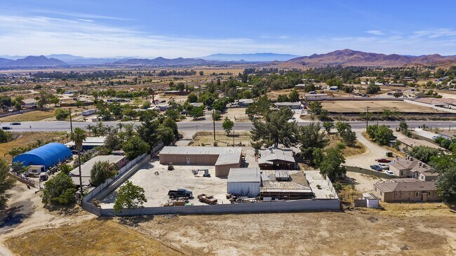
Property Record
24079 State Highway 74, Perris, CA 92570


NEARBY LISTINGS FOR SALE OR LEASE
Property Detail
24079 State Highway 74
Riverside-San Bernardino-Ontario, CA
42 43 Of Rinehart's Boulevard Tract
342-071-020
Riverside
Sfr
California
D
1.49 AC
06065C1420G
Moreno Valley/Perris
1,200 SF
Inland Empire (California)
DEMOGRAPHICS near 24079 State Highway 74
1 Mile
3 Mile
5 Mile
2024 Total Population
4,928
47,999
98,852
2029 Population
5,174
51,221
104,644
Pop Growth 2024-2029
+ 4.99%
+ 6.71%
+ 5.86%
Average Age
33
33
35
2024 Total Households
1,151
11,761
25,811
HH Growth 2024-2029
+ 4.43%
+ 6.53%
+ 5.55%
Median Household Inc
$63,366
$64,441
$67,755
Avg Household Size
4.10
3.90
3.70
2024 Avg HH Vehicles
3.00
2.00
2.00
Median Home Value
$318,750
$345,917
$354,305
Median Year Built
1982
1990
1990
Nearby Places
Map Layers
Map Styles
 Street
 Aerial
- Restaurants
- Banks
- Shops
- Fitness
- Groceries
PUBLIC TRANSPORTATION
COMMUTER RAIL
Perris Downtown (Metrolink 91-Perris Valley Line - Metrolink Trains)
DRIVE
WALK
Distance
Perris Downtown (Metrolink 91-Perris Valley Line - Metrolink Trains)
4 min
2.0 mi
South Perris (Metrolink 91-Perris Valley Line - Metrolink Trains)
DRIVE
WALK
Distance
South Perris (Metrolink 91-Perris Valley Line - Metrolink Trains)
6 min
3.9 mi
AIRPORT
Ontario International
DRIVE
WALK
Distance
Ontario International
45 min
36.0 mi
Freight Ports
Port of Long Beach
DRIVE
WALK
Distance
Port of Long Beach
89 min
70.1 mi
SALE & LEASE HISTORY
LISTING DATE
SALE/LEASE

Sep 03, 2021
For Sale
Apr 23, 2021
For Sale
Nearby Properties
Address
Land Use
TOTAL SIZE
Lot Size
Zoning
Address
Land Use
TOTAL SIZE
Lot Size
Zoning
325,560 SF
16.65 AC
Address
Land Use
TOTAL SIZE
Lot Size
Zoning
28.13 AC
RR
Address
Land Use
TOTAL SIZE
Lot Size
Zoning
197,865 SF
10.74 AC
Address
Land Use
TOTAL SIZE
Lot Size
Zoning
57,600 SF
51.69 AC
Address
Land Use
TOTAL SIZE
Lot Size
Zoning
187,889 SF
20.64 AC
Address
Land Use
TOTAL SIZE
Lot Size
Zoning
32,709 SF
4.61 AC
C2
Address
Land Use
TOTAL SIZE
Lot Size
Zoning
89,409 SF
6.18 AC
Address
Land Use
TOTAL SIZE
Lot Size
Zoning
207,130 SF
16.15 AC
Address
Land Use
TOTAL SIZE
Lot Size
Zoning
22,119 SF
4.59 AC
R3
Address
Land Use
TOTAL SIZE
Lot Size
Zoning
75,109 SF
9.39 AC
Address
Land Use
TOTAL SIZE
Lot Size
Zoning
1,080 SF
9.53 AC
A02
Address
Land Use
TOTAL SIZE
Lot Size
Zoning
122,824 SF
5.18 AC
CC
Address
Land Use
TOTAL SIZE
Lot Size
Zoning
50,000 SF
5.36 AC
CC
Address
Land Use
TOTAL SIZE
Lot Size
Zoning
1,018,178 SF
57.91 AC
Address
Land Use
TOTAL SIZE
Lot Size
Zoning
3,750 SF
37.79 AC
GI
Address
Land Use
TOTAL SIZE
Lot Size
Zoning
201,496 SF
13.35 AC
LI
Address
Land Use
TOTAL SIZE
Lot Size
Zoning
35,600 SF
3.19 AC
Address
Land Use
TOTAL SIZE
Lot Size
Zoning
13,489 SF
6.18 AC
R3
Address
Land Use
TOTAL SIZE
Lot Size
Zoning
114,400 SF
9.88 AC
Address
Land Use
TOTAL SIZE
Lot Size
Zoning
12,665 SF
1.34 AC
CC
Address
Land Use
TOTAL SIZE
Lot Size
Zoning
9,974 SF
1.05 AC
CC
The World's #1 Commercial Real Estate Marketplace
Connect with us
© 2026 CoStar Group
The information above has been obtained from sources believed reliable. While we do not doubt its accuracy we have not verified it and make no guarantee, warranty or representation about it. It is your responsibility to independently confirm its accuracy and completeness. Any projections, opinions, assumptions, or estimates used are for example only and do not represent the current or future performance of the property. The value of this transaction to you depends on tax and other factors which should be evaluated by your tax, financial, and legal advisors. You and your advisors should conduct a careful, independent investigation of the property to determine to your satisfaction the suitability of the property for your needs.