Property Record
201 E Alexandersville Bellbrook Rd, Dayton, OH 45459


NEARBY LISTINGS FOR SALE OR LEASE
Property Detail
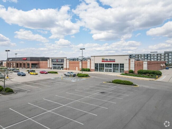
201 E Alexandersville Bellbrook Rd
O68-00309-0077
Cross Pointe Subd
Departmentstore
1 CROSS POINTE SUBDIVISION
X
Montgomery
39113C0269F
Ohio
2023
10.80 AC
2024
South Dayton
040204
Cincinnati/Dayton
116,016 SF
Dayton, OH
DEMOGRAPHICS near 201 E Alexandersville Bellbrook Rd
1 Mile
3 Mile
5 Mile
2024 Total Population
7,606
63,501
163,086
2029 Population
7,588
62,536
161,488
Pop Growth 2024-2029
(0.24%)
(1.52%)
(0.98%)
Average Age
44
44
42
2024 Total Households
3,653
28,149
71,252
HH Growth 2024-2029
+ 0.49%
(1.46%)
(1.08%)
Median Household Inc
$69,201
$78,900
$77,370
Avg Household Size
2.00
2.20
2.20
2024 Avg HH Vehicles
2.00
2.00
2.00
Median Home Value
$234,385
$235,411
$224,663
Median Year Built
1974
1973
1973
Nearby Places
Map Layers
Map Styles
 Street
 Aerial
- Restaurants
- Banks
- Shops
- Fitness
- Groceries
PUBLIC TRANSPORTATION
AIRPORT
James M Cox Dayton International
DRIVE
WALK
Distance
James M Cox Dayton International
36 min
21.8 mi
Freight Ports
Port of Toledo
DRIVE
WALK
Distance
Port of Toledo
193 min
162.0 mi
SALE & LEASE HISTORY
LISTING DATE
SALE/LEASE

Nov 18, 2020
For Lease
Nearby Properties
Address
Land Use
TOTAL SIZE
Lot Size
Zoning
Address
Land Use
TOTAL SIZE
Lot Size
Zoning
508,366 SF
114.86 AC
Address
Land Use
TOTAL SIZE
Lot Size
Zoning
25,715 SF
23.28 AC
Address
Land Use
TOTAL SIZE
Lot Size
Zoning
42.40 AC
Address
Land Use
TOTAL SIZE
Lot Size
Zoning
462,864 SF
38.86 AC
Address
Land Use
TOTAL SIZE
Lot Size
Zoning
191,667 SF
35.98 AC
Address
Land Use
TOTAL SIZE
Lot Size
Zoning
490,354 SF
60 AC
Address
Land Use
TOTAL SIZE
Lot Size
Zoning
59,658 SF
74.94 AC
Address
Land Use
TOTAL SIZE
Lot Size
Zoning
5,461 SF
10.35 AC
Address
Land Use
TOTAL SIZE
Lot Size
Zoning
203,122 SF
4.63 AC
Address
Land Use
TOTAL SIZE
Lot Size
Zoning
18.33 AC
Address
Land Use
TOTAL SIZE
Lot Size
Zoning
9,233 SF
22.26 AC
Address
Land Use
TOTAL SIZE
Lot Size
Zoning
142,887 SF
15.25 AC
Address
Land Use
TOTAL SIZE
Lot Size
Zoning
272,855 SF
29.01 AC
Address
Land Use
TOTAL SIZE
Lot Size
Zoning
81,787 SF
45.38 AC
Address
Land Use
TOTAL SIZE
Lot Size
Zoning
198,030 SF
22.32 AC
Address
Land Use
TOTAL SIZE
Lot Size
Zoning
138,484 SF
23.04 AC
Address
Land Use
TOTAL SIZE
Lot Size
Zoning
187,824 SF
27.52 AC
Address
Land Use
TOTAL SIZE
Lot Size
Zoning
24,928 SF
13.67 AC
Address
Land Use
TOTAL SIZE
Lot Size
Zoning
10.33 AC
Address
Land Use
TOTAL SIZE
Lot Size
Zoning
137,948 SF
4.60 AC
Address
Land Use
TOTAL SIZE
Lot Size
Zoning
10,912 SF
15.28 AC
Address
Land Use
TOTAL SIZE
Lot Size
Zoning
109,775 SF
1.25 AC
Address
Land Use
TOTAL SIZE
Lot Size
Zoning
24.77 AC
Address
Land Use
TOTAL SIZE
Lot Size
Zoning
236,103 SF
7.28 AC
Address
Land Use
TOTAL SIZE
Lot Size
Zoning
148,369 SF
14.69 AC
Address
Land Use
TOTAL SIZE
Lot Size
Zoning
88,556 SF
23.94 AC
Address
Land Use
TOTAL SIZE
Lot Size
Zoning
9,344 SF
9.08 AC
Address
Land Use
TOTAL SIZE
Lot Size
Zoning
44,736 SF
18.32 AC
Address
Land Use
TOTAL SIZE
Lot Size
Zoning
54,664 SF
19.37 AC
Address
Land Use
TOTAL SIZE
Lot Size
Zoning
124,197 SF
13.72 AC
The World's #1 Commercial Real Estate Marketplace
Connect with us
© 2025 CoStar Group
The information above has been obtained from sources believed reliable. While we do not doubt its accuracy we have not verified it and make no guarantee, warranty or representation about it. It is your responsibility to independently confirm its accuracy and completeness. Any projections, opinions, assumptions, or estimates used are for example only and do not represent the current or future performance of the property. The value of this transaction to you depends on tax and other factors which should be evaluated by your tax, financial, and legal advisors. You and your advisors should conduct a careful, independent investigation of the property to determine to your satisfaction the suitability of the property for your needs.