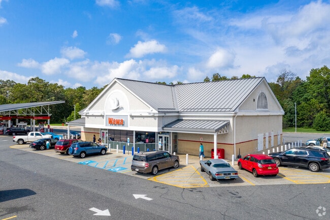
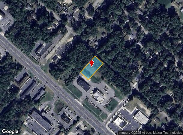
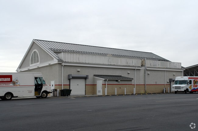
Property Record
241 E White Horse Pike, Absecon, NJ 08205

NEARBY LISTINGS FOR SALE OR LEASE
Property Detail
241 E White Horse Pike
Atlantic City-Hammonton, NJ
Absecon Hlnds 09
11-00892-0000-00003
Atlantic
Storebuilding
New Jersey
ARE
3
34001C0309F
5 AC
2024
Atlantic City/Hammonton
2025
Philadelphia
010503
DEMOGRAPHICS near 241 E White Horse Pike
1 Mile
3 Mile
5 Mile
2024 Total Population
2,607
32,476
72,717
2029 Population
2,642
31,754
71,017
Pop Growth 2024-2029
+ 1.34%
(2.22%)
(2.34%)
Average Age
42
39
40
2024 Total Households
893
10,826
25,185
HH Growth 2024-2029
+ 0.78%
(3.17%)
(3.21%)
Median Household Inc
$95,160
$70,498
$64,000
Avg Household Size
2.80
2.70
2.60
2024 Avg HH Vehicles
2.00
2.00
2.00
Median Home Value
$235,714
$216,982
$209,176
Median Year Built
1985
1983
1982
Nearby Places
Map Layers
Map Styles
 Street
 Aerial
- Restaurants
- Banks
- Shops
- Fitness
- Groceries
PUBLIC TRANSPORTATION
COMMUTER RAIL
Absecon (Atlantic City Line - NJ Transit Commuter Rail (NJ Transit))
DRIVE
WALK
Distance
Absecon (Atlantic City Line - NJ Transit Commuter Rail (NJ Transit))
4 min
2.4 mi
Atlantic City (Atlantic City Line - NJ Transit Commuter Rail (NJ Transit))
DRIVE
WALK
Distance
Atlantic City (Atlantic City Line - NJ Transit Commuter Rail (NJ Transit))
17 min
9.1 mi
AIRPORT
Atlantic City International
DRIVE
WALK
Distance
Atlantic City International
31 min
9.0 mi
Freight Ports
Broadway Terminal - Pier 5
DRIVE
WALK
Distance
Broadway Terminal - Pier 5
63 min
48.3 mi
Nearby Properties
Address
Land Use
TOTAL SIZE
Lot Size
Zoning
Address
Land Use
TOTAL SIZE
Lot Size
Zoning
67,752 SF
2,381.05 AC
Address
Land Use
TOTAL SIZE
Lot Size
Zoning
1.57 AC
GI
Address
Land Use
TOTAL SIZE
Lot Size
Zoning
Address
Land Use
TOTAL SIZE
Lot Size
Zoning
40.29 AC
IND
Address
Land Use
TOTAL SIZE
Lot Size
Zoning
16.75 AC
Address
Land Use
TOTAL SIZE
Lot Size
Zoning
2,824 SF
GI
Address
Land Use
TOTAL SIZE
Lot Size
Zoning
14.32 AC
PO
Address
Land Use
TOTAL SIZE
Lot Size
Zoning
1.74 AC
GI
Address
Land Use
TOTAL SIZE
Lot Size
Zoning
3.66 AC
GI
Address
Land Use
TOTAL SIZE
Lot Size
Zoning
109 AC
NR
Address
Land Use
TOTAL SIZE
Lot Size
Zoning
17,312 SF
14.95 AC
MF
Address
Land Use
TOTAL SIZE
Lot Size
Zoning
5.56 AC
R-50
Address
Land Use
TOTAL SIZE
Lot Size
Zoning
16.27 AC
Address
Land Use
TOTAL SIZE
Lot Size
Zoning
68.94 AC
NR
Address
Land Use
TOTAL SIZE
Lot Size
Zoning
Address
Land Use
TOTAL SIZE
Lot Size
Zoning
Address
Land Use
TOTAL SIZE
Lot Size
Zoning
14.09 AC
DC
Address
Land Use
TOTAL SIZE
Lot Size
Zoning
9.96 AC
GI
Address
Land Use
TOTAL SIZE
Lot Size
Zoning
4.50 AC
R-1
Address
Land Use
TOTAL SIZE
Lot Size
Zoning
9.53 AC
PO
Address
Land Use
TOTAL SIZE
Lot Size
Zoning
16.39 AC
R-1
Address
Land Use
TOTAL SIZE
Lot Size
Zoning
1,796 SF
11.10 AC
MF
Address
Land Use
TOTAL SIZE
Lot Size
Zoning
14.57 AC
RC
Address
Land Use
TOTAL SIZE
Lot Size
Zoning
Address
Land Use
TOTAL SIZE
Lot Size
Zoning
29.20 AC
Address
Land Use
TOTAL SIZE
Lot Size
Zoning
7.16 AC
Address
Land Use
TOTAL SIZE
Lot Size
Zoning
65,250 SF
8 AC
CVC
Address
Land Use
TOTAL SIZE
Lot Size
Zoning
3,281 SF
23.91 AC
NR
Address
Land Use
TOTAL SIZE
Lot Size
Zoning
8.67 AC
PO
Address
Land Use
TOTAL SIZE
Lot Size
Zoning
16,960 SF
9.15 AC
MF
The World's #1 Commercial Real Estate Marketplace
Connect with us
© 2025 CoStar Group
The information above has been obtained from sources believed reliable. While we do not doubt its accuracy we have not verified it and make no guarantee, warranty or representation about it. It is your responsibility to independently confirm its accuracy and completeness. Any projections, opinions, assumptions, or estimates used are for example only and do not represent the current or future performance of the property. The value of this transaction to you depends on tax and other factors which should be evaluated by your tax, financial, and legal advisors. You and your advisors should conduct a careful, independent investigation of the property to determine to your satisfaction the suitability of the property for your needs.