Property Record
241 Sturbridge Rd, Charlton, MA 01507
NEARBY LISTINGS FOR SALE OR LEASE
Property Detail
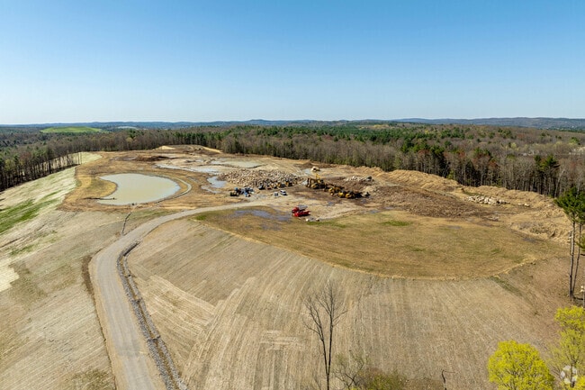
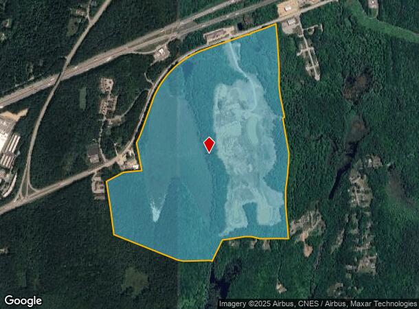
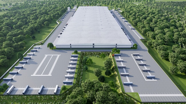
241 Sturbridge Rd
CHAR-31-D-3
Worcester
Industrialacreage
Massachusetts
X
3
25027C0768F
195.60 AC
2025
Outlying Worcester
2025
Boston
756101
Worcester, MA-CT
DEMOGRAPHICS near 241 Sturbridge Rd
1 Mile
3 Mile
5 Mile
2024 Total Population
544
8,075
34,979
2029 Population
538
8,039
34,775
Pop Growth 2024-2029
(1.10%)
(0.45%)
(0.58%)
Average Age
41
43
41
2024 Total Households
212
3,225
14,021
HH Growth 2024-2029
(0.94%)
(0.53%)
(0.61%)
Median Household Inc
$113,281
$106,250
$77,746
Avg Household Size
2.50
2.50
2.50
2024 Avg HH Vehicles
2.00
2.00
2.00
Median Home Value
$417,763
$393,196
$346,409
Median Year Built
1981
1980
1969
Nearby Places
Map Layers
Map Styles
 Street
 Aerial
- Restaurants
- Banks
- Shops
- Fitness
- Groceries
PUBLIC TRANSPORTATION
AIRPORT
Worcester Regional
DRIVE
WALK
Distance
Worcester Regional
31 min
16.6 mi
Freight Ports
Port of Davisville, RI
DRIVE
WALK
Distance
Port of Davisville, RI
94 min
74.1 mi
Nearby Properties
Address
Land Use
TOTAL SIZE
Lot Size
Zoning
Address
Land Use
TOTAL SIZE
Lot Size
Zoning
1,800 SF
10.02 AC
IG
Address
Land Use
TOTAL SIZE
Lot Size
Zoning
15,648 SF
50.82 AC
A
Address
Land Use
TOTAL SIZE
Lot Size
Zoning
45.13 AC
GB
Address
Land Use
TOTAL SIZE
Lot Size
Zoning
102,966 SF
30.95 AC
Address
Land Use
TOTAL SIZE
Lot Size
Zoning
189,270 SF
97.55 AC
FB
Address
Land Use
TOTAL SIZE
Lot Size
Zoning
208,444 SF
14.09 AC
Address
Land Use
TOTAL SIZE
Lot Size
Zoning
104,471 SF
29.98 AC
A
Address
Land Use
TOTAL SIZE
Lot Size
Zoning
105,660 SF
Address
Land Use
TOTAL SIZE
Lot Size
Zoning
93,552 SF
40.84 AC
Address
Land Use
TOTAL SIZE
Lot Size
Zoning
15,000 SF
2 AC
Address
Land Use
TOTAL SIZE
Lot Size
Zoning
5,024 SF
10.60 AC
Address
Land Use
TOTAL SIZE
Lot Size
Zoning
43,817 SF
3.17 AC
Address
Land Use
TOTAL SIZE
Lot Size
Zoning
56,336 SF
5 AC
GB
Address
Land Use
TOTAL SIZE
Lot Size
Zoning
55,530 SF
4.74 AC
Address
Land Use
TOTAL SIZE
Lot Size
Zoning
45.59 AC
IG
Address
Land Use
TOTAL SIZE
Lot Size
Zoning
76,734 SF
7.75 AC
IG
Address
Land Use
TOTAL SIZE
Lot Size
Zoning
226.35 AC
M
Address
Land Use
TOTAL SIZE
Lot Size
Zoning
52,255 SF
Address
Land Use
TOTAL SIZE
Lot Size
Zoning
65,104 SF
9.60 AC
Address
Land Use
TOTAL SIZE
Lot Size
Zoning
2,267 SF
10 AC
A
Address
Land Use
TOTAL SIZE
Lot Size
Zoning
22.15 AC
R40
Address
Land Use
TOTAL SIZE
Lot Size
Zoning
1,237.46 AC
Address
Land Use
TOTAL SIZE
Lot Size
Zoning
6.35 AC
A
Address
Land Use
TOTAL SIZE
Lot Size
Zoning
53,874 SF
8.50 AC
R40
Address
Land Use
TOTAL SIZE
Lot Size
Zoning
53,267 SF
4.16 AC
Address
Land Use
TOTAL SIZE
Lot Size
Zoning
35,281 SF
2.68 AC
Address
Land Use
TOTAL SIZE
Lot Size
Zoning
48,464 SF
2.73 AC
IG
Address
Land Use
TOTAL SIZE
Lot Size
Zoning
180,013 SF
6.84 AC
Address
Land Use
TOTAL SIZE
Lot Size
Zoning
39,576 SF
3.48 AC
The World's #1 Commercial Real Estate Marketplace
Connect with us
© 2025 CoStar Group
The information above has been obtained from sources believed reliable. While we do not doubt its accuracy we have not verified it and make no guarantee, warranty or representation about it. It is your responsibility to independently confirm its accuracy and completeness. Any projections, opinions, assumptions, or estimates used are for example only and do not represent the current or future performance of the property. The value of this transaction to you depends on tax and other factors which should be evaluated by your tax, financial, and legal advisors. You and your advisors should conduct a careful, independent investigation of the property to determine to your satisfaction the suitability of the property for your needs.