Property Record
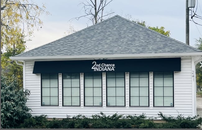
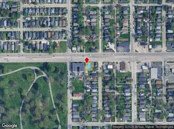
241 W 38Th St, Indianapolis, IN 46208

This Property Is For Sale
NEARBY LISTINGS FOR SALE OR LEASE
Property Detail
241 W 38Th St
Indianapolis-Carmel-Anderson, IN
J M Masters Sub T C Harrison Cos Add 65
49-06-23-148-010.000-101
J M MASTERS SUB T C HARRISON COS ADD 65 W END L33 & L34
Commercialnec
Marion
X
Indiana
18097C0135F
33,34
2023
0.12 AC
2024
Uptown
350300
Indianapolis
884 SF
DEMOGRAPHICS near 241 W 38Th St
1 Mile
3 Mile
5 Mile
2024 Total Population
16,258
101,007
286,862
2029 Population
16,442
101,929
288,438
Pop Growth 2024-2029
+ 1.13%
+ 0.91%
+ 0.55%
Average Age
36
36
36
2024 Total Households
6,783
43,705
122,507
HH Growth 2024-2029
+ 1.19%
+ 0.88%
+ 0.54%
Median Household Inc
$49,043
$56,203
$55,878
Avg Household Size
2.10
2.10
2.20
2024 Avg HH Vehicles
1.00
2.00
2.00
Median Home Value
$261,082
$252,736
$207,180
Median Year Built
1947
1950
1958
Nearby Places
- Restaurants
- Banks
- Shops
- Fitness
- Groceries
PUBLIC TRANSPORTATION
COMMUTER RAIL
Indianapolis (Cardinal - Amtrak)
DRIVE
WALK
Distance
Indianapolis (Cardinal - Amtrak)
10 min
5.1 mi
AIRPORT
Indianapolis International
DRIVE
WALK
Distance
Indianapolis International
33 min
17.6 mi
Freight Ports
Port of Toledo
DRIVE
WALK
Distance
Port of Toledo
264 min
221.9 mi
Nearby Properties
Address
Land Use
TOTAL SIZE
Lot Size
Zoning
Address
Land Use
TOTAL SIZE
Lot Size
Zoning
19,176 SF
28.36 AC
ZO01
Address
Land Use
TOTAL SIZE
Lot Size
Zoning
176,017 SF
3.92 AC
ZO01
Address
Land Use
TOTAL SIZE
Lot Size
Zoning
271,411 SF
3 AC
ZO01
Address
Land Use
TOTAL SIZE
Lot Size
Zoning
20,072 SF
2.74 AC
Address
Land Use
TOTAL SIZE
Lot Size
Zoning
296,086 SF
6.19 AC
ZO01
Address
Land Use
TOTAL SIZE
Lot Size
Zoning
866 SF
14.33 AC
ZO01
Address
Land Use
TOTAL SIZE
Lot Size
Zoning
1,417 SF
2.26 AC
ZO01
Address
Land Use
TOTAL SIZE
Lot Size
Zoning
207,800 SF
2.23 AC
ZO01
Address
Land Use
TOTAL SIZE
Lot Size
Zoning
4,808 SF
5.76 AC
ZO01
Address
Land Use
TOTAL SIZE
Lot Size
Zoning
2,505 SF
13.80 AC
ZO01
Address
Land Use
TOTAL SIZE
Lot Size
Zoning
3,546 SF
25.09 AC
ZO01
Address
Land Use
TOTAL SIZE
Lot Size
Zoning
18,154 SF
9.40 AC
ZO01
Address
Land Use
TOTAL SIZE
Lot Size
Zoning
2,142 SF
9.91 AC
ZO01
Address
Land Use
TOTAL SIZE
Lot Size
Zoning
2,288 SF
6 AC
ZO01
Address
Land Use
TOTAL SIZE
Lot Size
Zoning
2.81 AC
ZO01
Address
Land Use
TOTAL SIZE
Lot Size
Zoning
3,288 SF
3.65 AC
ZO01
Address
Land Use
TOTAL SIZE
Lot Size
Zoning
70,717 SF
7.40 AC
ZO01
Address
Land Use
TOTAL SIZE
Lot Size
Zoning
23,195 SF
31.18 AC
Address
Land Use
TOTAL SIZE
Lot Size
Zoning
163,712 SF
1.02 AC
ZO01
Address
Land Use
TOTAL SIZE
Lot Size
Zoning
42,611 SF
151.50 AC
ZO01
Address
Land Use
TOTAL SIZE
Lot Size
Zoning
87,321 SF
3.14 AC
ZO01
Address
Land Use
TOTAL SIZE
Lot Size
Zoning
61,534 SF
5.35 AC
Address
Land Use
TOTAL SIZE
Lot Size
Zoning
1.39 AC
ZO01
Address
Land Use
TOTAL SIZE
Lot Size
Zoning
20,746 SF
28.38 AC
ZO01
Address
Land Use
TOTAL SIZE
Lot Size
Zoning
8,496 SF
20 AC
ZO01
Address
Land Use
TOTAL SIZE
Lot Size
Zoning
8,998 SF
3.56 AC
ZO01
Address
Land Use
TOTAL SIZE
Lot Size
Zoning
7,740 SF
2.04 AC
ZO01
Address
Land Use
TOTAL SIZE
Lot Size
Zoning
190,257 SF
1.91 AC
ZO01
Address
Land Use
TOTAL SIZE
Lot Size
Zoning
19,800 SF
0.54 AC
ZO01
Address
Land Use
TOTAL SIZE
Lot Size
Zoning
76,022 SF
57.30 AC
ZO01
The World's #1 Commercial Real Estate Marketplace
Connect with us
© 2025 CoStar Group
The information above has been obtained from sources believed reliable. While we do not doubt its accuracy we have not verified it and make no guarantee, warranty or representation about it. It is your responsibility to independently confirm its accuracy and completeness. Any projections, opinions, assumptions, or estimates used are for example only and do not represent the current or future performance of the property. The value of this transaction to you depends on tax and other factors which should be evaluated by your tax, financial, and legal advisors. You and your advisors should conduct a careful, independent investigation of the property to determine to your satisfaction the suitability of the property for your needs.