Property Record
2410 Allerton Way, Charlotte, NC 28213
NEARBY LISTINGS FOR SALE OR LEASE
-
-
View all Charlotte listings for sale on LoopNet.com
Property Detail
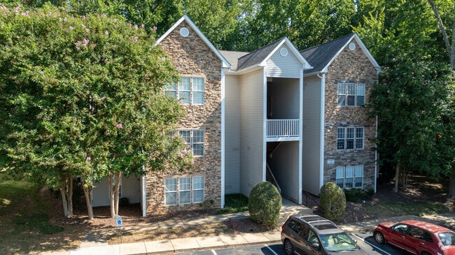
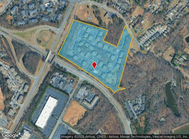
2410 Allerton Way
105-372-02
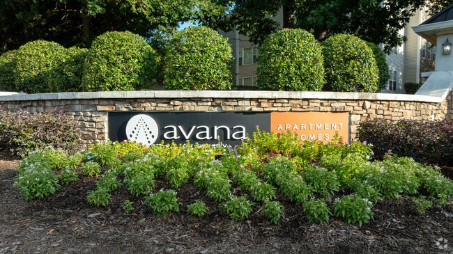
Barrington Place
Multifamilydwelling
Mecklenburg
AE
North Carolina
3710458600L
2
2024
28.83 AC
2025
Newell
005613
Charlotte
389,680 SF
Charlotte-Concord-Gastonia, NC-SC
DEMOGRAPHICS near 2410 Allerton Way
1 Mile
3 Mile
5 Mile
2024 Total Population
12,695
79,232
202,378
2029 Population
13,452
84,346
215,857
Pop Growth 2024-2029
+ 5.96%
+ 6.45%
+ 6.66%
Average Age
33
34
35
2024 Total Households
5,247
30,361
76,850
HH Growth 2024-2029
+ 6.02%
+ 6.46%
+ 6.57%
Median Household Inc
$47,638
$55,593
$58,779
Avg Household Size
2.40
2.50
2.50
2024 Avg HH Vehicles
2.00
2.00
2.00
Median Home Value
$239,657
$250,650
$258,170
Median Year Built
1999
1999
1996
Nearby Places
Map Layers
Map Styles
 Street
 Aerial
- Restaurants
- Banks
- Shops
- Fitness
- Groceries
PUBLIC TRANSPORTATION
COMMUTER RAIL
Charlotte Amtrak Station (Carolinian - Amtrak, Crescent - Amtrak, Piedmont - Amtrak)
DRIVE
WALK
Distance
Charlotte Amtrak Station (Carolinian - Amtrak, Crescent - Amtrak, Piedmont - Amtrak)
14 min
7.6 mi
AIRPORT
Concord-Padgett Regional
DRIVE
WALK
Distance
Concord-Padgett Regional
16 min
9.6 mi
Charlotte/Douglas International
DRIVE
WALK
Distance
Charlotte/Douglas International
29 min
18.0 mi
Freight Ports
North Charleston Terminal
DRIVE
WALK
Distance
North Charleston Terminal
242 min
210.3 mi
Nearby Properties
Address
Land Use
TOTAL SIZE
Lot Size
Zoning
Address
Land Use
TOTAL SIZE
Lot Size
Zoning
2,022,784 SF
654.80 AC
INST
Address
Land Use
TOTAL SIZE
Lot Size
Zoning
2,215,042 SF
68.45 AC
RE2
Address
Land Use
TOTAL SIZE
Lot Size
Zoning
1,532,477 SF
92.30 AC
RE1
Address
Land Use
TOTAL SIZE
Lot Size
Zoning
628,300 SF
197.32 AC
INST
Address
Land Use
TOTAL SIZE
Lot Size
Zoning
727,169 SF
6.07 AC
INST
Address
Land Use
TOTAL SIZE
Lot Size
Zoning
419,364 SF
17.40 AC
Address
Land Use
TOTAL SIZE
Lot Size
Zoning
412,078 SF
27.46 AC
R17MFCD
Address
Land Use
TOTAL SIZE
Lot Size
Zoning
333,683 SF
24.11 AC
RE2
Address
Land Use
TOTAL SIZE
Lot Size
Zoning
16,601 SF
7.42 AC
R-12MF(CD)
Address
Land Use
TOTAL SIZE
Lot Size
Zoning
346,666 SF
26.53 AC
R17MFCD
Address
Land Use
TOTAL SIZE
Lot Size
Zoning
324,898 SF
22.31 AC
R17MFCD
Address
Land Use
TOTAL SIZE
Lot Size
Zoning
347,856 SF
21.16 AC
R17MFCD
Address
Land Use
TOTAL SIZE
Lot Size
Zoning
215,899 SF
4.86 AC
B-2(CD)
Address
Land Use
TOTAL SIZE
Lot Size
Zoning
284,360 SF
21.68 AC
R12MFCD
Address
Land Use
TOTAL SIZE
Lot Size
Zoning
335,688 SF
22.54 AC
Address
Land Use
TOTAL SIZE
Lot Size
Zoning
549,120 SF
5.29 AC
NS
Address
Land Use
TOTAL SIZE
Lot Size
Zoning
358,524 SF
23.80 AC
R17MFCD
Address
Land Use
TOTAL SIZE
Lot Size
Zoning
306,269 SF
9.44 AC
MUDD-O
Address
Land Use
TOTAL SIZE
Lot Size
Zoning
333,498 SF
17.66 AC
R3
Address
Land Use
TOTAL SIZE
Lot Size
Zoning
464,520 SF
3.43 AC
Address
Land Use
TOTAL SIZE
Lot Size
Zoning
325,799 SF
37.65 AC
R9MFCD
Address
Land Use
TOTAL SIZE
Lot Size
Zoning
306,583 SF
24.15 AC
Address
Land Use
TOTAL SIZE
Lot Size
Zoning
357,469 SF
49.75 AC
Address
Land Use
TOTAL SIZE
Lot Size
Zoning
19.62 AC
Address
Land Use
TOTAL SIZE
Lot Size
Zoning
352,085 SF
23.50 AC
NS
Address
Land Use
TOTAL SIZE
Lot Size
Zoning
276,596 SF
41.26 AC
Address
Land Use
TOTAL SIZE
Lot Size
Zoning
330,598 SF
20.29 AC
Address
Land Use
TOTAL SIZE
Lot Size
Zoning
311,358 SF
8.95 AC
B2
Address
Land Use
TOTAL SIZE
Lot Size
Zoning
205,022 SF
15.68 AC
R9MFCD
The World's #1 Commercial Real Estate Marketplace
Connect with us
© 2026 CoStar Group
The information above has been obtained from sources believed reliable. While we do not doubt its accuracy we have not verified it and make no guarantee, warranty or representation about it. It is your responsibility to independently confirm its accuracy and completeness. Any projections, opinions, assumptions, or estimates used are for example only and do not represent the current or future performance of the property. The value of this transaction to you depends on tax and other factors which should be evaluated by your tax, financial, and legal advisors. You and your advisors should conduct a careful, independent investigation of the property to determine to your satisfaction the suitability of the property for your needs.