Property Record
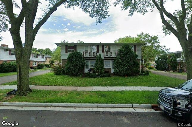
2410 Calypso Rd, Madison, WI 53704


Property Detail
2410 Calypso Rd
0809-364-0330-4
BRENTWOOD MEADOWS, LOT 3.
Commercialnec
Dane
SR-V1
Wisconsin
B and X Area of moderate flood hazard, usually the area between the limits of the 100-year and 500-year floods.
3
2025
0.28 AC
2025
Brentwood Village
002200
Milwaukee/Madison
6,097 SF
Madison, WI
NEARBY LISTINGS FOR SALE OR LEASE
DEMOGRAPHICS near 2410 Calypso Rd
1 mile
3 mile
5 mile
2025 Total Population
9,489
47,418
194,347
2030 Population
9,910
49,328
207,291
Pop Growth 2025-2030
+ 4.44%
+ 4.03%
+ 6.66%
Average Age
40
41
36
2025 Total Households
4,416
22,942
86,360
HH Growth 2025-2030
+ 4.64%
+ 4.37%
+ 7.03%
Median Household Inc
$67,692
$72,526
$65,721
Avg Household Size
2.10
2.00
2.00
2025 Avg HH Vehicles
2.00
2.00
1.00
Median Home Value
$288,260
$321,229
$366,286
Median Year Built
1965
1964
1980
Nearby Places
Map Layers
Map Styles
 Street
 Aerial
Layers
 Traffic
 Biking
Places
Listings with unknown addresses are not visible on the map
- Restaurants
- Banks
- Shops
- Fitness
- Groceries
PUBLIC TRANSPORTATION
AIRPORT
Dane County Regional/Truax Field
Drive
Walk
Distance
Dane County Regional/Truax Field
5 min
2.1 mi
Nearby Properties
Address
Land Use
TOTAL SIZE
Lot Size
Zoning
Address
Land Use
TOTAL SIZE
Lot Size
Zoning
287,341 SF
40.17 AC
IL
Address
Land Use
TOTAL SIZE
Lot Size
Zoning
461,594 SF
3.37 AC
CC-T
Address
Land Use
TOTAL SIZE
Lot Size
Zoning
278,154 SF
3.88 AC
TE
Address
Land Use
TOTAL SIZE
Lot Size
Zoning
296,708 SF
1 AC
WP-24
Address
Land Use
TOTAL SIZE
Lot Size
Zoning
216,017 SF
3.35 AC
TE
Address
Land Use
TOTAL SIZE
Lot Size
Zoning
141,058 SF
WP-24
Address
Land Use
TOTAL SIZE
Lot Size
Zoning
115,920 SF
2.38 AC
WP-24
Address
Land Use
TOTAL SIZE
Lot Size
Zoning
103,769 SF
11.21 AC
WP-15
Address
Land Use
TOTAL SIZE
Lot Size
Zoning
176,088 SF
6.29 AC
PD
Address
Land Use
TOTAL SIZE
Lot Size
Zoning
109,450 SF
4.33 AC
TR-U1
Address
Land Use
TOTAL SIZE
Lot Size
Zoning
109,396 SF
3 AC
PD
Address
Land Use
TOTAL SIZE
Lot Size
Zoning
63,081 SF
3.36 AC
PD
Address
Land Use
TOTAL SIZE
Lot Size
Zoning
74,286 SF
1.02 AC
CC-T
Address
Land Use
TOTAL SIZE
Lot Size
Zoning
150,439 SF
4.71 AC
CC-T
Address
Land Use
TOTAL SIZE
Lot Size
Zoning
134,088 SF
6.45 AC
PD
Address
Land Use
TOTAL SIZE
Lot Size
Zoning
105,743 SF
9.50 AC
IG
Address
Land Use
TOTAL SIZE
Lot Size
Zoning
118,897 SF
5.31 AC
CC-T
Address
Land Use
TOTAL SIZE
Lot Size
Zoning
80,320 SF
0.98 AC
TSS
Address
Land Use
TOTAL SIZE
Lot Size
Zoning
143,325 SF
1.64 AC
CC-T
Address
Land Use
TOTAL SIZE
Lot Size
Zoning
293,459 SF
6.38 AC
CC-T
Address
Land Use
TOTAL SIZE
Lot Size
Zoning
42,900 SF
0.01 AC
TE
Address
Land Use
TOTAL SIZE
Lot Size
Zoning
68,064 SF
26.16 AC
TE
Address
Land Use
TOTAL SIZE
Lot Size
Zoning
150,501 SF
13.79 AC
SE
Address
Land Use
TOTAL SIZE
Lot Size
Zoning
146,946 SF
3.80 AC
PD
Address
Land Use
TOTAL SIZE
Lot Size
Zoning
83,769 SF
1.10 AC
NMX
Address
Land Use
TOTAL SIZE
Lot Size
Zoning
114,884 SF
1.99 AC
PD
Address
Land Use
TOTAL SIZE
Lot Size
Zoning
1.67 AC
RMX
Address
Land Use
TOTAL SIZE
Lot Size
Zoning
63,089 SF
8.06 AC
CC
Address
Land Use
TOTAL SIZE
Lot Size
Zoning
1,976 SF
52.10 AC
PMHP
Address
Land Use
TOTAL SIZE
Lot Size
Zoning
115,215 SF
16.33 AC
CC-T
The World's #1 Commercial Real Estate Marketplace
Connect with us
© 2026 CoStar Group
The information above has been obtained from sources believed reliable. While we do not doubt its accuracy we have not verified it and make no guarantee, warranty or representation about it. It is your responsibility to independently confirm its accuracy and completeness. Any projections, opinions, assumptions, or estimates used are for example only and do not represent the current or future performance of the property. The value of this transaction to you depends on tax and other factors which should be evaluated by your tax, financial, and legal advisors. You and your advisors should conduct a careful, independent investigation of the property to determine to your satisfaction the suitability of the property for your needs.