Property Record
2410 Massillon Rd, Akron, OH 44312

Save to a Folder
{{folder.Name}}
{{folder.ListingIds.length}} Properties
{{folder.ListingIds.length}} Property
Create a New Folder
Property Detail
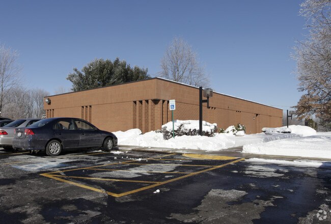
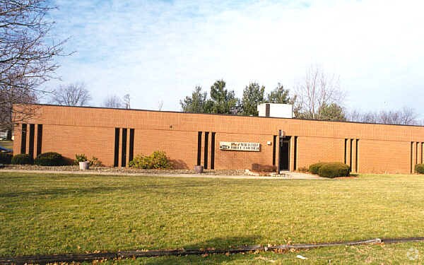
2410 Massillon Rd
Akron, OH
TR 4 LOT 6 N OF KILLIAN RD & W OF MASS RD .95AC AUD#11158
51-06234
Summit
Officebuilding
Ohio
B and X Area of moderate flood hazard, usually the area between the limits of the 100-year and 500-year floods.
6
2025
0.95 AC
2026
Akron
531103
Cleveland
4,922 SF
NEARBY LISTINGS FOR SALE OR LEASE
DEMOGRAPHICS near 2410 Massillon Rd
1 mile
3 mile
5 mile
2025 Total Population
2,171
30,009
119,123
2030 Population
2,163
30,058
119,435
Pop Growth 2025-2030
(0.37%)
+ 0.16%
+ 0.26%
Average Age
45
43
42
2025 Total Households
892
12,642
50,528
HH Growth 2025-2030
(0.34%)
+ 0.14%
+ 0.24%
Median Household Inc
$74,084
$72,489
$63,786
Avg Household Size
2.40
2.30
2.30
2025 Avg HH Vehicles
2.00
2.00
2.00
Median Home Value
$198,055
$220,839
$180,155
Median Year Built
1972
1974
1964
Nearby Places
Map Layers
Map Styles
 Street
 Aerial
Layers
 Traffic
 Biking
Places
Listings with unknown addresses are not visible on the map
- Restaurants
- Banks
- Shops
- Fitness
- Groceries
PUBLIC TRANSPORTATION
COMMUTER RAIL
Akron Northside (National Park Scenic Railway - Cuyahoga Valley Scenic Railroad)
Drive
Walk
Distance
Akron Northside (National Park Scenic Railway - Cuyahoga Valley Scenic Railroad)
17 min
9.4 mi
AIRPORT
Akron-Canton Regional
Drive
Walk
Distance
Akron-Canton Regional
11 min
6.8 mi
Freight Ports
Port of Toledo
Drive
Walk
Distance
Port of Toledo
171 min
143.6 mi
Nearby Properties
Address
Land Use
TOTAL SIZE
Lot Size
Zoning
Address
Land Use
TOTAL SIZE
Lot Size
Zoning
162,774 SF
16.58 AC
Address
Land Use
TOTAL SIZE
Lot Size
Zoning
242,719 SF
50.20 AC
Address
Land Use
TOTAL SIZE
Lot Size
Zoning
Address
Land Use
TOTAL SIZE
Lot Size
Zoning
57,369 SF
93.97 AC
Address
Land Use
TOTAL SIZE
Lot Size
Zoning
Address
Land Use
TOTAL SIZE
Lot Size
Zoning
116,456 SF
76.66 AC
Address
Land Use
TOTAL SIZE
Lot Size
Zoning
63,913 SF
10.34 AC
Address
Land Use
TOTAL SIZE
Lot Size
Zoning
Address
Land Use
TOTAL SIZE
Lot Size
Zoning
639,478 SF
29.51 AC
Address
Land Use
TOTAL SIZE
Lot Size
Zoning
22,589 SF
31.65 AC
Address
Land Use
TOTAL SIZE
Lot Size
Zoning
42,750 SF
24.99 AC
Address
Land Use
TOTAL SIZE
Lot Size
Zoning
22,977 SF
263.47 AC
Address
Land Use
TOTAL SIZE
Lot Size
Zoning
84,622 SF
30.74 AC
Address
Land Use
TOTAL SIZE
Lot Size
Zoning
72,614 SF
14.91 AC
Address
Land Use
TOTAL SIZE
Lot Size
Zoning
Address
Land Use
TOTAL SIZE
Lot Size
Zoning
709,827 SF
8.82 AC
Address
Land Use
TOTAL SIZE
Lot Size
Zoning
203,059 SF
55.62 AC
Address
Land Use
TOTAL SIZE
Lot Size
Zoning
2.08 AC
Address
Land Use
TOTAL SIZE
Lot Size
Zoning
78,302 SF
19.73 AC
Address
Land Use
TOTAL SIZE
Lot Size
Zoning
16,604 SF
248.86 AC
Address
Land Use
TOTAL SIZE
Lot Size
Zoning
187,454 SF
12.59 AC
Address
Land Use
TOTAL SIZE
Lot Size
Zoning
21,794 SF
8.78 AC
Address
Land Use
TOTAL SIZE
Lot Size
Zoning
57,782 SF
10.13 AC
Address
Land Use
TOTAL SIZE
Lot Size
Zoning
69,372 SF
7.86 AC
Address
Land Use
TOTAL SIZE
Lot Size
Zoning
243,424 SF
13.24 AC
Address
Land Use
TOTAL SIZE
Lot Size
Zoning
156,522 SF
24.05 AC
Address
Land Use
TOTAL SIZE
Lot Size
Zoning
179,780 SF
15.02 AC
Address
Land Use
TOTAL SIZE
Lot Size
Zoning
9.54 AC
Address
Land Use
TOTAL SIZE
Lot Size
Zoning
99,004 SF
25 AC
Address
Land Use
TOTAL SIZE
Lot Size
Zoning
11.01 AC
The World's #1 Commercial Real Estate Marketplace
Connect with us
© 2026 CoStar Group
The information above has been obtained from sources believed reliable. While we do not doubt its accuracy we have not verified it and make no guarantee, warranty or representation about it. It is your responsibility to independently confirm its accuracy and completeness. Any projections, opinions, assumptions, or estimates used are for example only and do not represent the current or future performance of the property. The value of this transaction to you depends on tax and other factors which should be evaluated by your tax, financial, and legal advisors. You and your advisors should conduct a careful, independent investigation of the property to determine to your satisfaction the suitability of the property for your needs.