Property Record
2410 S Lapeer Rd, Orion, MI 48360
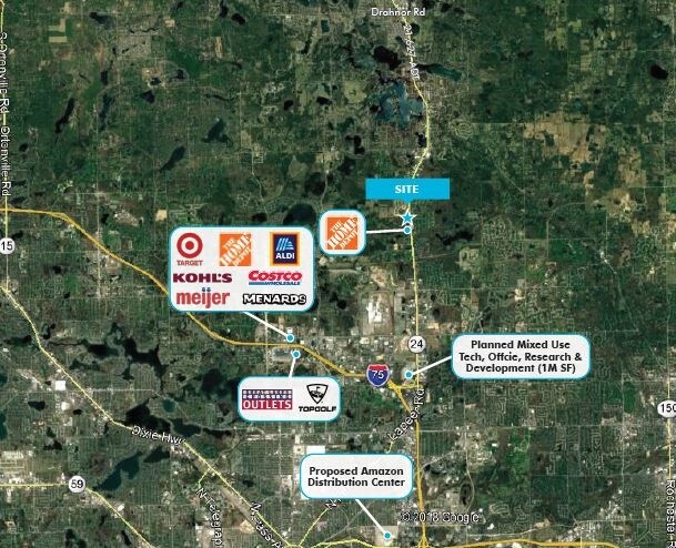
NEARBY LISTINGS FOR SALE OR LEASE
Property Detail
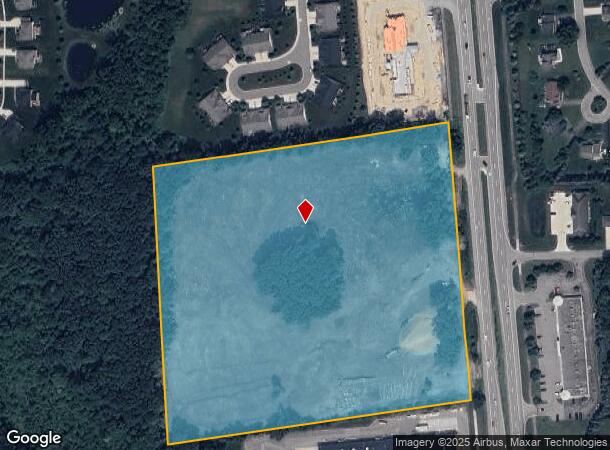
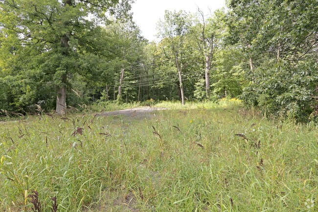
2410 S Lapeer Rd
09-23-301-005
T4N, R10E, SEC 23 PART OF SW 1/4 BEG AT CEN OF SEC, TH S 85-13-30 W 981 FT, TH S 00-38-20 W 469.82 FT, TH N 85-13-30 E 992.84 FT, TH N 00-48-00 W 468.85 FT TO BEG, EXC THAT PART TAKEN FOR M-24 HWY 8.70 A 0364A-1
Commercialacreage
Oakland
X
Michigan
26125C0376F
9.31 AC
2024
St Clair & Lapeer Counties
2024
Detroit
128400
Detroit-Warren-Dearborn, MI
DEMOGRAPHICS near 2410 S Lapeer Rd
1 Mile
3 Mile
5 Mile
2024 Total Population
5,253
32,577
86,488
2029 Population
5,399
32,567
86,187
Pop Growth 2024-2029
+ 2.78%
(0.03%)
(0.35%)
Average Age
38
40
40
2024 Total Households
2,022
12,433
33,495
HH Growth 2024-2029
+ 2.87%
+ 0.02%
(0.35%)
Median Household Inc
$90,878
$107,899
$105,061
Avg Household Size
2.50
2.60
2.50
2024 Avg HH Vehicles
2.00
2.00
2.00
Median Home Value
$363,543
$365,780
$373,691
Median Year Built
1998
1990
1989
Nearby Places
Map Layers
Map Styles
 Street
 Aerial
- Restaurants
- Banks
- Shops
- Fitness
- Groceries
PUBLIC TRANSPORTATION
AIRPORT
Detroit City
DRIVE
WALK
Distance
Detroit City
38 min
37.4 mi
Bishop International
DRIVE
WALK
Distance
Bishop International
37 min
39.0 mi
SALE & LEASE HISTORY
LISTING DATE
SALE/LEASE

Oct 09, 2017
For Sale
Mar 07, 2017
For Sale
Jan 30, 2017
For Sale
Apr 25, 2019
For Sale
Nearby Properties
Address
Land Use
TOTAL SIZE
Lot Size
Zoning
Address
Land Use
TOTAL SIZE
Lot Size
Zoning
6,255,758 SF
Address
Land Use
TOTAL SIZE
Lot Size
Zoning
891,314 SF
60.90 AC
II
Address
Land Use
TOTAL SIZE
Lot Size
Zoning
6,255,758 SF
Address
Land Use
TOTAL SIZE
Lot Size
Zoning
6,255,758 SF
223.95 AC
Address
Land Use
TOTAL SIZE
Lot Size
Zoning
6,255,758 SF
233.05 AC
II
Address
Land Use
TOTAL SIZE
Lot Size
Zoning
247,500 SF
Address
Land Use
TOTAL SIZE
Lot Size
Zoning
179,510 SF
8.80 AC
Address
Land Use
TOTAL SIZE
Lot Size
Zoning
347,979 SF
58.38 AC
AI
Address
Land Use
TOTAL SIZE
Lot Size
Zoning
329,335 SF
17.40 AC
Address
Land Use
TOTAL SIZE
Lot Size
Zoning
245,436 SF
39.08 AC
Address
Land Use
TOTAL SIZE
Lot Size
Zoning
133,546 SF
3.09 AC
BI
Address
Land Use
TOTAL SIZE
Lot Size
Zoning
172,412 SF
9.68 AC
I1
Address
Land Use
TOTAL SIZE
Lot Size
Zoning
104,020 SF
6.48 AC
I2
Address
Land Use
TOTAL SIZE
Lot Size
Zoning
245,436 SF
29.85 AC
Address
Land Use
TOTAL SIZE
Lot Size
Zoning
175,822 SF
8.08 AC
II
Address
Land Use
TOTAL SIZE
Lot Size
Zoning
183,920 SF
12.06 AC
I1
Address
Land Use
TOTAL SIZE
Lot Size
Zoning
280,000 SF
40.08 AC
R1
Address
Land Use
TOTAL SIZE
Lot Size
Zoning
166,200 SF
10.35 AC
I1
Address
Land Use
TOTAL SIZE
Lot Size
Zoning
272,879 SF
Address
Land Use
TOTAL SIZE
Lot Size
Zoning
121,830 SF
9 AC
II
Address
Land Use
TOTAL SIZE
Lot Size
Zoning
116,140 SF
12.82 AC
II
Address
Land Use
TOTAL SIZE
Lot Size
Zoning
207,942 SF
29.20 AC
AI
Address
Land Use
TOTAL SIZE
Lot Size
Zoning
100,000 SF
Address
Land Use
TOTAL SIZE
Lot Size
Zoning
79,139 SF
6.55 AC
Address
Land Use
TOTAL SIZE
Lot Size
Zoning
89,899 SF
6.41 AC
BI
Address
Land Use
TOTAL SIZE
Lot Size
Zoning
156,154 SF
9 AC
I1
Address
Land Use
TOTAL SIZE
Lot Size
Zoning
74,557 SF
3.78 AC
IV
Address
Land Use
TOTAL SIZE
Lot Size
Zoning
149,114 SF
23.08 AC
II
Address
Land Use
TOTAL SIZE
Lot Size
Zoning
53,039 SF
4.22 AC
BI
Address
Land Use
TOTAL SIZE
Lot Size
Zoning
125,960 SF
10.75 AC
The World's #1 Commercial Real Estate Marketplace
Connect with us
© 2025 CoStar Group
The information above has been obtained from sources believed reliable. While we do not doubt its accuracy we have not verified it and make no guarantee, warranty or representation about it. It is your responsibility to independently confirm its accuracy and completeness. Any projections, opinions, assumptions, or estimates used are for example only and do not represent the current or future performance of the property. The value of this transaction to you depends on tax and other factors which should be evaluated by your tax, financial, and legal advisors. You and your advisors should conduct a careful, independent investigation of the property to determine to your satisfaction the suitability of the property for your needs.