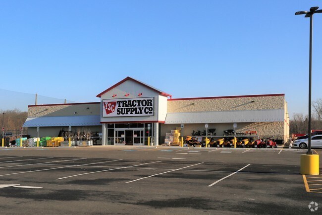
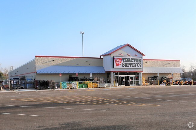
Property Record
24100 Royalton Rd, Columbia Station, OH 44028

NEARBY LISTINGS FOR SALE OR LEASE
Property Detail
24100 Royalton Rd
Departmentstore
Lorain
X
Ohio
39035C0259E
4.59 AC
2024
Lorain County
2024
Cleveland
090100
Cleveland-Elyria, OH
19,000 SF
12-00-025-000-075
DEMOGRAPHICS near 24100 Royalton Rd
1 Mile
3 Mile
5 Mile
2024 Total Population
689
21,566
89,272
2029 Population
723
21,488
87,989
Pop Growth 2024-2029
+ 4.93%
(0.36%)
(1.44%)
Average Age
44
45
43
2024 Total Households
268
8,557
35,555
HH Growth 2024-2029
+ 4.85%
(0.64%)
(1.67%)
Median Household Inc
$89,285
$96,623
$89,523
Avg Household Size
2.50
2.50
2.40
2024 Avg HH Vehicles
2.00
2.00
2.00
Median Home Value
$282,203
$259,778
$238,344
Median Year Built
1972
1979
1978
Nearby Places
Map Layers
Map Styles
 Street
 Aerial
- Restaurants
- Banks
- Shops
- Fitness
- Groceries
PUBLIC TRANSPORTATION
AIRPORT
Cleveland-Hopkins International
DRIVE
WALK
Distance
Cleveland-Hopkins International
25 min
11.9 mi
Freight Ports
Port of Toledo
DRIVE
WALK
Distance
Port of Toledo
125 min
102.6 mi
Nearby Properties
Address
Land Use
TOTAL SIZE
Lot Size
Zoning
Address
Land Use
TOTAL SIZE
Lot Size
Zoning
345,524 SF
107.02 AC
PF
Address
Land Use
TOTAL SIZE
Lot Size
Zoning
53,653 SF
30.83 AC
Address
Land Use
TOTAL SIZE
Lot Size
Zoning
437,700 SF
36.09 AC
GI
Address
Land Use
TOTAL SIZE
Lot Size
Zoning
310,080 SF
28.30 AC
GI
Address
Land Use
TOTAL SIZE
Lot Size
Zoning
381,528 SF
42.50 AC
GI
Address
Land Use
TOTAL SIZE
Lot Size
Zoning
120,478 SF
17.45 AC
Address
Land Use
TOTAL SIZE
Lot Size
Zoning
180,606 SF
10.99 AC
Address
Land Use
TOTAL SIZE
Lot Size
Zoning
185,284 SF
10.84 AC
Address
Land Use
TOTAL SIZE
Lot Size
Zoning
80,578 SF
46.73 AC
Address
Land Use
TOTAL SIZE
Lot Size
Zoning
119,880 SF
11.61 AC
GI
Address
Land Use
TOTAL SIZE
Lot Size
Zoning
247,299 SF
23.38 AC
GI
Address
Land Use
TOTAL SIZE
Lot Size
Zoning
271,272 SF
25.13 AC
GI
Address
Land Use
TOTAL SIZE
Lot Size
Zoning
175,308 SF
51.03 AC
GI
Address
Land Use
TOTAL SIZE
Lot Size
Zoning
173,390 SF
11.56 AC
GI
Address
Land Use
TOTAL SIZE
Lot Size
Zoning
171,000 SF
10.17 AC
GI
Address
Land Use
TOTAL SIZE
Lot Size
Zoning
104,092 SF
22.45 AC
GI
Address
Land Use
TOTAL SIZE
Lot Size
Zoning
49,444 SF
4.93 AC
LB
Address
Land Use
TOTAL SIZE
Lot Size
Zoning
163,030 SF
7.68 AC
Address
Land Use
TOTAL SIZE
Lot Size
Zoning
63,904 SF
19.62 AC
Address
Land Use
TOTAL SIZE
Lot Size
Zoning
90,351 SF
9.46 AC
D-5
Address
Land Use
TOTAL SIZE
Lot Size
Zoning
140,000 SF
14.26 AC
GI-A
Address
Land Use
TOTAL SIZE
Lot Size
Zoning
229,487 SF
14.06 AC
GI
Address
Land Use
TOTAL SIZE
Lot Size
Zoning
19,870 SF
16.12 AC
Address
Land Use
TOTAL SIZE
Lot Size
Zoning
12,246 SF
22.26 AC
GI
Address
Land Use
TOTAL SIZE
Lot Size
Zoning
121,795 SF
24.09 AC
GI
Address
Land Use
TOTAL SIZE
Lot Size
Zoning
103,541 SF
6.32 AC
GI-A
Address
Land Use
TOTAL SIZE
Lot Size
Zoning
157,993 SF
8 AC
GI
Address
Land Use
TOTAL SIZE
Lot Size
Zoning
214,930 SF
16.73 AC
Address
Land Use
TOTAL SIZE
Lot Size
Zoning
142,440 SF
10.11 AC
GI
Address
Land Use
TOTAL SIZE
Lot Size
Zoning
68,609 SF
13.30 AC
PF
The World's #1 Commercial Real Estate Marketplace
Connect with us
© 2026 CoStar Group
The information above has been obtained from sources believed reliable. While we do not doubt its accuracy we have not verified it and make no guarantee, warranty or representation about it. It is your responsibility to independently confirm its accuracy and completeness. Any projections, opinions, assumptions, or estimates used are for example only and do not represent the current or future performance of the property. The value of this transaction to you depends on tax and other factors which should be evaluated by your tax, financial, and legal advisors. You and your advisors should conduct a careful, independent investigation of the property to determine to your satisfaction the suitability of the property for your needs.