Property Record
24101 Iris Ave, Moreno Valley, CA 92551


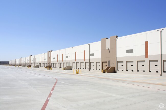
Property Detail
24101 Iris Ave
316-020-050
47.64 ACRES M/L IN PAR 1 PM 239/022 PM 35879
Warehouse
Riverside
LI
California
B and X Area of moderate flood hazard, usually the area between the limits of the 100-year and 500-year floods.
1
2024
47.64 AC
2025
Moreno Valley/Perris
042507
Inland Empire (California)
1,103,003 SF
Riverside-San Bernardino-Ontario, CA
NEARBY LISTINGS FOR SALE OR LEASE
DEMOGRAPHICS near 24101 Iris Ave
1 mile
3 mile
5 mile
2025 Total Population
7,262
89,150
240,544
2030 Population
7,394
91,072
245,449
Pop Growth 2025-2030
+ 1.82%
+ 2.16%
+ 2.04%
Average Age
35
34
35
2025 Total Households
1,792
22,392
62,026
HH Growth 2025-2030
+ 1.62%
+ 1.84%
+ 1.67%
Median Household Inc
$110,775
$86,198
$92,620
Avg Household Size
3.80
3.80
3.70
2025 Avg HH Vehicles
3.00
3.00
3.00
Median Home Value
$541,345
$484,842
$535,752
Median Year Built
1988
1986
1989
Nearby Places
Map Layers
Map Styles
 Street
 Aerial
Layers
 Traffic
 Biking
Places
Listings with unknown addresses are not visible on the map
- Restaurants
- Banks
- Shops
- Fitness
- Groceries
PUBLIC TRANSPORTATION
COMMUTER RAIL
Moreno Valley/March Field (Metrolink 91-Perris Valley Line - Metrolink Trains)
Drive
Walk
Distance
Moreno Valley/March Field (Metrolink 91-Perris Valley Line - Metrolink Trains)
10 min
5.0 mi
Perris Downtown (Metrolink 91-Perris Valley Line - Metrolink Trains)
Drive
Walk
Distance
Perris Downtown (Metrolink 91-Perris Valley Line - Metrolink Trains)
16 min
8.0 mi
AIRPORT
Ontario International
Drive
Walk
Distance
Ontario International
40 min
29.4 mi
Freight Ports
Port of Long Beach
Drive
Walk
Distance
Port of Long Beach
90 min
65.9 mi
Nearby Properties
Address
Land Use
TOTAL SIZE
Lot Size
Zoning
Address
Land Use
TOTAL SIZE
Lot Size
Zoning
1,530,974 SF
71.21 AC
Address
Land Use
TOTAL SIZE
Lot Size
Zoning
1,851,898 SF
128.07 AC
Address
Land Use
TOTAL SIZE
Lot Size
Zoning
1,101,504 SF
59.45 AC
Address
Land Use
TOTAL SIZE
Lot Size
Zoning
1,009,869 SF
46.76 AC
Address
Land Use
TOTAL SIZE
Lot Size
Zoning
656,695 SF
30.75 AC
RA5
Address
Land Use
TOTAL SIZE
Lot Size
Zoning
617,000 SF
23.91 AC
W2
Address
Land Use
TOTAL SIZE
Lot Size
Zoning
1,331,763 SF
62.60 AC
Address
Land Use
TOTAL SIZE
Lot Size
Zoning
1,280,446 SF
51.47 AC
Address
Land Use
TOTAL SIZE
Lot Size
Zoning
1,547,145 SF
83.15 AC
Address
Land Use
TOTAL SIZE
Lot Size
Zoning
1,461,146 SF
72.62 AC
Address
Land Use
TOTAL SIZE
Lot Size
Zoning
436,350 SF
19.47 AC
Address
Land Use
TOTAL SIZE
Lot Size
Zoning
1,364,580 SF
80.02 AC
Address
Land Use
TOTAL SIZE
Lot Size
Zoning
692,465 SF
34.46 AC
Address
Land Use
TOTAL SIZE
Lot Size
Zoning
695,786 SF
92.37 AC
Address
Land Use
TOTAL SIZE
Lot Size
Zoning
340,285 SF
14.39 AC
Address
Land Use
TOTAL SIZE
Lot Size
Zoning
1,297,200 SF
57.36 AC
Address
Land Use
TOTAL SIZE
Lot Size
Zoning
1,172,289 SF
41.82 AC
Address
Land Use
TOTAL SIZE
Lot Size
Zoning
348,375 SF
21.80 AC
Address
Land Use
TOTAL SIZE
Lot Size
Zoning
332,377 SF
21.12 AC
Address
Land Use
TOTAL SIZE
Lot Size
Zoning
481,636 SF
45 AC
Address
Land Use
TOTAL SIZE
Lot Size
Zoning
800,218 SF
37.43 AC
Address
Land Use
TOTAL SIZE
Lot Size
Zoning
1,387,899 SF
49.40 AC
Address
Land Use
TOTAL SIZE
Lot Size
Zoning
406,650 SF
21.49 AC
Address
Land Use
TOTAL SIZE
Lot Size
Zoning
63,962 SF
11.43 AC
H
Address
Land Use
TOTAL SIZE
Lot Size
Zoning
864,000 SF
43.64 AC
RA10
Address
Land Use
TOTAL SIZE
Lot Size
Zoning
753,895 SF
36.38 AC
Address
Land Use
TOTAL SIZE
Lot Size
Zoning
91,891 SF
20.61 AC
R20
The World's #1 Commercial Real Estate Marketplace
Connect with us
© 2026 CoStar Group
The information above has been obtained from sources believed reliable. While we do not doubt its accuracy we have not verified it and make no guarantee, warranty or representation about it. It is your responsibility to independently confirm its accuracy and completeness. Any projections, opinions, assumptions, or estimates used are for example only and do not represent the current or future performance of the property. The value of this transaction to you depends on tax and other factors which should be evaluated by your tax, financial, and legal advisors. You and your advisors should conduct a careful, independent investigation of the property to determine to your satisfaction the suitability of the property for your needs.