Property Record
24101 Park Place Dr N, Punta Gorda, FL 33980
NEARBY LISTINGS FOR SALE OR LEASE
Property Detail
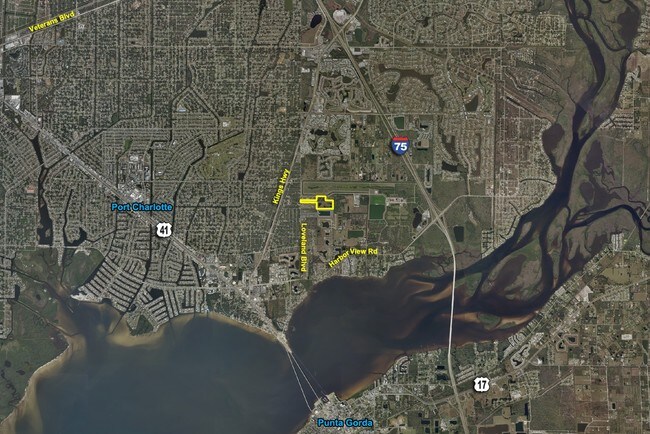
24101 Park Place Dr N
Punta Gorda, FL
Place Estates At Port Charlotte
402319152001
19 40 23 P5-24-1 25.06 AC M/L COMM AT NW COR SEC 19 TH S ALONG SEC LINE 1662.66 FT TH E 20 TO POB TH CONT E 2630.16 FT W 659.68 FT W 1323.47 FT N 496.78 FT W 1305.82 FT N 166.26 FT TO POB. 316/408 512/483 608/1399 622/940 650/1003 E653/1983 6
Agriculturalland
Charlotte
X
Florida
12015C0231G
25.29 AC
2024
Charlotte County
2025
Southwest Florida
021002
DEMOGRAPHICS near 24101 Park Place Dr N
1 Mile
3 Mile
5 Mile
2024 Total Population
4,611
44,390
96,262
2029 Population
5,645
53,101
114,978
Pop Growth 2024-2029
+ 22.42%
+ 19.62%
+ 19.44%
Average Age
58
51
51
2024 Total Households
2,314
20,217
43,835
HH Growth 2024-2029
+ 22.95%
+ 20.07%
+ 19.81%
Median Household Inc
$53,140
$53,161
$55,214
Avg Household Size
1.90
2.10
2.10
2024 Avg HH Vehicles
2.00
2.00
2.00
Median Home Value
$158,639
$206,857
$231,429
Median Year Built
1990
1985
1986
Nearby Places
Map Layers
Map Styles
 Street
 Aerial
- Restaurants
- Banks
- Shops
- Fitness
- Groceries
PUBLIC TRANSPORTATION
AIRPORT
Punta Gorda
DRIVE
WALK
Distance
Punta Gorda
20 min
8.7 mi
Freight Ports
Port Manatee
DRIVE
WALK
Distance
Port Manatee
84 min
67.9 mi
SALE & LEASE HISTORY
LISTING DATE
SALE/LEASE

Mar 27, 2017
For Sale
Nearby Properties
Address
Land Use
TOTAL SIZE
Lot Size
Zoning
Address
Land Use
TOTAL SIZE
Lot Size
Zoning
333,027 SF
9.79 AC
CHRW
Address
Land Use
TOTAL SIZE
Lot Size
Zoning
156,350 SF
12.49 AC
OMI
Address
Land Use
TOTAL SIZE
Lot Size
Zoning
202,009 SF
20.89 AC
PD
Address
Land Use
TOTAL SIZE
Lot Size
Zoning
129,475 SF
16.04 AC
OMI
Address
Land Use
TOTAL SIZE
Lot Size
Zoning
204,731 SF
16.11 AC
PD
Address
Land Use
TOTAL SIZE
Lot Size
Zoning
229,973 SF
21.33 AC
PD
Address
Land Use
TOTAL SIZE
Lot Size
Zoning
121,585 SF
696.03 AC
RE1
Address
Land Use
TOTAL SIZE
Lot Size
Zoning
249,777 SF
48 AC
RMF10
Address
Land Use
TOTAL SIZE
Lot Size
Zoning
172,298 SF
37.42 AC
OMI
Address
Land Use
TOTAL SIZE
Lot Size
Zoning
789,392 SF
31.39 AC
RMF15
Address
Land Use
TOTAL SIZE
Lot Size
Zoning
254.31 AC
PD
Address
Land Use
TOTAL SIZE
Lot Size
Zoning
217,784 SF
38.63 AC
PD
Address
Land Use
TOTAL SIZE
Lot Size
Zoning
139,109 SF
23.44 AC
CG
Address
Land Use
TOTAL SIZE
Lot Size
Zoning
238,852 SF
26.63 AC
CG
Address
Land Use
TOTAL SIZE
Lot Size
Zoning
40,430 SF
5.63 AC
RMF12
Address
Land Use
TOTAL SIZE
Lot Size
Zoning
128,594 SF
25.54 AC
PD
Address
Land Use
TOTAL SIZE
Lot Size
Zoning
70,518 SF
2.08 AC
PD
Address
Land Use
TOTAL SIZE
Lot Size
Zoning
102,337 SF
10.43 AC
RSF3.5
Address
Land Use
TOTAL SIZE
Lot Size
Zoning
73,222 SF
5.14 AC
PD
Address
Land Use
TOTAL SIZE
Lot Size
Zoning
50,970 SF
9.74 AC
RSF3.5
Address
Land Use
TOTAL SIZE
Lot Size
Zoning
83,180 SF
9.31 AC
PD
Address
Land Use
TOTAL SIZE
Lot Size
Zoning
95,547 SF
14.06 AC
PD
Address
Land Use
TOTAL SIZE
Lot Size
Zoning
125.54 AC
PD
Address
Land Use
TOTAL SIZE
Lot Size
Zoning
35,951 SF
24.23 AC
PD
Address
Land Use
TOTAL SIZE
Lot Size
Zoning
1,296 SF
14.46 AC
CG
Address
Land Use
TOTAL SIZE
Lot Size
Zoning
35,587 SF
6.27 AC
RMF15
Address
Land Use
TOTAL SIZE
Lot Size
Zoning
27,082 SF
2.05 AC
PD
Address
Land Use
TOTAL SIZE
Lot Size
Zoning
84,500 SF
5.59 AC
CG
Address
Land Use
TOTAL SIZE
Lot Size
Zoning
81,167 SF
5.63 AC
CG
Address
Land Use
TOTAL SIZE
Lot Size
Zoning
30,940 SF
0.42 AC
NC
The World's #1 Commercial Real Estate Marketplace
Connect with us
© 2025 CoStar Group
The information above has been obtained from sources believed reliable. While we do not doubt its accuracy we have not verified it and make no guarantee, warranty or representation about it. It is your responsibility to independently confirm its accuracy and completeness. Any projections, opinions, assumptions, or estimates used are for example only and do not represent the current or future performance of the property. The value of this transaction to you depends on tax and other factors which should be evaluated by your tax, financial, and legal advisors. You and your advisors should conduct a careful, independent investigation of the property to determine to your satisfaction the suitability of the property for your needs.