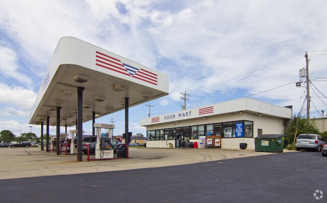
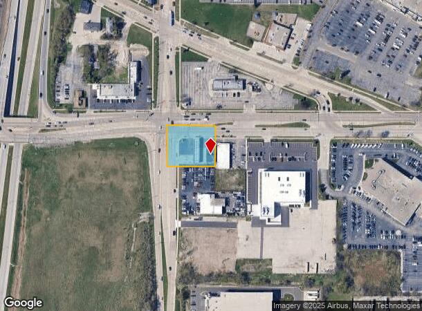
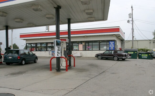
Property Record
2415 E Layton Ave, Cudahy, WI 53110

NEARBY LISTINGS FOR SALE OR LEASE
Property Detail
2415 E Layton Ave
630-9961-000
Metes & Bounds
Commercialnec
COM AT NW COR OF NE 1/4 SEC 27-6-22 TH E 200 FT TH S 170 FT TH W 200 FT TH N 170 FT TO BEG
X
Milwaukee
55079C0159E
Wisconsin
2024
0.35 AC
2024
Milwaukee SE
185200
Milwaukee/Madison
1,800 SF
Milwaukee-Waukesha-West Allis, WI
DEMOGRAPHICS near 2415 E Layton Ave
1 Mile
3 Mile
5 Mile
2024 Total Population
7,313
70,735
202,498
2029 Population
7,100
68,863
197,088
Pop Growth 2024-2029
(2.91%)
(2.65%)
(2.67%)
Average Age
41
41
38
2024 Total Households
3,371
32,009
82,141
HH Growth 2024-2029
(3.06%)
(2.70%)
(2.73%)
Median Household Inc
$63,030
$66,087
$58,691
Avg Household Size
2.10
2.20
2.40
2024 Avg HH Vehicles
2.00
2.00
2.00
Median Home Value
$193,987
$193,248
$189,170
Median Year Built
1958
1954
1954
Nearby Places
Map Layers
Map Styles
 Street
 Aerial
- Restaurants
- Banks
- Shops
- Fitness
- Groceries
PUBLIC TRANSPORTATION
COMMUTER RAIL
DRIVE
WALK
Distance
9 min
3.4 mi
DRIVE
WALK
Distance
12 min
6.7 mi
AIRPORT
General Mitchell International
DRIVE
WALK
Distance
General Mitchell International
7 min
2.8 mi
Freight Ports
Port Milwaukee
DRIVE
WALK
Distance
Port Milwaukee
9 min
4.0 mi
Nearby Properties
Address
Land Use
TOTAL SIZE
Lot Size
Zoning
Address
Land Use
TOTAL SIZE
Lot Size
Zoning
Address
Land Use
TOTAL SIZE
Lot Size
Zoning
11.09 AC
Address
Land Use
TOTAL SIZE
Lot Size
Zoning
48.34 AC
IO1
Address
Land Use
TOTAL SIZE
Lot Size
Zoning
197,354 SF
18 AC
CS
Address
Land Use
TOTAL SIZE
Lot Size
Zoning
0.43 AC
RT3
Address
Land Use
TOTAL SIZE
Lot Size
Zoning
Address
Land Use
TOTAL SIZE
Lot Size
Zoning
26.21 AC
Address
Land Use
TOTAL SIZE
Lot Size
Zoning
76.97 AC
IH
Address
Land Use
TOTAL SIZE
Lot Size
Zoning
360,000 SF
14.60 AC
IL1
Address
Land Use
TOTAL SIZE
Lot Size
Zoning
378,000 SF
19.24 AC
M-1PUD
Address
Land Use
TOTAL SIZE
Lot Size
Zoning
152,130 SF
7.68 AC
PD
Address
Land Use
TOTAL SIZE
Lot Size
Zoning
94.05 AC
PK
Address
Land Use
TOTAL SIZE
Lot Size
Zoning
153,300 SF
7.39 AC
M-1PUD
Address
Land Use
TOTAL SIZE
Lot Size
Zoning
85,264 SF
3.67 AC
PD
Address
Land Use
TOTAL SIZE
Lot Size
Zoning
216,281 SF
5.99 AC
RESIDENTIA
Address
Land Use
TOTAL SIZE
Lot Size
Zoning
Address
Land Use
TOTAL SIZE
Lot Size
Zoning
Address
Land Use
TOTAL SIZE
Lot Size
Zoning
Address
Land Use
TOTAL SIZE
Lot Size
Zoning
Address
Land Use
TOTAL SIZE
Lot Size
Zoning
66,300 SF
3.95 AC
LB1
Address
Land Use
TOTAL SIZE
Lot Size
Zoning
Address
Land Use
TOTAL SIZE
Lot Size
Zoning
Address
Land Use
TOTAL SIZE
Lot Size
Zoning
111,759 SF
9.31 AC
LB2
Address
Land Use
TOTAL SIZE
Lot Size
Zoning
249,637 SF
14.60 AC
PD
Address
Land Use
TOTAL SIZE
Lot Size
Zoning
153,000 SF
8.22 AC
M-1PUD
Address
Land Use
TOTAL SIZE
Lot Size
Zoning
149,489 SF
7.43 AC
M-1PUD
Address
Land Use
TOTAL SIZE
Lot Size
Zoning
142,210 SF
14.70 AC
M-1PUD
Address
Land Use
TOTAL SIZE
Lot Size
Zoning
405,764 SF
12.70 AC
M-2
Address
Land Use
TOTAL SIZE
Lot Size
Zoning
300,313 SF
10.22 AC
IL1
Address
Land Use
TOTAL SIZE
Lot Size
Zoning
1.07 AC
LB2
The World's #1 Commercial Real Estate Marketplace
Connect with us
© 2025 CoStar Group
The information above has been obtained from sources believed reliable. While we do not doubt its accuracy we have not verified it and make no guarantee, warranty or representation about it. It is your responsibility to independently confirm its accuracy and completeness. Any projections, opinions, assumptions, or estimates used are for example only and do not represent the current or future performance of the property. The value of this transaction to you depends on tax and other factors which should be evaluated by your tax, financial, and legal advisors. You and your advisors should conduct a careful, independent investigation of the property to determine to your satisfaction the suitability of the property for your needs.