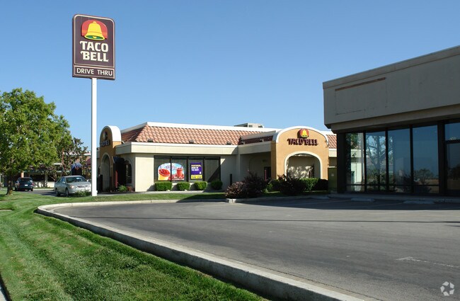
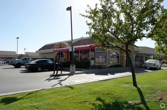
Property Record
2415 Highway 46, Wasco, CA 93280

Property Detail
2415 Highway 46
488-040-06-00-6
PARCEL MAP 7580 , LOT 2
Restaurantdrivein
Kern
C-R
California
B and X Area of moderate flood hazard, usually the area between the limits of the 100-year and 500-year floods.
2
2024
0.55 AC
2025
NW Outlying Kern County
004403
Bakersfield
2,355 SF
Bakersfield-Delano, CA
NEARBY LISTINGS FOR SALE OR LEASE
DEMOGRAPHICS near 2415 Highway 46
1 mile
3 mile
5 mile
2025 Total Population
11,749
23,166
23,494
2030 Population
11,937
23,467
23,791
Pop Growth 2025-2030
+ 1.60%
+ 1.30%
+ 1.26%
Average Age
33
33
33
2025 Total Households
3,166
6,236
6,310
HH Growth 2025-2030
+ 1.48%
+ 1.22%
+ 1.20%
Median Household Inc
$67,958
$59,392
$59,474
Avg Household Size
3.80
3.70
3.70
2025 Avg HH Vehicles
2.00
2.00
2.00
Median Home Value
$295,678
$281,600
$282,652
Median Year Built
1984
1984
1984
Nearby Places
Map Layers
Map Styles
 Street
 Aerial
Layers
 Traffic
 Biking
Places
Listings with unknown addresses are not visible on the map
- Restaurants
- Banks
- Shops
- Fitness
- Groceries
PUBLIC TRANSPORTATION
AIRPORT
Meadows Field
Drive
Walk
Distance
Meadows Field
34 min
24.5 mi
Freight Ports
The Port of Hueneme
Drive
Walk
Distance
The Port of Hueneme
182 min
149.2 mi
Nearby Properties
Address
Land Use
TOTAL SIZE
Lot Size
Zoning
Address
Land Use
TOTAL SIZE
Lot Size
Zoning
52,500 SF
30.43 AC
M-3
Address
Land Use
TOTAL SIZE
Lot Size
Zoning
9,732 SF
0.61 AC
IH
Address
Land Use
TOTAL SIZE
Lot Size
Zoning
142,560 SF
320.86 AC
A
Address
Land Use
TOTAL SIZE
Lot Size
Zoning
166,468 SF
9.14 AC
R-1
Address
Land Use
TOTAL SIZE
Lot Size
Zoning
4.39 AC
R2
Address
Land Use
TOTAL SIZE
Lot Size
Zoning
60,495 SF
3.09 AC
C2
Address
Land Use
TOTAL SIZE
Lot Size
Zoning
57,471 SF
3.88 AC
Address
Land Use
TOTAL SIZE
Lot Size
Zoning
2.60 AC
Address
Land Use
TOTAL SIZE
Lot Size
Zoning
311,962 SF
39.60 AC
A
Address
Land Use
TOTAL SIZE
Lot Size
Zoning
883 SF
166.90 AC
A
Address
Land Use
TOTAL SIZE
Lot Size
Zoning
37,251 SF
1.42 AC
GC
Address
Land Use
TOTAL SIZE
Lot Size
Zoning
160 AC
Address
Land Use
TOTAL SIZE
Lot Size
Zoning
7,150 SF
3.62 AC
M-3
Address
Land Use
TOTAL SIZE
Lot Size
Zoning
665 SF
5.10 AC
R-1
Address
Land Use
TOTAL SIZE
Lot Size
Zoning
8,846 SF
1.12 AC
CR
Address
Land Use
TOTAL SIZE
Lot Size
Zoning
7,056 SF
4.10 AC
Address
Land Use
TOTAL SIZE
Lot Size
Zoning
68,362 SF
3.68 AC
Address
Land Use
TOTAL SIZE
Lot Size
Zoning
4,379 SF
1 AC
C-R
Address
Land Use
TOTAL SIZE
Lot Size
Zoning
18.33 AC
A
Address
Land Use
TOTAL SIZE
Lot Size
Zoning
29,002 SF
4.16 AC
R1
Address
Land Use
TOTAL SIZE
Lot Size
Zoning
12,361 SF
1.68 AC
C-R
Address
Land Use
TOTAL SIZE
Lot Size
Zoning
2,637 SF
4.79 AC
Address
Land Use
TOTAL SIZE
Lot Size
Zoning
16,626 SF
1.68 AC
CR
Address
Land Use
TOTAL SIZE
Lot Size
Zoning
30,496 SF
1.92 AC
Address
Land Use
TOTAL SIZE
Lot Size
Zoning
2,632 SF
0.38 AC
C1
Address
Land Use
TOTAL SIZE
Lot Size
Zoning
4,699 SF
6.33 AC
C2
Address
Land Use
TOTAL SIZE
Lot Size
Zoning
3,600 SF
0.77 AC
M-3
Address
Land Use
TOTAL SIZE
Lot Size
Zoning
24,757 SF
4.40 AC
C-N
The World's #1 Commercial Real Estate Marketplace
Connect with us
© 2026 CoStar Group
The information above has been obtained from sources believed reliable. While we do not doubt its accuracy we have not verified it and make no guarantee, warranty or representation about it. It is your responsibility to independently confirm its accuracy and completeness. Any projections, opinions, assumptions, or estimates used are for example only and do not represent the current or future performance of the property. The value of this transaction to you depends on tax and other factors which should be evaluated by your tax, financial, and legal advisors. You and your advisors should conduct a careful, independent investigation of the property to determine to your satisfaction the suitability of the property for your needs.