Property Record
2417 Tarpon Bay Blvd, Naples, FL 34119

NEARBY LISTINGS FOR SALE OR LEASE
Property Detail
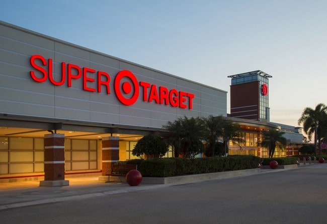
2417 Tarpon Bay Blvd
Naples-Immokalee-Marco Island, FL
Brentwood Two
24745001065
BRENTWOOD TWO TRACT B LESS THAT PORTION AS DESC IN OR 4456 PG 285-288, LESS THAT PORTION AS DESC IN OR 4644 PG 1537, LESS TRACT E BRENTWOOD TWO
Regionalshoppingcenterormallwithanchorstore
Collier
AH
Florida
12021C0213H
1
2024
14.61 AC
2025
North Naples
010435
Southwest Florida
175,337 SF
DEMOGRAPHICS near 2417 Tarpon Bay Blvd
1 Mile
3 Mile
5 Mile
2024 Total Population
6,143
53,512
125,157
2029 Population
6,916
60,229
142,710
Pop Growth 2024-2029
+ 12.58%
+ 12.55%
+ 14.02%
Average Age
50
48
50
2024 Total Households
2,861
22,980
54,897
HH Growth 2024-2029
+ 12.13%
+ 12.18%
+ 13.73%
Median Household Inc
$64,465
$82,808
$84,812
Avg Household Size
2.10
2.20
2.20
2024 Avg HH Vehicles
1.00
2.00
2.00
Median Home Value
$392,831
$473,564
$468,136
Median Year Built
2001
2001
1999
Nearby Places
Map Layers
Map Styles
 Street
 Aerial
- Restaurants
- Banks
- Shops
- Fitness
- Groceries
PUBLIC TRANSPORTATION
AIRPORT
Southwest Florida International
DRIVE
WALK
Distance
Southwest Florida International
31 min
23.3 mi
SALE & LEASE HISTORY
LISTING DATE
SALE/LEASE

Sep 25, 2016
For Lease
Sep 01, 2017
For Lease
Nearby Properties
Address
Land Use
TOTAL SIZE
Lot Size
Zoning
Address
Land Use
TOTAL SIZE
Lot Size
Zoning
688,632 SF
29.28 AC
A
Address
Land Use
TOTAL SIZE
Lot Size
Zoning
325,993 SF
35.92 AC
A
Address
Land Use
TOTAL SIZE
Lot Size
Zoning
463,985 SF
28.48 AC
Address
Land Use
TOTAL SIZE
Lot Size
Zoning
216,788 SF
85.21 AC
PUD
Address
Land Use
TOTAL SIZE
Lot Size
Zoning
275,219 SF
16.20 AC
Address
Land Use
TOTAL SIZE
Lot Size
Zoning
110,908 SF
210.45 AC
A
Address
Land Use
TOTAL SIZE
Lot Size
Zoning
413,313 SF
48.48 AC
PUD
Address
Land Use
TOTAL SIZE
Lot Size
Zoning
376,493 SF
65.03 AC
RSF-3
Address
Land Use
TOTAL SIZE
Lot Size
Zoning
353,756 SF
23.26 AC
ROAD
Address
Land Use
TOTAL SIZE
Lot Size
Zoning
292,967 SF
13.12 AC
PUD
Address
Land Use
TOTAL SIZE
Lot Size
Zoning
426,074 SF
23.25 AC
PUD
Address
Land Use
TOTAL SIZE
Lot Size
Zoning
192,347 SF
7.84 AC
PUD
Address
Land Use
TOTAL SIZE
Lot Size
Zoning
174,365 SF
18.56 AC
PUD
Address
Land Use
TOTAL SIZE
Lot Size
Zoning
188,741 SF
9.04 AC
A
Address
Land Use
TOTAL SIZE
Lot Size
Zoning
128,681 SF
49.55 AC
A
Address
Land Use
TOTAL SIZE
Lot Size
Zoning
223,844 SF
27.55 AC
PUD
Address
Land Use
TOTAL SIZE
Lot Size
Zoning
329,031 SF
20 AC
A
Address
Land Use
TOTAL SIZE
Lot Size
Zoning
106,929 SF
23.05 AC
A
Address
Land Use
TOTAL SIZE
Lot Size
Zoning
115,552 SF
13.20 AC
PUD
Address
Land Use
TOTAL SIZE
Lot Size
Zoning
104,317 SF
20 AC
PUD
Address
Land Use
TOTAL SIZE
Lot Size
Zoning
86,254 SF
18.57 AC
A
Address
Land Use
TOTAL SIZE
Lot Size
Zoning
209,373 SF
23.76 AC
PUD
Address
Land Use
TOTAL SIZE
Lot Size
Zoning
52,370 SF
7.82 AC
PUD
Address
Land Use
TOTAL SIZE
Lot Size
Zoning
75,307 SF
2.49 AC
Address
Land Use
TOTAL SIZE
Lot Size
Zoning
81,202 SF
183.18 AC
GC
Address
Land Use
TOTAL SIZE
Lot Size
Zoning
98,809 SF
18 AC
PUD
Address
Land Use
TOTAL SIZE
Lot Size
Zoning
81,890 SF
5.14 AC
PUD
Address
Land Use
TOTAL SIZE
Lot Size
Zoning
84,344 SF
8.20 AC
MPUD
Address
Land Use
TOTAL SIZE
Lot Size
Zoning
77,805 SF
9.85 AC
PUD
The World's #1 Commercial Real Estate Marketplace
Connect with us
© 2025 CoStar Group
The information above has been obtained from sources believed reliable. While we do not doubt its accuracy we have not verified it and make no guarantee, warranty or representation about it. It is your responsibility to independently confirm its accuracy and completeness. Any projections, opinions, assumptions, or estimates used are for example only and do not represent the current or future performance of the property. The value of this transaction to you depends on tax and other factors which should be evaluated by your tax, financial, and legal advisors. You and your advisors should conduct a careful, independent investigation of the property to determine to your satisfaction the suitability of the property for your needs.