Property Record
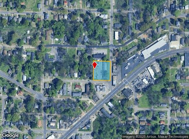
2418 Eufaula Ct, Birmingham, AL 35208
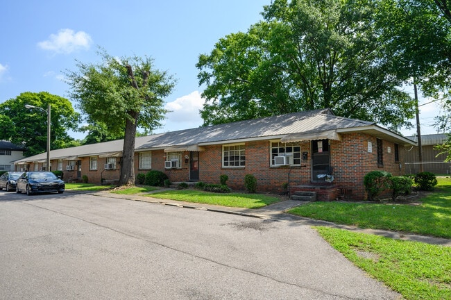
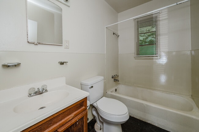
This Property Is For Sale
NEARBY LISTINGS FOR SALE OR LEASE
Property Detail
2418 Eufaula Ct
29-00-05-1-011-020.000
POB N INTER OF W 25TH ST & EUFAULA AVE TH N 204 FT S ALONG EUFAULA AVE TH W 176.9 FT TO ALLEY TH S 202 FT S ALONG ALLEY TO W 25TH ST TH E 176.9 FT ALONG W 25TH ST TO POB
Apartment
Jefferson
X
Alabama
01073C0388H
0.82 AC
2023
Fairview
2024
Birmingham
003100
Birmingham-Hoover, AL
10,248 SF
DEMOGRAPHICS near 2418 Eufaula Ct
1 Mile
3 Mile
5 Mile
2024 Total Population
10,168
71,926
155,691
2029 Population
10,622
73,729
157,806
Pop Growth 2024-2029
+ 4.46%
+ 2.51%
+ 1.36%
Average Age
42
42
40
2024 Total Households
4,301
31,227
68,305
HH Growth 2024-2029
+ 4.70%
+ 2.56%
+ 1.47%
Median Household Inc
$31,118
$33,846
$39,201
Avg Household Size
2.10
2.10
2.10
2024 Avg HH Vehicles
1.00
1.00
1.00
Median Home Value
$74,145
$74,696
$105,442
Median Year Built
1955
1960
1965
Nearby Places
- Restaurants
- Banks
- Shops
- Fitness
- Groceries
PUBLIC TRANSPORTATION
COMMUTER RAIL
Birmingham (Crescent - Amtrak)
DRIVE
WALK
Distance
Birmingham (Crescent - Amtrak)
6 min
3.9 mi
AIRPORT
Birmingham-Shuttlesworth International
DRIVE
WALK
Distance
Birmingham-Shuttlesworth International
15 min
9.0 mi
Freight Ports
Port of Mobile
DRIVE
WALK
Distance
Port of Mobile
282 min
258.1 mi
Nearby Properties
Address
Land Use
TOTAL SIZE
Lot Size
Zoning
Address
Land Use
TOTAL SIZE
Lot Size
Zoning
203,878 SF
12.58 AC
B6
Address
Land Use
TOTAL SIZE
Lot Size
Zoning
230,441 SF
10.22 AC
M1
Address
Land Use
TOTAL SIZE
Lot Size
Zoning
344,150 SF
42 AC
R5
Address
Land Use
TOTAL SIZE
Lot Size
Zoning
416,477 SF
80 AC
R5
Address
Land Use
TOTAL SIZE
Lot Size
Zoning
311,982 SF
30 AC
R6
Address
Land Use
TOTAL SIZE
Lot Size
Zoning
180,412 SF
14.89 AC
R6
Address
Land Use
TOTAL SIZE
Lot Size
Zoning
1.77 AC
QO&I
Address
Land Use
TOTAL SIZE
Lot Size
Zoning
146,358 SF
13.70 AC
R6
Address
Land Use
TOTAL SIZE
Lot Size
Zoning
127,240 SF
3.50 AC
R4
Address
Land Use
TOTAL SIZE
Lot Size
Zoning
200,650 SF
19.48 AC
R4
Address
Land Use
TOTAL SIZE
Lot Size
Zoning
49,220 SF
2.76 AC
M1
Address
Land Use
TOTAL SIZE
Lot Size
Zoning
100,583 SF
7.98 AC
M1
Address
Land Use
TOTAL SIZE
Lot Size
Zoning
106,366 SF
8.70 AC
R3
Address
Land Use
TOTAL SIZE
Lot Size
Zoning
98,932 SF
11 AC
R5
Address
Land Use
TOTAL SIZE
Lot Size
Zoning
68,046 SF
6 AC
B6
Address
Land Use
TOTAL SIZE
Lot Size
Zoning
83,583 SF
10.61 AC
R5
Address
Land Use
TOTAL SIZE
Lot Size
Zoning
64.50 AC
R5/C
Address
Land Use
TOTAL SIZE
Lot Size
Zoning
250,918 SF
10 AC
B-2
Address
Land Use
TOTAL SIZE
Lot Size
Zoning
65,299 SF
2 AC
B2
Address
Land Use
TOTAL SIZE
Lot Size
Zoning
35,566 SF
12 AC
M2
Address
Land Use
TOTAL SIZE
Lot Size
Zoning
93,081 SF
1.06 AC
B2
Address
Land Use
TOTAL SIZE
Lot Size
Zoning
1.83 AC
B6
Address
Land Use
TOTAL SIZE
Lot Size
Zoning
38,148 SF
3.67 AC
M1
Address
Land Use
TOTAL SIZE
Lot Size
Zoning
225,942 SF
7.30 AC
M1
Address
Land Use
TOTAL SIZE
Lot Size
Zoning
41,695 SF
5.40 AC
R4
Address
Land Use
TOTAL SIZE
Lot Size
Zoning
74,509 SF
9 AC
B6
Address
Land Use
TOTAL SIZE
Lot Size
Zoning
211,517 SF
9.50 AC
M1
Address
Land Use
TOTAL SIZE
Lot Size
Zoning
140,764 SF
7.21 AC
R6
Address
Land Use
TOTAL SIZE
Lot Size
Zoning
37,619 SF
9.36 AC
R3
Address
Land Use
TOTAL SIZE
Lot Size
Zoning
225,899 SF
11 AC
M1
The World's #1 Commercial Real Estate Marketplace
Connect with us
© 2025 CoStar Group
The information above has been obtained from sources believed reliable. While we do not doubt its accuracy we have not verified it and make no guarantee, warranty or representation about it. It is your responsibility to independently confirm its accuracy and completeness. Any projections, opinions, assumptions, or estimates used are for example only and do not represent the current or future performance of the property. The value of this transaction to you depends on tax and other factors which should be evaluated by your tax, financial, and legal advisors. You and your advisors should conduct a careful, independent investigation of the property to determine to your satisfaction the suitability of the property for your needs.