Property Record
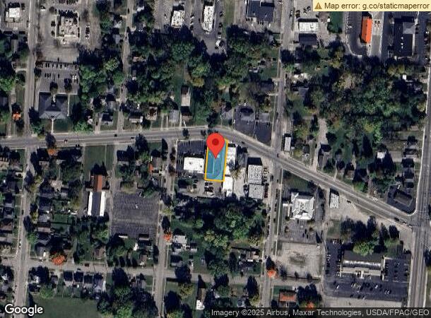
2419 E High St, Springfield, OH 45505


NEARBY LISTINGS FOR SALE OR LEASE
Property Detail
2419 E High St
Springfield, OH
East Spfld
34-00700-02210-5040
EAST SPFLD PT 8 & N E PT 7 & PT VAC ALLEY 7 & 8
Medicalbuilding
Clark
X
Ohio
39023C0192E
40
2024
0.32 AC
2025
Northeast Dayton
001400
Cincinnati/Dayton
4,000 SF
DEMOGRAPHICS near 2419 E High St
1 Mile
3 Mile
5 Mile
2024 Total Population
12,657
56,697
81,064
2029 Population
12,613
56,881
80,933
Pop Growth 2024-2029
(0.35%)
+ 0.32%
(0.16%)
Average Age
39
39
41
2024 Total Households
5,419
23,036
33,623
HH Growth 2024-2029
(0.39%)
+ 0.24%
(0.26%)
Median Household Inc
$50,349
$46,266
$50,755
Avg Household Size
2.20
2.30
2.30
2024 Avg HH Vehicles
2.00
2.00
2.00
Median Home Value
$81,490
$106,861
$129,923
Median Year Built
1948
1951
1957
Nearby Places
Map Layers
Map Styles
 Street
 Aerial
- Restaurants
- Banks
- Shops
- Fitness
- Groceries
PUBLIC TRANSPORTATION
AIRPORT
James M Cox Dayton International
DRIVE
WALK
Distance
James M Cox Dayton International
37 min
28.7 mi
SALE & LEASE HISTORY
LISTING DATE
SALE/LEASE

Oct 30, 2024
For Sale
Mar 03, 2017
For Lease
Jun 17, 2025
For Sale
Nearby Properties
Address
Land Use
TOTAL SIZE
Lot Size
Zoning
Address
Land Use
TOTAL SIZE
Lot Size
Zoning
479,515 SF
1.69 AC
Address
Land Use
TOTAL SIZE
Lot Size
Zoning
399,308 SF
11.06 AC
Address
Land Use
TOTAL SIZE
Lot Size
Zoning
32.89 AC
Address
Land Use
TOTAL SIZE
Lot Size
Zoning
107.87 AC
Address
Land Use
TOTAL SIZE
Lot Size
Zoning
Address
Land Use
TOTAL SIZE
Lot Size
Zoning
44.85 AC
Address
Land Use
TOTAL SIZE
Lot Size
Zoning
103,458 SF
5.51 AC
Address
Land Use
TOTAL SIZE
Lot Size
Zoning
12,657 SF
8.17 AC
Address
Land Use
TOTAL SIZE
Lot Size
Zoning
399,308 SF
11.06 AC
Address
Land Use
TOTAL SIZE
Lot Size
Zoning
516,191 SF
91.52 AC
A
Address
Land Use
TOTAL SIZE
Lot Size
Zoning
61,376 SF
3.95 AC
Address
Land Use
TOTAL SIZE
Lot Size
Zoning
8,316 SF
34.41 AC
R-1
Address
Land Use
TOTAL SIZE
Lot Size
Zoning
25.44 AC
Address
Land Use
TOTAL SIZE
Lot Size
Zoning
47,929 SF
2.77 AC
Address
Land Use
TOTAL SIZE
Lot Size
Zoning
Address
Land Use
TOTAL SIZE
Lot Size
Zoning
199,566 SF
109.96 AC
Address
Land Use
TOTAL SIZE
Lot Size
Zoning
229,125 SF
40.19 AC
Address
Land Use
TOTAL SIZE
Lot Size
Zoning
56,381 SF
2.37 AC
Address
Land Use
TOTAL SIZE
Lot Size
Zoning
6,521 SF
94.30 AC
Address
Land Use
TOTAL SIZE
Lot Size
Zoning
Address
Land Use
TOTAL SIZE
Lot Size
Zoning
Address
Land Use
TOTAL SIZE
Lot Size
Zoning
Address
Land Use
TOTAL SIZE
Lot Size
Zoning
32,566 SF
1.90 AC
Address
Land Use
TOTAL SIZE
Lot Size
Zoning
217,626 SF
17.85 AC
Address
Land Use
TOTAL SIZE
Lot Size
Zoning
Address
Land Use
TOTAL SIZE
Lot Size
Zoning
399,308 SF
31.78 AC
Address
Land Use
TOTAL SIZE
Lot Size
Zoning
1.05 AC
Address
Land Use
TOTAL SIZE
Lot Size
Zoning
Address
Land Use
TOTAL SIZE
Lot Size
Zoning
Address
Land Use
TOTAL SIZE
Lot Size
Zoning
77,006 SF
1.39 AC
The World's #1 Commercial Real Estate Marketplace
Connect with us
© 2026 CoStar Group
The information above has been obtained from sources believed reliable. While we do not doubt its accuracy we have not verified it and make no guarantee, warranty or representation about it. It is your responsibility to independently confirm its accuracy and completeness. Any projections, opinions, assumptions, or estimates used are for example only and do not represent the current or future performance of the property. The value of this transaction to you depends on tax and other factors which should be evaluated by your tax, financial, and legal advisors. You and your advisors should conduct a careful, independent investigation of the property to determine to your satisfaction the suitability of the property for your needs.