Property Record
2419 Mcgaw Rd, Columbus, OH 43207

Save to a Folder
{{folder.Name}}
{{folder.ListingIds.length}} Properties
{{folder.ListingIds.length}} Property
Create a New Folder
Property Detail
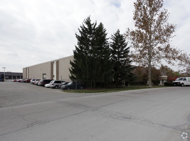
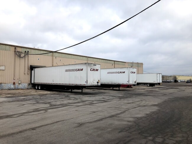
2419 Mcgaw Rd
152-000257
2419 MCGRAW RD R22 T4 S24 4.354 ACRES
Warehouse
FRANKLIN
B and X Area of moderate flood hazard, usually the area between the limits of the 100-year and 500-year floods.
Ohio
2024
4.35 AC
2025
Southeast
008811
Columbus
71,600 SF
Columbus, OH
NEARBY LISTINGS FOR SALE OR LEASE
DEMOGRAPHICS near 2419 Mcgaw Rd
1 mile
3 mile
5 mile
2025 Total Population
2,953
35,309
89,496
2030 Population
3,050
36,375
92,616
Pop Growth 2025-2030
+ 3.28%
+ 3.02%
+ 3.49%
Average Age
39
39
39
2025 Total Households
1,069
13,117
35,820
HH Growth 2025-2030
+ 3.37%
+ 3.10%
+ 3.64%
Median Household Inc
$67,500
$70,986
$60,650
Avg Household Size
2.80
2.70
2.40
2025 Avg HH Vehicles
2.00
2.00
2.00
Median Home Value
$207,669
$210,291
$206,470
Median Year Built
1977
1974
1972
Nearby Places
Map Layers
Map Styles
 Street
 Aerial
Layers
 Traffic
 Biking
Places
Listings with unknown addresses are not visible on the map
- Restaurants
- Banks
- Shops
- Fitness
- Groceries
PUBLIC TRANSPORTATION
AIRPORT
Rickenbacker International
Drive
Walk
Distance
Rickenbacker International
10 min
4.1 mi
John Glenn Columbus International
Drive
Walk
Distance
John Glenn Columbus International
23 min
15.8 mi
SALE & LEASE HISTORY
LISTING DATE
SALE/LEASE

Jan 20, 2020
For Lease
Jan 20, 2020
For Sale
Nearby Properties
Address
Land Use
TOTAL SIZE
Lot Size
Zoning
Address
Land Use
TOTAL SIZE
Lot Size
Zoning
4,200 SF
852.55 AC
Address
Land Use
TOTAL SIZE
Lot Size
Zoning
1,075,600 SF
49.33 AC
Address
Land Use
TOTAL SIZE
Lot Size
Zoning
1,466,512 SF
49.72 AC
Address
Land Use
TOTAL SIZE
Lot Size
Zoning
1,054,500 SF
59.77 AC
Address
Land Use
TOTAL SIZE
Lot Size
Zoning
1,219,000 SF
59.32 AC
Address
Land Use
TOTAL SIZE
Lot Size
Zoning
1,021,020 SF
68.44 AC
Address
Land Use
TOTAL SIZE
Lot Size
Zoning
1,600,052 SF
70.19 AC
Address
Land Use
TOTAL SIZE
Lot Size
Zoning
1,280,501 SF
69.60 AC
Address
Land Use
TOTAL SIZE
Lot Size
Zoning
816,200 SF
51.08 AC
Address
Land Use
TOTAL SIZE
Lot Size
Zoning
959,688 SF
55.34 AC
Address
Land Use
TOTAL SIZE
Lot Size
Zoning
778,272 SF
42.31 AC
Address
Land Use
TOTAL SIZE
Lot Size
Zoning
903,780 SF
45.43 AC
Address
Land Use
TOTAL SIZE
Lot Size
Zoning
720,200 SF
35.71 AC
Address
Land Use
TOTAL SIZE
Lot Size
Zoning
785,854 SF
30.85 AC
Address
Land Use
TOTAL SIZE
Lot Size
Zoning
Address
Land Use
TOTAL SIZE
Lot Size
Zoning
547,200 SF
43.58 AC
Address
Land Use
TOTAL SIZE
Lot Size
Zoning
541,910 SF
36.84 AC
Address
Land Use
TOTAL SIZE
Lot Size
Zoning
743,315 SF
42.17 AC
Address
Land Use
TOTAL SIZE
Lot Size
Zoning
567,000 SF
23.08 AC
Address
Land Use
TOTAL SIZE
Lot Size
Zoning
130,865 SF
9.97 AC
Address
Land Use
TOTAL SIZE
Lot Size
Zoning
767,697 SF
39.49 AC
Address
Land Use
TOTAL SIZE
Lot Size
Zoning
655,288 SF
40.76 AC
Address
Land Use
TOTAL SIZE
Lot Size
Zoning
705,600 SF
43.41 AC
Address
Land Use
TOTAL SIZE
Lot Size
Zoning
590,225 SF
42.21 AC
Address
Land Use
TOTAL SIZE
Lot Size
Zoning
245,756 SF
102.40 AC
Address
Land Use
TOTAL SIZE
Lot Size
Zoning
737,054 SF
37.15 AC
Address
Land Use
TOTAL SIZE
Lot Size
Zoning
614,138 SF
36.90 AC
Address
Land Use
TOTAL SIZE
Lot Size
Zoning
Address
Land Use
TOTAL SIZE
Lot Size
Zoning
642,331 SF
25.16 AC
Address
Land Use
TOTAL SIZE
Lot Size
Zoning
668,447 SF
41.68 AC
The World's #1 Commercial Real Estate Marketplace
Connect with us
© 2026 CoStar Group
The information above has been obtained from sources believed reliable. While we do not doubt its accuracy we have not verified it and make no guarantee, warranty or representation about it. It is your responsibility to independently confirm its accuracy and completeness. Any projections, opinions, assumptions, or estimates used are for example only and do not represent the current or future performance of the property. The value of this transaction to you depends on tax and other factors which should be evaluated by your tax, financial, and legal advisors. You and your advisors should conduct a careful, independent investigation of the property to determine to your satisfaction the suitability of the property for your needs.