Property Record
2419 Navy Blvd, Panama City, FL 32408
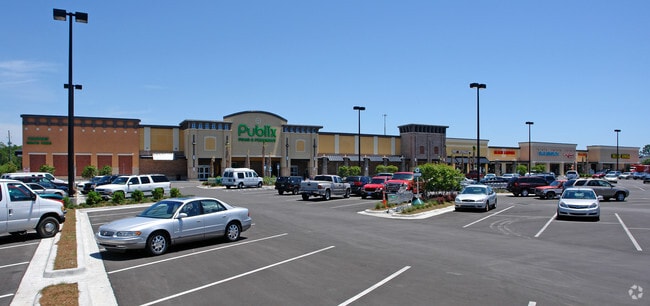


Property Detail
2419 Navy Blvd
30933-002-000
9 4S 15W -1.2- 69C1 COM AT INTERSECTION OF N LINE OF SEC & E R/W OF THOMAS DR TH SELY ALONG R/W 738.74 FOR POB TH NELY 742 SELY 491 SWLY 100 SWLY 115.15 SLY 218.82 TO N R/W LINE OF MAGNOLIA BCH RD W 348.21 NWLY 212.73 SWLY 150 TO E R/W OF THOMAS DR N
Regionalshoppingcenterormallwithanchorstore
BAY
BC05
Florida
B and X Area of moderate flood hazard, usually the area between the limits of the 100-year and 500-year floods.
9.86 AC
2024
Panama City
2025
Other Market Areas
002609
Panama City-Panama City Beach, FL
81,540 SF
NEARBY LISTINGS FOR SALE OR LEASE
DEMOGRAPHICS near 2419 Navy Blvd
1 mile
3 mile
5 mile
2025 Total Population
7,322
30,562
59,022
2030 Population
8,430
35,126
67,995
Pop Growth 2025-2030
+ 15.13%
+ 14.93%
+ 15.20%
Average Age
44
44
43
2025 Total Households
3,256
13,699
26,207
HH Growth 2025-2030
+ 15.57%
+ 15.61%
+ 15.95%
Median Household Inc
$76,298
$74,846
$70,067
Avg Household Size
2.20
2.20
2.20
2025 Avg HH Vehicles
2.00
2.00
2.00
Median Home Value
$363,648
$382,504
$369,422
Median Year Built
1989
1993
1993
Nearby Places
Map Layers
Map Styles
 Street
 Aerial
Layers
 Traffic
 Biking
Places
Listings with unknown addresses are not visible on the map
- Restaurants
- Banks
- Shops
- Fitness
- Groceries
PUBLIC TRANSPORTATION
AIRPORT
Northwest Florida Beaches International
Drive
Walk
Distance
Northwest Florida Beaches International
37 min
22.6 mi
Freight Ports
Port of Panama City
Drive
Walk
Distance
Port of Panama City
9 min
4.3 mi
SALE & LEASE HISTORY
LISTING DATE
SALE/LEASE

Nov 23, 2016
For Lease
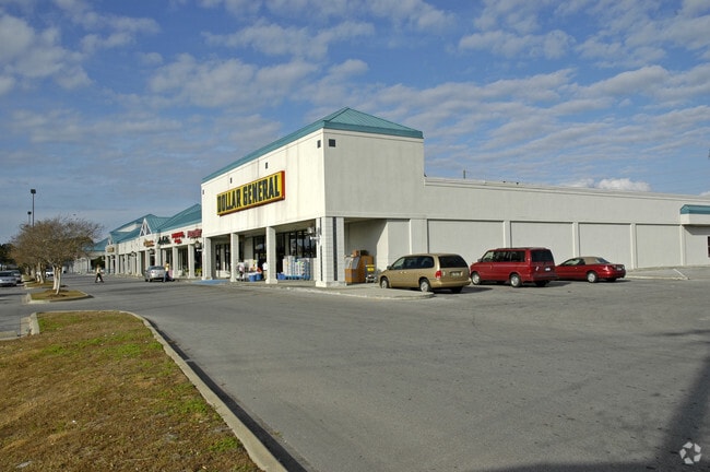
Nearby Properties
Address
Land Use
TOTAL SIZE
Lot Size
Zoning
Address
Land Use
TOTAL SIZE
Lot Size
Zoning
96 AC
BC14
Address
Land Use
TOTAL SIZE
Lot Size
Zoning
68 AC
BC14
Address
Land Use
TOTAL SIZE
Lot Size
Zoning
176.88 AC
BC14
Address
Land Use
TOTAL SIZE
Lot Size
Zoning
287 AC
BC10
Address
Land Use
TOTAL SIZE
Lot Size
Zoning
335,150 SF
17.17 AC
BC05
Address
Land Use
TOTAL SIZE
Lot Size
Zoning
285,798 SF
16.50 AC
BC19
Address
Land Use
TOTAL SIZE
Lot Size
Zoning
648,279 SF
73.10 AC
PC14
Address
Land Use
TOTAL SIZE
Lot Size
Zoning
503,491 SF
79.46 AC
PC12
Address
Land Use
TOTAL SIZE
Lot Size
Zoning
40,690 SF
24.86 AC
BC19
Address
Land Use
TOTAL SIZE
Lot Size
Zoning
38,884 SF
149 AC
BC10
Address
Land Use
TOTAL SIZE
Lot Size
Zoning
254,904 SF
20.60 AC
BC05
Address
Land Use
TOTAL SIZE
Lot Size
Zoning
210,652 SF
19.47 AC
BC19
Address
Land Use
TOTAL SIZE
Lot Size
Zoning
132,433 SF
6.43 AC
PCB21
Address
Land Use
TOTAL SIZE
Lot Size
Zoning
84.50 AC
BC10
Address
Land Use
TOTAL SIZE
Lot Size
Zoning
206,450 SF
12.52 AC
BC05
Address
Land Use
TOTAL SIZE
Lot Size
Zoning
56,045 SF
2.82 AC
BC05
Address
Land Use
TOTAL SIZE
Lot Size
Zoning
208,296 SF
24.72 AC
PC05
Address
Land Use
TOTAL SIZE
Lot Size
Zoning
43,287 SF
7.73 AC
BC04
Address
Land Use
TOTAL SIZE
Lot Size
Zoning
22,462 SF
1.99 AC
BC05
Address
Land Use
TOTAL SIZE
Lot Size
Zoning
145,935 SF
45.63 AC
Address
Land Use
TOTAL SIZE
Lot Size
Zoning
112,780 SF
20.85 AC
BC14
Address
Land Use
TOTAL SIZE
Lot Size
Zoning
143,993 SF
7.27 AC
BC05
Address
Land Use
TOTAL SIZE
Lot Size
Zoning
50,377 SF
1.88 AC
BC05
Address
Land Use
TOTAL SIZE
Lot Size
Zoning
55 AC
BC14
Address
Land Use
TOTAL SIZE
Lot Size
Zoning
54 AC
BC10
Address
Land Use
TOTAL SIZE
Lot Size
Zoning
49,004 SF
6.85 AC
PCB21
Address
Land Use
TOTAL SIZE
Lot Size
Zoning
58,752 SF
4.62 AC
PCB21
Address
Land Use
TOTAL SIZE
Lot Size
Zoning
104,254 SF
2.20 AC
BC05
Address
Land Use
TOTAL SIZE
Lot Size
Zoning
112,121 SF
4.97 AC
Address
Land Use
TOTAL SIZE
Lot Size
Zoning
49.47 AC
BC14
The World's #1 Commercial Real Estate Marketplace
Connect with us
© 2026 CoStar Group
The information above has been obtained from sources believed reliable. While we do not doubt its accuracy we have not verified it and make no guarantee, warranty or representation about it. It is your responsibility to independently confirm its accuracy and completeness. Any projections, opinions, assumptions, or estimates used are for example only and do not represent the current or future performance of the property. The value of this transaction to you depends on tax and other factors which should be evaluated by your tax, financial, and legal advisors. You and your advisors should conduct a careful, independent investigation of the property to determine to your satisfaction the suitability of the property for your needs.