Property Record
142 E Main St, Thomaston, CT 06787


Property Detail
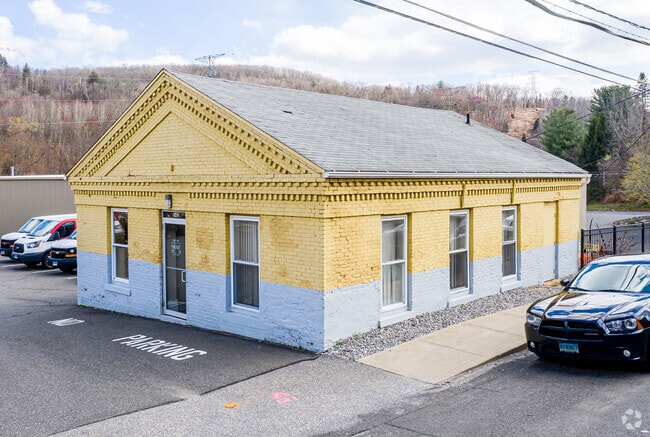
142 E Main St
THOM-000041-000001-000009
LITCHFIELD
Commercialnec
Connecticut
GC
9
2025
0.99 AC
2025
SE Litchfield County
349200
Hartford
7,800 SF
Torrington, CT
NEARBY LISTINGS FOR SALE OR LEASE
-
-
View all Thomaston listings for lease on LoopNet.com
DEMOGRAPHICS near 142 E Main St
1 mile
3 mile
5 mile
2025 Total Population
3,302
14,331
30,499
2030 Population
3,398
14,707
31,348
Pop Growth 2025-2030
+ 2.91%
+ 2.62%
+ 2.78%
Average Age
43
44
44
2025 Total Households
1,441
5,926
12,580
HH Growth 2025-2030
+ 2.78%
+ 2.58%
+ 2.73%
Median Household Inc
$90,757
$100,994
$96,354
Avg Household Size
2.30
2.30
2.40
2025 Avg HH Vehicles
2.00
2.00
2.00
Median Home Value
$305,853
$308,493
$312,101
Median Year Built
1952
1970
1972
Nearby Places
Map Layers
Map Styles
 Street
 Aerial
Transit
 Traffic
 Biking
Places
Listings with unknown addresses are not visible on the map
- Restaurants
- Banks
- Shops
- Fitness
- Groceries
PUBLIC TRANSPORTATION
AIRPORT
Tweed/New Haven
Drive
Walk
Distance
Tweed/New Haven
56 min
37.4 mi
Bradley International
Drive
Walk
Distance
Bradley International
64 min
37.5 mi
Freight Ports
Port of New Haven
Drive
Walk
Distance
Port of New Haven
51 min
34.5 mi
SALE & LEASE HISTORY
LISTING DATE
SALE/LEASE

Jan 12, 2024
For Lease
Nearby Properties
Address
Land Use
TOTAL SIZE
Lot Size
Zoning
Address
Land Use
TOTAL SIZE
Lot Size
Zoning
65,974 SF
20.70 AC
RA15
Address
Land Use
TOTAL SIZE
Lot Size
Zoning
15 AC
M1
Address
Land Use
TOTAL SIZE
Lot Size
Zoning
1,154 SF
435 AC
R90
Address
Land Use
TOTAL SIZE
Lot Size
Zoning
10 AC
RA1
Address
Land Use
TOTAL SIZE
Lot Size
Zoning
2.77 AC
C
Address
Land Use
TOTAL SIZE
Lot Size
Zoning
18,252 SF
1.56 AC
GC
Address
Land Use
TOTAL SIZE
Lot Size
Zoning
3.99 AC
RA1
Address
Land Use
TOTAL SIZE
Lot Size
Zoning
22,938 SF
1.92 AC
M
Address
Land Use
TOTAL SIZE
Lot Size
Zoning
17,085 SF
3.77 AC
RR
Address
Land Use
TOTAL SIZE
Lot Size
Zoning
12.44 AC
M2
Address
Land Use
TOTAL SIZE
Lot Size
Zoning
49,954 SF
3.90 AC
M1
Address
Land Use
TOTAL SIZE
Lot Size
Zoning
94,414 SF
6.50 AC
M
Address
Land Use
TOTAL SIZE
Lot Size
Zoning
4.08 AC
RA15
Address
Land Use
TOTAL SIZE
Lot Size
Zoning
16,867 SF
7.94 AC
RA15GC
Address
Land Use
TOTAL SIZE
Lot Size
Zoning
11,920 SF
4.20 AC
RA15
Address
Land Use
TOTAL SIZE
Lot Size
Zoning
37.72 AC
RA80A
Address
Land Use
TOTAL SIZE
Lot Size
Zoning
49,690 SF
3.59 AC
M
Address
Land Use
TOTAL SIZE
Lot Size
Zoning
129,174 SF
11.92 AC
GC
Address
Land Use
TOTAL SIZE
Lot Size
Zoning
9,594 SF
1.87 AC
GC
Address
Land Use
TOTAL SIZE
Lot Size
Zoning
2.10 AC
C
Address
Land Use
TOTAL SIZE
Lot Size
Zoning
6.10 AC
M
Address
Land Use
TOTAL SIZE
Lot Size
Zoning
2.30 AC
GC
Address
Land Use
TOTAL SIZE
Lot Size
Zoning
130,374 SF
10.50 AC
M2
Address
Land Use
TOTAL SIZE
Lot Size
Zoning
6.55 AC
M1
Address
Land Use
TOTAL SIZE
Lot Size
Zoning
11,067 SF
1.69 AC
M1
Address
Land Use
TOTAL SIZE
Lot Size
Zoning
7.47 AC
M2
Address
Land Use
TOTAL SIZE
Lot Size
Zoning
201.84 AC
RA80A
Address
Land Use
TOTAL SIZE
Lot Size
Zoning
9.16 AC
GC
Address
Land Use
TOTAL SIZE
Lot Size
Zoning
5.11 AC
RA15
Address
Land Use
TOTAL SIZE
Lot Size
Zoning
14.37 AC
M1
The World's #1 Commercial Real Estate Marketplace
Connect with us
© 2026 CoStar Group
The information above has been obtained from sources believed reliable. While we do not doubt its accuracy we have not verified it and make no guarantee, warranty or representation about it. It is your responsibility to independently confirm its accuracy and completeness. Any projections, opinions, assumptions, or estimates used are for example only and do not represent the current or future performance of the property. The value of this transaction to you depends on tax and other factors which should be evaluated by your tax, financial, and legal advisors. You and your advisors should conduct a careful, independent investigation of the property to determine to your satisfaction the suitability of the property for your needs.