Property Record
242 Fm 1984, Maxwell, TX 78656
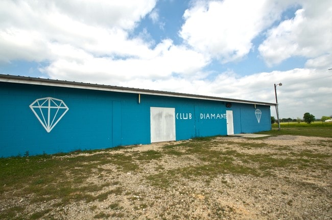


Property Detail
242 Fm 1984
Austin-Round Rock-San Marcos, TX
KOEGLAR HILLS, BLOCK A, LOT 6, ACRES 2.0
12861
Caldwell
Commercialnec
Texas
B and X Area of moderate flood hazard, usually the area between the limits of the 100-year and 500-year floods.
6
2025
2 AC
2025
Caldwell County
960502
Austin
5,474 SF
NEARBY LISTINGS FOR SALE OR LEASE
DEMOGRAPHICS near 242 Fm 1984
1 mile
3 mile
5 mile
2025 Total Population
392
6,029
30,825
2030 Population
445
7,267
36,010
Pop Growth 2025-2030
+ 13.52%
+ 20.53%
+ 16.82%
Average Age
40
37
34
2025 Total Households
146
1,938
10,039
HH Growth 2025-2030
+ 14.38%
+ 21.31%
+ 18.00%
Median Household Inc
$84,091
$99,574
$77,415
Avg Household Size
2.70
3.00
2.90
2025 Avg HH Vehicles
3.00
3.00
2.00
Median Home Value
$256,249
$284,932
$289,795
Median Year Built
1996
2010
2010
Nearby Places
Map Layers
Map Styles
 Street
 Aerial
Transit
 Traffic
 Biking
Places
Listings with unknown addresses are not visible on the map
- Restaurants
- Banks
- Shops
- Fitness
- Groceries
PUBLIC TRANSPORTATION
COMMUTER RAIL
San Marcos Amtrak (Texas Eagle - Amtrak)
Drive
Walk
Distance
San Marcos Amtrak (Texas Eagle - Amtrak)
17 min
9.2 mi
AIRPORT
Austin-Bergstrom International
Drive
Walk
Distance
Austin-Bergstrom International
41 min
27.4 mi
Freight Ports
Calhoun Port
Drive
Walk
Distance
Calhoun Port
164 min
134.5 mi
SALE & LEASE HISTORY
LISTING DATE
SALE/LEASE

Jun 23, 2017
For Sale
Apr 26, 2017
For Sale
Nearby Properties
Address
Land Use
TOTAL SIZE
Lot Size
Zoning
Address
Land Use
TOTAL SIZE
Lot Size
Zoning
1,600 SF
49.26 AC
Address
Land Use
TOTAL SIZE
Lot Size
Zoning
68,590 SF
34.95 AC
Address
Land Use
TOTAL SIZE
Lot Size
Zoning
29,570 SF
0.57 AC
Address
Land Use
TOTAL SIZE
Lot Size
Zoning
13,956 SF
49.65 AC
Address
Land Use
TOTAL SIZE
Lot Size
Zoning
9,300 SF
5.90 AC
Address
Land Use
TOTAL SIZE
Lot Size
Zoning
4,091 SF
42.29 AC
Address
Land Use
TOTAL SIZE
Lot Size
Zoning
11,900 SF
75 AC
Address
Land Use
TOTAL SIZE
Lot Size
Zoning
98.70 AC
Address
Land Use
TOTAL SIZE
Lot Size
Zoning
4.47 AC
Address
Land Use
TOTAL SIZE
Lot Size
Zoning
44.79 AC
Address
Land Use
TOTAL SIZE
Lot Size
Zoning
31,640 SF
1.36 AC
Address
Land Use
TOTAL SIZE
Lot Size
Zoning
11,900 SF
121.96 AC
Address
Land Use
TOTAL SIZE
Lot Size
Zoning
20,000 SF
50 AC
Address
Land Use
TOTAL SIZE
Lot Size
Zoning
3,284 SF
4 AC
Address
Land Use
TOTAL SIZE
Lot Size
Zoning
13.22 AC
Address
Land Use
TOTAL SIZE
Lot Size
Zoning
113.60 AC
Address
Land Use
TOTAL SIZE
Lot Size
Zoning
396 SF
9.55 AC
Address
Land Use
TOTAL SIZE
Lot Size
Zoning
1,218 SF
15.39 AC
Address
Land Use
TOTAL SIZE
Lot Size
Zoning
4,980 SF
19.46 AC
Address
Land Use
TOTAL SIZE
Lot Size
Zoning
11,768 SF
0.26 AC
Address
Land Use
TOTAL SIZE
Lot Size
Zoning
9,060 SF
13.25 AC
Address
Land Use
TOTAL SIZE
Lot Size
Zoning
Address
Land Use
TOTAL SIZE
Lot Size
Zoning
8,936 SF
0.98 AC
Address
Land Use
TOTAL SIZE
Lot Size
Zoning
3,133 SF
2.39 AC
Address
Land Use
TOTAL SIZE
Lot Size
Zoning
Address
Land Use
TOTAL SIZE
Lot Size
Zoning
5,983 SF
15.17 AC
Address
Land Use
TOTAL SIZE
Lot Size
Zoning
34,656 SF
0.80 AC
Address
Land Use
TOTAL SIZE
Lot Size
Zoning
12,432 SF
1 AC
Address
Land Use
TOTAL SIZE
Lot Size
Zoning
432 SF
40 AC
Address
Land Use
TOTAL SIZE
Lot Size
Zoning
47.95 AC
The World's #1 Commercial Real Estate Marketplace
Connect with us
© 2026 CoStar Group
The information above has been obtained from sources believed reliable. While we do not doubt its accuracy we have not verified it and make no guarantee, warranty or representation about it. It is your responsibility to independently confirm its accuracy and completeness. Any projections, opinions, assumptions, or estimates used are for example only and do not represent the current or future performance of the property. The value of this transaction to you depends on tax and other factors which should be evaluated by your tax, financial, and legal advisors. You and your advisors should conduct a careful, independent investigation of the property to determine to your satisfaction the suitability of the property for your needs.