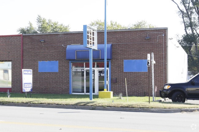
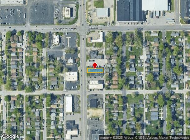
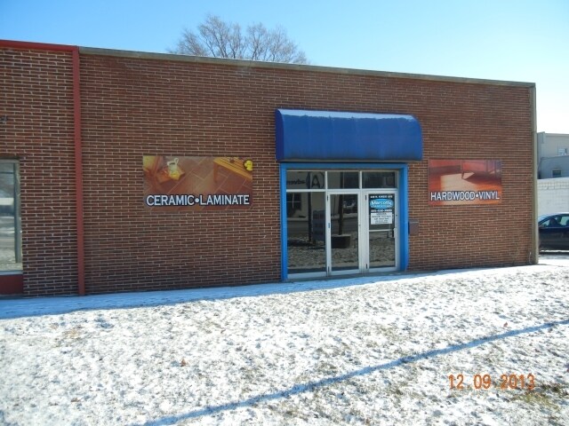
Property Record
242 N Bradley Blvd, Bradley, IL 60915
NEARBY LISTINGS FOR SALE OR LEASE
Property Detail
242 N Bradley Blvd
Kankakee, IL
Village Of Bradley
17-09-28-104-008
VILLAGE OF BRADLEY LOT 9 BLK 92 28-31-12E
Commercialnec
Kankakee
X
Illinois
17091C0213E
9
2024
0.13 AC
2024
Illinois North Area
010702
Other Market Areas
DEMOGRAPHICS near 242 N Bradley Blvd
1 Mile
3 Mile
5 Mile
2024 Total Population
6,461
53,978
67,708
2029 Population
6,266
53,060
66,545
Pop Growth 2024-2029
(3.02%)
(1.70%)
(1.72%)
Average Age
38
38
38
2024 Total Households
2,597
20,440
25,519
HH Growth 2024-2029
(3.16%)
(1.80%)
(1.81%)
Median Household Inc
$50,085
$56,970
$60,740
Avg Household Size
2.30
2.40
2.50
2024 Avg HH Vehicles
2.00
2.00
2.00
Median Home Value
$143,573
$159,988
$162,163
Median Year Built
1964
1969
1970
Nearby Places
Map Layers
Map Styles
 Street
 Aerial
- Restaurants
- Banks
- Shops
- Fitness
- Groceries
PUBLIC TRANSPORTATION
COMMUTER RAIL
Kankakee (City of New Orleans - Amtrak, Illini - Amtrak, Saluki - Amtrak)
DRIVE
WALK
Distance
Kankakee (City of New Orleans - Amtrak, Illini - Amtrak, Saluki - Amtrak)
5 min
2.7 mi
Freight Ports
Port Milwaukee
DRIVE
WALK
Distance
Port Milwaukee
172 min
141.5 mi
Nearby Properties
Address
Land Use
TOTAL SIZE
Lot Size
Zoning
Address
Land Use
TOTAL SIZE
Lot Size
Zoning
Address
Land Use
TOTAL SIZE
Lot Size
Zoning
43.69 AC
Address
Land Use
TOTAL SIZE
Lot Size
Zoning
52.73 AC
I2
Address
Land Use
TOTAL SIZE
Lot Size
Zoning
Address
Land Use
TOTAL SIZE
Lot Size
Zoning
Address
Land Use
TOTAL SIZE
Lot Size
Zoning
Address
Land Use
TOTAL SIZE
Lot Size
Zoning
13.96 AC
Address
Land Use
TOTAL SIZE
Lot Size
Zoning
4.60 AC
Address
Land Use
TOTAL SIZE
Lot Size
Zoning
35.35 AC
C2
Address
Land Use
TOTAL SIZE
Lot Size
Zoning
Address
Land Use
TOTAL SIZE
Lot Size
Zoning
11.40 AC
Address
Land Use
TOTAL SIZE
Lot Size
Zoning
1.70 AC
Address
Land Use
TOTAL SIZE
Lot Size
Zoning
Address
Land Use
TOTAL SIZE
Lot Size
Zoning
27.09 AC
Address
Land Use
TOTAL SIZE
Lot Size
Zoning
Address
Land Use
TOTAL SIZE
Lot Size
Zoning
Address
Land Use
TOTAL SIZE
Lot Size
Zoning
Address
Land Use
TOTAL SIZE
Lot Size
Zoning
Address
Land Use
TOTAL SIZE
Lot Size
Zoning
13.50 AC
Address
Land Use
TOTAL SIZE
Lot Size
Zoning
Address
Land Use
TOTAL SIZE
Lot Size
Zoning
0.92 AC
Address
Land Use
TOTAL SIZE
Lot Size
Zoning
Address
Land Use
TOTAL SIZE
Lot Size
Zoning
23.74 AC
Address
Land Use
TOTAL SIZE
Lot Size
Zoning
Address
Land Use
TOTAL SIZE
Lot Size
Zoning
4.79 AC
Address
Land Use
TOTAL SIZE
Lot Size
Zoning
Address
Land Use
TOTAL SIZE
Lot Size
Zoning
Address
Land Use
TOTAL SIZE
Lot Size
Zoning
1.33 AC
Address
Land Use
TOTAL SIZE
Lot Size
Zoning
8.29 AC
Address
Land Use
TOTAL SIZE
Lot Size
Zoning
The World's #1 Commercial Real Estate Marketplace
Connect with us
© 2025 CoStar Group
The information above has been obtained from sources believed reliable. While we do not doubt its accuracy we have not verified it and make no guarantee, warranty or representation about it. It is your responsibility to independently confirm its accuracy and completeness. Any projections, opinions, assumptions, or estimates used are for example only and do not represent the current or future performance of the property. The value of this transaction to you depends on tax and other factors which should be evaluated by your tax, financial, and legal advisors. You and your advisors should conduct a careful, independent investigation of the property to determine to your satisfaction the suitability of the property for your needs.