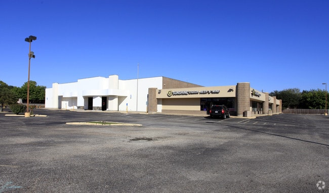
Property Record
2420 Cartwright Rd, Missouri City, TX 77489


NEARBY LISTINGS FOR SALE OR LEASE
Property Detail
2420 Cartwright Rd
Houston-The Woodlands-Sugar Land, TX
Meadowcreek Sec 2
4960-02-000-0010-907
MEADOWCREEK SEC 2, LOT 1, ACRES 2.9104, RESERVE A (PT) (GROCERY STORE)
Commercialnec
Fort Bend
X
Texas
48157C0285M
1
2024
2.91 AC
2025
Stafford
671101
Houston
27,556 SF
DEMOGRAPHICS near 2420 Cartwright Rd
1 Mile
3 Mile
5 Mile
2024 Total Population
14,960
97,936
257,051
2029 Population
18,014
117,426
300,305
Pop Growth 2024-2029
+ 20.41%
+ 19.90%
+ 16.83%
Average Age
41
40
39
2024 Total Households
5,279
33,131
87,854
HH Growth 2024-2029
+ 20.95%
+ 20.50%
+ 17.28%
Median Household Inc
$68,435
$80,181
$77,607
Avg Household Size
2.80
2.90
2.90
2024 Avg HH Vehicles
2.00
2.00
2.00
Median Home Value
$196,116
$242,399
$263,593
Median Year Built
1981
1991
1991
Nearby Places
Map Layers
Map Styles
 Street
 Aerial
- Restaurants
- Banks
- Shops
- Fitness
- Groceries
PUBLIC TRANSPORTATION
AIRPORT
William P Hobby
DRIVE
WALK
Distance
William P Hobby
35 min
21.0 mi
George Bush Intcntl/Houston
DRIVE
WALK
Distance
George Bush Intcntl/Houston
53 min
37.1 mi
SALE & LEASE HISTORY
LISTING DATE
SALE/LEASE

Dec 18, 2025
For Sale
Dec 12, 2025
For Sale
Nearby Properties
Address
Land Use
TOTAL SIZE
Lot Size
Zoning
Address
Land Use
TOTAL SIZE
Lot Size
Zoning
257,051 SF
64.85 AC
Address
Land Use
TOTAL SIZE
Lot Size
Zoning
109,083 SF
20.81 AC
Address
Land Use
TOTAL SIZE
Lot Size
Zoning
967,659 SF
75.03 AC
Address
Land Use
TOTAL SIZE
Lot Size
Zoning
365,915 SF
57.06 AC
AT
Address
Land Use
TOTAL SIZE
Lot Size
Zoning
344,620 SF
53.65 AC
STHQZ
Address
Land Use
TOTAL SIZE
Lot Size
Zoning
93,310 SF
13.41 AC
Address
Land Use
TOTAL SIZE
Lot Size
Zoning
14,038 SF
23.83 AC
Address
Land Use
TOTAL SIZE
Lot Size
Zoning
Address
Land Use
TOTAL SIZE
Lot Size
Zoning
Address
Land Use
TOTAL SIZE
Lot Size
Zoning
127,458 SF
14.21 AC
Address
Land Use
TOTAL SIZE
Lot Size
Zoning
1,712 SF
17.93 AC
SM
Address
Land Use
TOTAL SIZE
Lot Size
Zoning
490,720 SF
26.78 AC
S
Address
Land Use
TOTAL SIZE
Lot Size
Zoning
Address
Land Use
TOTAL SIZE
Lot Size
Zoning
88,560 SF
10.25 AC
QZ
Address
Land Use
TOTAL SIZE
Lot Size
Zoning
39.26 AC
Address
Land Use
TOTAL SIZE
Lot Size
Zoning
9.10 AC
Address
Land Use
TOTAL SIZE
Lot Size
Zoning
24.49 AC
QSY
Address
Land Use
TOTAL SIZE
Lot Size
Zoning
21.84 AC
QSY
Address
Land Use
TOTAL SIZE
Lot Size
Zoning
294,941 SF
18.86 AC
Address
Land Use
TOTAL SIZE
Lot Size
Zoning
189,336 SF
42.18 AC
MJT
Address
Land Use
TOTAL SIZE
Lot Size
Zoning
19.33 AC
Address
Land Use
TOTAL SIZE
Lot Size
Zoning
189,336 SF
25.53 AC
S
Address
Land Use
TOTAL SIZE
Lot Size
Zoning
84,673 SF
9.57 AC
X
Address
Land Use
TOTAL SIZE
Lot Size
Zoning
966,869 SF
16.14 AC
Address
Land Use
TOTAL SIZE
Lot Size
Zoning
120,046 SF
10.19 AC
QSXA
Address
Land Use
TOTAL SIZE
Lot Size
Zoning
98,525 SF
14.81 AC
S
Address
Land Use
TOTAL SIZE
Lot Size
Zoning
984 SF
9.08 AC
S
Address
Land Use
TOTAL SIZE
Lot Size
Zoning
12.22 AC
OS
Address
Land Use
TOTAL SIZE
Lot Size
Zoning
73,196 SF
19.52 AC
SH
Address
Land Use
TOTAL SIZE
Lot Size
Zoning
13.32 AC
The World's #1 Commercial Real Estate Marketplace
Connect with us
© 2025 CoStar Group
The information above has been obtained from sources believed reliable. While we do not doubt its accuracy we have not verified it and make no guarantee, warranty or representation about it. It is your responsibility to independently confirm its accuracy and completeness. Any projections, opinions, assumptions, or estimates used are for example only and do not represent the current or future performance of the property. The value of this transaction to you depends on tax and other factors which should be evaluated by your tax, financial, and legal advisors. You and your advisors should conduct a careful, independent investigation of the property to determine to your satisfaction the suitability of the property for your needs.