Property Record
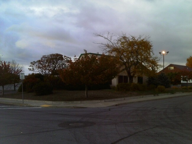
2420 Dahlia St, Klamath Falls, OR 97601


Property Detail
2420 Dahlia St
R170120
LP 5-17 PARCEL 2
Officebuilding
Klamath
PUD
Oregon
B and X Area of moderate flood hazard, usually the area between the limits of the 100-year and 500-year floods.
6-7
2025
0.25 AC
2025
Oregon East Area
972000
Other Market Areas
1,716 SF
Klamath Falls, OR
NEARBY LISTINGS FOR SALE OR LEASE
DEMOGRAPHICS near 2420 Dahlia St
1 mile
3 mile
5 mile
2024 Total Population
5,339
18,906
36,309
2029 Population
5,353
18,944
36,376
Pop Growth 2024-2029
+ 0.26%
+ 0.20%
+ 0.18%
Average Age
38
39
40
2024 Total Households
2,030
7,866
14,947
HH Growth 2024-2029
(0.20%)
(0.04%)
+ 0.01%
Median Household Inc
$44,512
$39,371
$42,647
Avg Household Size
2.30
2.20
2.30
2024 Avg HH Vehicles
2.00
2.00
2.00
Median Home Value
$263,182
$251,545
$242,834
Median Year Built
1968
1961
1967
Nearby Places
Map Layers
Map Styles
 Street
 Aerial
Transit
 Traffic
 Biking
Places
Listings with unknown addresses are not visible on the map
- Restaurants
- Banks
- Shops
- Fitness
- Groceries
PUBLIC TRANSPORTATION
COMMUTER RAIL
Drive
Walk
Distance
5 min
2.3 mi
SALE & LEASE HISTORY
LISTING DATE
SALE/LEASE

Sep 24, 2016
For Sale
Nearby Properties
Address
Land Use
TOTAL SIZE
Lot Size
Zoning
Address
Land Use
TOTAL SIZE
Lot Size
Zoning
210,396 SF
12.99 AC
PUD
Address
Land Use
TOTAL SIZE
Lot Size
Zoning
15,313 SF
1.63 AC
PUD
Address
Land Use
TOTAL SIZE
Lot Size
Zoning
530,947 SF
156.42 AC
PUD
Address
Land Use
TOTAL SIZE
Lot Size
Zoning
Address
Land Use
TOTAL SIZE
Lot Size
Zoning
784 SF
5.73 AC
I
Address
Land Use
TOTAL SIZE
Lot Size
Zoning
3.92 AC
MU
Address
Land Use
TOTAL SIZE
Lot Size
Zoning
179,904 SF
13.90 AC
GC
Address
Land Use
TOTAL SIZE
Lot Size
Zoning
66,904 SF
36.90 AC
PF
Address
Land Use
TOTAL SIZE
Lot Size
Zoning
145,149 SF
4.90 AC
PF
Address
Land Use
TOTAL SIZE
Lot Size
Zoning
57,008 SF
1.43 AC
PF
Address
Land Use
TOTAL SIZE
Lot Size
Zoning
10.33 AC
I
Address
Land Use
TOTAL SIZE
Lot Size
Zoning
1 SF
11.75 AC
Address
Land Use
TOTAL SIZE
Lot Size
Zoning
Address
Land Use
TOTAL SIZE
Lot Size
Zoning
98,373 SF
0.69 AC
PUD
Address
Land Use
TOTAL SIZE
Lot Size
Zoning
61,045 SF
2.44 AC
A
Address
Land Use
TOTAL SIZE
Lot Size
Zoning
41,978 SF
23.54 AC
PUD
Address
Land Use
TOTAL SIZE
Lot Size
Zoning
7,432 SF
0.16 AC
A
Address
Land Use
TOTAL SIZE
Lot Size
Zoning
2.46 AC
MU
Address
Land Use
TOTAL SIZE
Lot Size
Zoning
4,524 SF
0.88 AC
MD,GC
Address
Land Use
TOTAL SIZE
Lot Size
Zoning
41,938 SF
1.45 AC
PF
Address
Land Use
TOTAL SIZE
Lot Size
Zoning
26,645 SF
1.66 AC
A
Address
Land Use
TOTAL SIZE
Lot Size
Zoning
29,106 SF
8.76 AC
GC
Address
Land Use
TOTAL SIZE
Lot Size
Zoning
2,638 SF
8.17 AC
A
Address
Land Use
TOTAL SIZE
Lot Size
Zoning
20,430 SF
2.96 AC
MD,GC
Address
Land Use
TOTAL SIZE
Lot Size
Zoning
30.31 AC
I
Address
Land Use
TOTAL SIZE
Lot Size
Zoning
4.06 AC
PF
Address
Land Use
TOTAL SIZE
Lot Size
Zoning
16,952 SF
2.28 AC
GC
Address
Land Use
TOTAL SIZE
Lot Size
Zoning
62,750 SF
8.26 AC
GC,I
The World's #1 Commercial Real Estate Marketplace
Connect with us
© 2026 CoStar Group
The information above has been obtained from sources believed reliable. While we do not doubt its accuracy we have not verified it and make no guarantee, warranty or representation about it. It is your responsibility to independently confirm its accuracy and completeness. Any projections, opinions, assumptions, or estimates used are for example only and do not represent the current or future performance of the property. The value of this transaction to you depends on tax and other factors which should be evaluated by your tax, financial, and legal advisors. You and your advisors should conduct a careful, independent investigation of the property to determine to your satisfaction the suitability of the property for your needs.