Property Record
2420 Lippard Lane Ext, Harrisburg, NC 28075

NEARBY LISTINGS FOR SALE OR LEASE
Property Detail
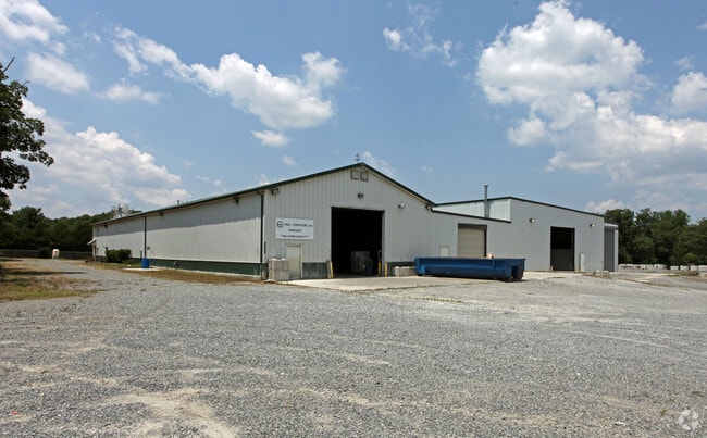
2420 Lippard Lane Ext
5518-73-9136-0000
Stough Rd
Warehouse
WEST SIDE NC HWY 49 S
X
Cabarrus
3710551800K
North Carolina
2025
1.73 AC
2025
Cabarrus County
041505
Charlotte
11,853 SF
Charlotte-Concord-Gastonia, NC-SC
DEMOGRAPHICS near 2420 Lippard Lane Ext
1 Mile
3 Mile
5 Mile
2024 Total Population
1,228
33,952
98,781
2029 Population
1,374
38,102
110,577
Pop Growth 2024-2029
+ 11.89%
+ 12.22%
+ 11.94%
Average Age
38
38
38
2024 Total Households
403
11,753
34,581
HH Growth 2024-2029
+ 10.67%
+ 10.79%
+ 10.63%
Median Household Inc
$105,482
$96,315
$87,453
Avg Household Size
3.00
2.80
2.80
2024 Avg HH Vehicles
2.00
2.00
2.00
Median Home Value
$275,609
$293,280
$281,119
Median Year Built
2004
2000
1999
Nearby Places
Map Layers
Map Styles
 Street
 Aerial
- Restaurants
- Banks
- Shops
- Fitness
- Groceries
PUBLIC TRANSPORTATION
AIRPORT
Concord-Padgett Regional
DRIVE
WALK
Distance
Concord-Padgett Regional
19 min
10.3 mi
Charlotte/Douglas International
DRIVE
WALK
Distance
Charlotte/Douglas International
39 min
24.8 mi
Freight Ports
Port of Wilmington
DRIVE
WALK
Distance
Port of Wilmington
256 min
199.1 mi
SALE & LEASE HISTORY
LISTING DATE
SALE/LEASE

Nov 06, 2017
For Lease
Nearby Properties
Address
Land Use
TOTAL SIZE
Lot Size
Zoning
Address
Land Use
TOTAL SIZE
Lot Size
Zoning
495.38 AC
I-2
Address
Land Use
TOTAL SIZE
Lot Size
Zoning
196,893 SF
43.82 AC
MDR
Address
Land Use
TOTAL SIZE
Lot Size
Zoning
226,355 SF
99.26 AC
O-I
Address
Land Use
TOTAL SIZE
Lot Size
Zoning
163,494 SF
89.85 AC
I-2
Address
Land Use
TOTAL SIZE
Lot Size
Zoning
350,339 SF
77.60 AC
RM-1
Address
Land Use
TOTAL SIZE
Lot Size
Zoning
175,978 SF
63.81 AC
O-I
Address
Land Use
TOTAL SIZE
Lot Size
Zoning
6,539 SF
173.17 AC
LI
Address
Land Use
TOTAL SIZE
Lot Size
Zoning
21,714 SF
15.02 AC
RC
Address
Land Use
TOTAL SIZE
Lot Size
Zoning
35,268 SF
54 AC
PUD
Address
Land Use
TOTAL SIZE
Lot Size
Zoning
152,554 SF
29.94 AC
O-I
Address
Land Use
TOTAL SIZE
Lot Size
Zoning
160,412 SF
39.97 AC
O-I
Address
Land Use
TOTAL SIZE
Lot Size
Zoning
360,400 SF
20.32 AC
EC
Address
Land Use
TOTAL SIZE
Lot Size
Zoning
116,471 SF
24.39 AC
PUD
Address
Land Use
TOTAL SIZE
Lot Size
Zoning
125,245 SF
21.47 AC
O-I
Address
Land Use
TOTAL SIZE
Lot Size
Zoning
304,000 SF
17.30 AC
EC
Address
Land Use
TOTAL SIZE
Lot Size
Zoning
160,357 SF
26.85 AC
O-I
Address
Land Use
TOTAL SIZE
Lot Size
Zoning
4,588 SF
550.66 AC
I-2
Address
Land Use
TOTAL SIZE
Lot Size
Zoning
8,640 SF
15.51 AC
RC
Address
Land Use
TOTAL SIZE
Lot Size
Zoning
48,888 SF
15.29 AC
GC
Address
Land Use
TOTAL SIZE
Lot Size
Zoning
126,214 SF
93.87 AC
O-I
Address
Land Use
TOTAL SIZE
Lot Size
Zoning
12,486 SF
232.04 AC
O-I
Address
Land Use
TOTAL SIZE
Lot Size
Zoning
174,732 SF
29.05 AC
LI
Address
Land Use
TOTAL SIZE
Lot Size
Zoning
8,656 SF
10.01 AC
RC
Address
Land Use
TOTAL SIZE
Lot Size
Zoning
54,503 SF
9.32 AC
EC
Address
Land Use
TOTAL SIZE
Lot Size
Zoning
12,150 SF
7.23 AC
GI
Address
Land Use
TOTAL SIZE
Lot Size
Zoning
220,121 SF
10.99 AC
I-2
Address
Land Use
TOTAL SIZE
Lot Size
Zoning
21,152 SF
6.03 AC
MDR
Address
Land Use
TOTAL SIZE
Lot Size
Zoning
38,274 SF
15.29 AC
PUD
Address
Land Use
TOTAL SIZE
Lot Size
Zoning
54.02 AC
Address
Land Use
TOTAL SIZE
Lot Size
Zoning
98,452 SF
10.46 AC
I-2
The World's #1 Commercial Real Estate Marketplace
Connect with us
© 2026 CoStar Group
The information above has been obtained from sources believed reliable. While we do not doubt its accuracy we have not verified it and make no guarantee, warranty or representation about it. It is your responsibility to independently confirm its accuracy and completeness. Any projections, opinions, assumptions, or estimates used are for example only and do not represent the current or future performance of the property. The value of this transaction to you depends on tax and other factors which should be evaluated by your tax, financial, and legal advisors. You and your advisors should conduct a careful, independent investigation of the property to determine to your satisfaction the suitability of the property for your needs.