Property Record
2420 Nw Button Rd, Topeka, KS 66618
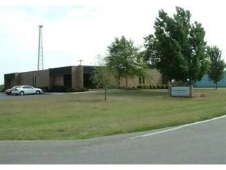

Property Detail
2420 Nw Button Rd
Topeka, KS
S13 , T11 , R15 , POB 688(S) & 30 E OF NW COR GVT LT 5, TH E 300, S 582.16, W 255.18, NW 85.97, N 515.9 TO POB
096-13-0-30-01-002-000
Shawnee
Officebuilding
Kansas
I2
5
2024
3.98 AC
2025
Topeka
000700
Kansas City
7,510 SF
NEARBY LISTINGS FOR SALE OR LEASE
DEMOGRAPHICS near 2420 Nw Button Rd
1 mile
3 mile
5 mile
2025 Total Population
860
25,196
77,652
2030 Population
877
25,295
77,873
Pop Growth 2025-2030
+ 1.98%
+ 0.39%
+ 0.28%
Average Age
39
41
41
2025 Total Households
325
10,793
33,258
HH Growth 2025-2030
+ 2.15%
+ 0.42%
+ 0.31%
Median Household Inc
$57,585
$57,290
$56,227
Avg Household Size
2.40
2.20
2.20
2025 Avg HH Vehicles
2.00
2.00
2.00
Median Home Value
$111,607
$151,501
$145,255
Median Year Built
1985
1957
1958
Nearby Places
Map Layers
Map Styles
 Street
 Aerial
Layers
 Traffic
 Biking
Places
Listings with unknown addresses are not visible on the map
- Restaurants
- Banks
- Shops
- Fitness
- Groceries
PUBLIC TRANSPORTATION
COMMUTER RAIL
Drive
Walk
Distance
12 min
4.9 mi
Nearby Properties
Address
Land Use
TOTAL SIZE
Lot Size
Zoning
Address
Land Use
TOTAL SIZE
Lot Size
Zoning
513,835 SF
13.39 AC
M1
Address
Land Use
TOTAL SIZE
Lot Size
Zoning
309,298 SF
7.34 AC
M1
Address
Land Use
TOTAL SIZE
Lot Size
Zoning
90,929 SF
8.68 AC
PUD,OI3,I1
Address
Land Use
TOTAL SIZE
Lot Size
Zoning
114,523 SF
6.92 AC
OI3
Address
Land Use
TOTAL SIZE
Lot Size
Zoning
94,830 SF
17.09 AC
PUD,M4
Address
Land Use
TOTAL SIZE
Lot Size
Zoning
123,795 SF
16.45 AC
PUD,R1,I1,
Address
Land Use
TOTAL SIZE
Lot Size
Zoning
129,425 SF
96.26 AC
R1
Address
Land Use
TOTAL SIZE
Lot Size
Zoning
22,484 SF
75.33 AC
R1
Address
Land Use
TOTAL SIZE
Lot Size
Zoning
32,838 SF
3.25 AC
MS1
Address
Land Use
TOTAL SIZE
Lot Size
Zoning
116,026 SF
47.17 AC
R1
Address
Land Use
TOTAL SIZE
Lot Size
Zoning
44,567 SF
2.88 AC
MS1
Address
Land Use
TOTAL SIZE
Lot Size
Zoning
55,353 SF
12.40 AC
OI2
Address
Land Use
TOTAL SIZE
Lot Size
Zoning
67,302 SF
6.62 AC
OI2,OI3
Address
Land Use
TOTAL SIZE
Lot Size
Zoning
135,164 SF
11.01 AC
PUD,I1
Address
Land Use
TOTAL SIZE
Lot Size
Zoning
39,790 SF
3.76 AC
PUD
Address
Land Use
TOTAL SIZE
Lot Size
Zoning
44,143 SF
2.44 AC
OI2
Address
Land Use
TOTAL SIZE
Lot Size
Zoning
64,310 SF
12.95 AC
PUD,R1,I1,
Address
Land Use
TOTAL SIZE
Lot Size
Zoning
52,406 SF
4.87 AC
M1
Address
Land Use
TOTAL SIZE
Lot Size
Zoning
17,544 SF
42.80 AC
PUD,I1,M2,
Address
Land Use
TOTAL SIZE
Lot Size
Zoning
26,269 SF
8.18 AC
RR1
Address
Land Use
TOTAL SIZE
Lot Size
Zoning
64,318 SF
10.17 AC
RR1
Address
Land Use
TOTAL SIZE
Lot Size
Zoning
16,168 SF
1.62 AC
MS1
Address
Land Use
TOTAL SIZE
Lot Size
Zoning
51,285 SF
36.63 AC
PUD,I1,M2,
Address
Land Use
TOTAL SIZE
Lot Size
Zoning
18,984 SF
0.35 AC
HL,X3
Address
Land Use
TOTAL SIZE
Lot Size
Zoning
91,840 SF
13.75 AC
PUD,I1
Address
Land Use
TOTAL SIZE
Lot Size
Zoning
20,304 SF
13.48 AC
RR1
Address
Land Use
TOTAL SIZE
Lot Size
Zoning
26,783 SF
3.11 AC
PUD,I1,M2,
Address
Land Use
TOTAL SIZE
Lot Size
Zoning
50,854 SF
4.42 AC
PUD,R1
Address
Land Use
TOTAL SIZE
Lot Size
Zoning
0.41 AC
OI2
Address
Land Use
TOTAL SIZE
Lot Size
Zoning
421,639 SF
30.15 AC
PUD,I1
The World's #1 Commercial Real Estate Marketplace
Connect with us
© 2026 CoStar Group
The information above has been obtained from sources believed reliable. While we do not doubt its accuracy we have not verified it and make no guarantee, warranty or representation about it. It is your responsibility to independently confirm its accuracy and completeness. Any projections, opinions, assumptions, or estimates used are for example only and do not represent the current or future performance of the property. The value of this transaction to you depends on tax and other factors which should be evaluated by your tax, financial, and legal advisors. You and your advisors should conduct a careful, independent investigation of the property to determine to your satisfaction the suitability of the property for your needs.