Property Record
2420 Parsons Blvd, Whitestone, NY 11357
NEARBY LISTINGS FOR SALE OR LEASE
Property Detail
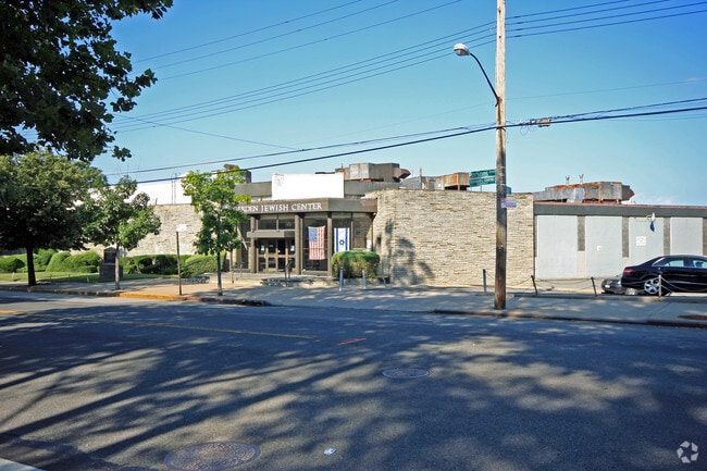
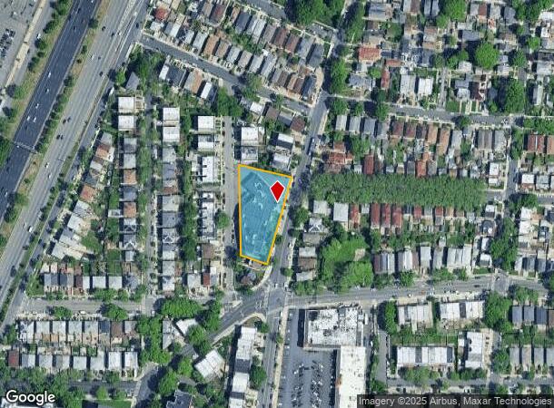
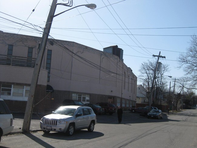
2420 Parsons Blvd
04250-0007
Flushing Gdns/Parsons Blvd
Publichealthcarefacility
Queens
X
New York
3604970114F
7
2024
0.92 AC
2025
Northeast Queens
088903
Long Island (New York)
36,400 SF
New York-Jersey City-White Plains, NY-NJ
DEMOGRAPHICS near 2420 Parsons Blvd
1 mile
3 mile
5 mile
2024 Total Population
60,288
406,179
1,453,828
2029 Population
56,756
376,804
1,356,623
Pop Growth 2024-2029
(5.86%)
(7.23%)
(6.69%)
Average Age
45
43
41
2024 Total Households
21,140
135,455
514,902
HH Growth 2024-2029
(6.19%)
(7.45%)
(6.95%)
Median Household Inc
$58,454
$65,577
$66,265
Avg Household Size
2.70
2.90
2.70
2024 Avg HH Vehicles
1.00
1.00
1.00
Median Home Value
$670,659
$730,150
$686,334
Median Year Built
1958
1957
1954
Nearby Places
Map Layers
Map Styles
 Street
 Aerial
Transit
 Traffic
 Biking
Places
Listings with unknown addresses are not visible on the map
- Restaurants
- Banks
- Shops
- Fitness
- Groceries
PUBLIC TRANSPORTATION
COMMUTER RAIL
Murray Hill Station (Port Washington Branch - Long Island Rail Road)
Drive
Walk
Distance
Murray Hill Station (Port Washington Branch - Long Island Rail Road)
3 min
1.5 mi
Flushing-Main Street Station (Port Washington Branch - Long Island Rail Road)
Drive
Walk
Distance
Flushing-Main Street Station (Port Washington Branch - Long Island Rail Road)
5 min
1.8 mi
AIRPORT
LaGuardia
Drive
Walk
Distance
LaGuardia
10 min
4.6 mi
John F Kennedy International
Drive
Walk
Distance
John F Kennedy International
16 min
12.1 mi
Newark Liberty International
Drive
Walk
Distance
Newark Liberty International
37 min
29.6 mi
Freight Ports
NY - Red Hook Container Terminal
Drive
Walk
Distance
NY - Red Hook Container Terminal
25 min
15.1 mi
Nearby Properties
Address
Land Use
TOTAL SIZE
Lot Size
Zoning
Address
Land Use
TOTAL SIZE
Lot Size
Zoning
2,078,606 SF
58.93 AC
R4
Address
Land Use
TOTAL SIZE
Lot Size
Zoning
1,258,350 SF
410.24 AC
PARK
Address
Land Use
TOTAL SIZE
Lot Size
Zoning
703,265 SF
83.45 AC
R4
Address
Land Use
TOTAL SIZE
Lot Size
Zoning
421,996 SF
136.05 AC
R3-1
Address
Land Use
TOTAL SIZE
Lot Size
Zoning
4,050 SF
113.40 AC
PARK
Address
Land Use
TOTAL SIZE
Lot Size
Zoning
4,800 SF
80.10 AC
PARK
Address
Land Use
TOTAL SIZE
Lot Size
Zoning
480 SF
55.26 AC
R4A
Address
Land Use
TOTAL SIZE
Lot Size
Zoning
480 SF
55.26 AC
R4A
Address
Land Use
TOTAL SIZE
Lot Size
Zoning
480 SF
55.26 AC
R4A
Address
Land Use
TOTAL SIZE
Lot Size
Zoning
480 SF
55.26 AC
R4A
Address
Land Use
TOTAL SIZE
Lot Size
Zoning
480 SF
55.26 AC
R4A
Address
Land Use
TOTAL SIZE
Lot Size
Zoning
480 SF
55.26 AC
R4A
Address
Land Use
TOTAL SIZE
Lot Size
Zoning
480 SF
55.26 AC
R4A
Address
Land Use
TOTAL SIZE
Lot Size
Zoning
480 SF
55.26 AC
R4A
Address
Land Use
TOTAL SIZE
Lot Size
Zoning
480 SF
55.26 AC
R4A
Address
Land Use
TOTAL SIZE
Lot Size
Zoning
480 SF
55.26 AC
R4A
Address
Land Use
TOTAL SIZE
Lot Size
Zoning
480 SF
55.26 AC
R4A
Address
Land Use
TOTAL SIZE
Lot Size
Zoning
480 SF
55.26 AC
R4A
Address
Land Use
TOTAL SIZE
Lot Size
Zoning
480 SF
55.26 AC
R4A
Address
Land Use
TOTAL SIZE
Lot Size
Zoning
480 SF
55.26 AC
R4A
Address
Land Use
TOTAL SIZE
Lot Size
Zoning
480 SF
55.26 AC
R4A
Address
Land Use
TOTAL SIZE
Lot Size
Zoning
480 SF
55.26 AC
R4A
Address
Land Use
TOTAL SIZE
Lot Size
Zoning
480 SF
55.26 AC
R4A
Address
Land Use
TOTAL SIZE
Lot Size
Zoning
480 SF
55.26 AC
R4A
Address
Land Use
TOTAL SIZE
Lot Size
Zoning
480 SF
55.26 AC
R4A
Address
Land Use
TOTAL SIZE
Lot Size
Zoning
480 SF
55.26 AC
R4A
Address
Land Use
TOTAL SIZE
Lot Size
Zoning
480 SF
55.26 AC
R4A
Address
Land Use
TOTAL SIZE
Lot Size
Zoning
480 SF
55.26 AC
R4A
Address
Land Use
TOTAL SIZE
Lot Size
Zoning
480 SF
55.26 AC
R4A
Address
Land Use
TOTAL SIZE
Lot Size
Zoning
480 SF
55.26 AC
R4A
The World's #1 Commercial Real Estate Marketplace
Connect with us
© 2026 CoStar Group
The information above has been obtained from sources believed reliable. While we do not doubt its accuracy we have not verified it and make no guarantee, warranty or representation about it. It is your responsibility to independently confirm its accuracy and completeness. Any projections, opinions, assumptions, or estimates used are for example only and do not represent the current or future performance of the property. The value of this transaction to you depends on tax and other factors which should be evaluated by your tax, financial, and legal advisors. You and your advisors should conduct a careful, independent investigation of the property to determine to your satisfaction the suitability of the property for your needs.