Property Record
2420 W 8Th St, Loveland, CO 80537


Property Detail
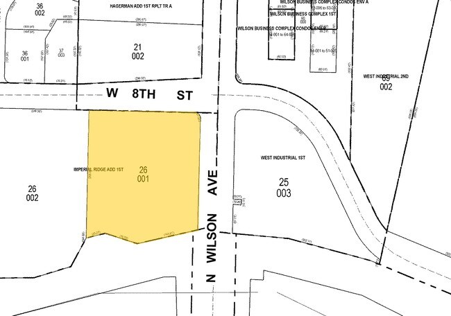
2420 W 8Th St
95152-26-001
TR A, IMPERIAL RIDGE 1ST ADD, LOV, LESS 20250038442
Commercialnec
LARIMER
FA
Colorado
B and X Area of moderate flood hazard, usually the area between the limits of the 100-year and 500-year floods.
1.75 AC
2024
Fort Collins
2025
Denver
001901
Fort Collins-Loveland, CO
10,792 SF
NEARBY LISTINGS FOR SALE OR LEASE
DEMOGRAPHICS near 2420 W 8Th St
1 mile
3 mile
5 mile
2025 Total Population
7,579
58,426
87,638
2030 Population
7,678
59,511
89,802
Pop Growth 2025-2030
+ 1.31%
+ 1.86%
+ 2.47%
Average Age
43
44
43
2025 Total Households
3,214
24,612
36,273
HH Growth 2025-2030
+ 1.37%
+ 1.94%
+ 2.53%
Median Household Inc
$75,290
$82,134
$84,670
Avg Household Size
2.30
2.30
2.40
2025 Avg HH Vehicles
2.00
2.00
2.00
Median Home Value
$463,659
$475,522
$491,502
Median Year Built
1977
1981
1990
Nearby Places
Map Layers
Map Styles
 Street
 Aerial
Transit
 Traffic
 Biking
Places
Listings with unknown addresses are not visible on the map
- Restaurants
- Banks
- Shops
- Fitness
- Groceries
Nearby Properties
Address
Land Use
TOTAL SIZE
Lot Size
Zoning
Address
Land Use
TOTAL SIZE
Lot Size
Zoning
201,500 SF
28.43 AC
R1E
Address
Land Use
TOTAL SIZE
Lot Size
Zoning
117,434 SF
29.34 AC
R1
Address
Land Use
TOTAL SIZE
Lot Size
Zoning
200,420 SF
41.52 AC
R1
Address
Land Use
TOTAL SIZE
Lot Size
Zoning
125,566 SF
8.27 AC
R3E
Address
Land Use
TOTAL SIZE
Lot Size
Zoning
137,225 SF
25.76 AC
R1
Address
Land Use
TOTAL SIZE
Lot Size
Zoning
115,599 SF
13.15 AC
P38
Address
Land Use
TOTAL SIZE
Lot Size
Zoning
147,663 SF
5.01 AC
R3E
Address
Land Use
TOTAL SIZE
Lot Size
Zoning
745,209 SF
63.03 AC
I
Address
Land Use
TOTAL SIZE
Lot Size
Zoning
96,723 SF
9.16 AC
I
Address
Land Use
TOTAL SIZE
Lot Size
Zoning
83,954 SF
5.79 AC
FA
Address
Land Use
TOTAL SIZE
Lot Size
Zoning
101,362 SF
4.80 AC
Address
Land Use
TOTAL SIZE
Lot Size
Zoning
139,289 SF
23.55 AC
I
Address
Land Use
TOTAL SIZE
Lot Size
Zoning
123,130 SF
4.17 AC
Address
Land Use
TOTAL SIZE
Lot Size
Zoning
59.21 AC
FA
Address
Land Use
TOTAL SIZE
Lot Size
Zoning
137,432 SF
12.89 AC
B
Address
Land Use
TOTAL SIZE
Lot Size
Zoning
75,000 SF
2.96 AC
B
Address
Land Use
TOTAL SIZE
Lot Size
Zoning
296,360 SF
11.88 AC
B
Address
Land Use
TOTAL SIZE
Lot Size
Zoning
162,703 SF
14.92 AC
B
Address
Land Use
TOTAL SIZE
Lot Size
Zoning
117,496 SF
6.24 AC
Address
Land Use
TOTAL SIZE
Lot Size
Zoning
165,709 SF
10.52 AC
Address
Land Use
TOTAL SIZE
Lot Size
Zoning
118,788 SF
14.01 AC
B
Address
Land Use
TOTAL SIZE
Lot Size
Zoning
137,950 SF
10.16 AC
Address
Land Use
TOTAL SIZE
Lot Size
Zoning
87,518 SF
8.02 AC
Address
Land Use
TOTAL SIZE
Lot Size
Zoning
93,908 SF
28.86 AC
R1
Address
Land Use
TOTAL SIZE
Lot Size
Zoning
303,858 SF
30.21 AC
Address
Land Use
TOTAL SIZE
Lot Size
Zoning
269,696 SF
1.97 AC
Address
Land Use
TOTAL SIZE
Lot Size
Zoning
48,952 SF
6.38 AC
FA
Address
Land Use
TOTAL SIZE
Lot Size
Zoning
97,225 SF
4.60 AC
P55
Address
Land Use
TOTAL SIZE
Lot Size
Zoning
41,580 SF
1.83 AC
B
Address
Land Use
TOTAL SIZE
Lot Size
Zoning
80,000 SF
3.69 AC
R3
The World's #1 Commercial Real Estate Marketplace
Connect with us
© 2026 CoStar Group
The information above has been obtained from sources believed reliable. While we do not doubt its accuracy we have not verified it and make no guarantee, warranty or representation about it. It is your responsibility to independently confirm its accuracy and completeness. Any projections, opinions, assumptions, or estimates used are for example only and do not represent the current or future performance of the property. The value of this transaction to you depends on tax and other factors which should be evaluated by your tax, financial, and legal advisors. You and your advisors should conduct a careful, independent investigation of the property to determine to your satisfaction the suitability of the property for your needs.