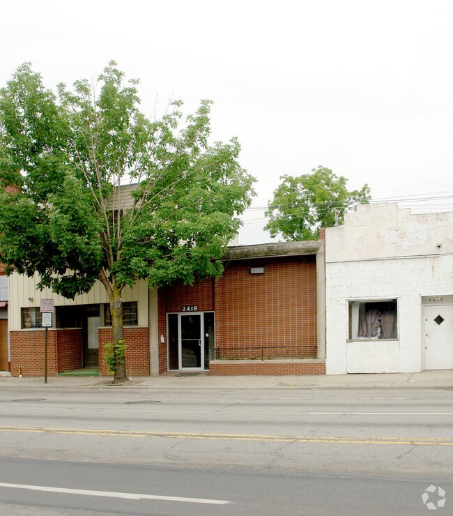
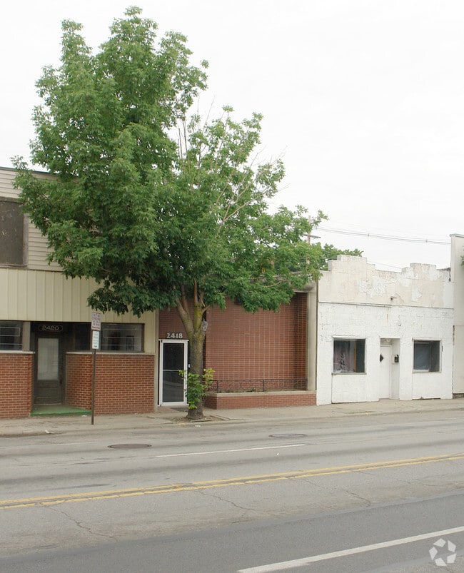
Property Record
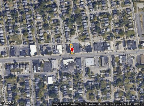
2418 W Broad St, Columbus, OH 43204
NEARBY LISTINGS FOR SALE OR LEASE
Property Detail
2418 W Broad St
Columbus, OH
Delbert B Ongs Eureka Sub
010-032488
W BROAD ST 21 FT E S EUREKA LOT 1
Officebuilding
Franklin
X
Ohio
39049C0304K
1
2024
0.06 AC
2024
West
004500
Columbus
4,746 SF
DEMOGRAPHICS near 2418 W Broad St
1 Mile
3 Mile
5 Mile
2024 Total Population
21,930
118,911
326,334
2029 Population
22,473
120,258
328,957
Pop Growth 2024-2029
+ 2.48%
+ 1.13%
+ 0.80%
Average Age
35
37
35
2024 Total Households
7,591
49,331
138,223
HH Growth 2024-2029
+ 2.33%
+ 0.93%
+ 0.82%
Median Household Inc
$46,574
$57,345
$60,143
Avg Household Size
2.70
2.30
2.20
2024 Avg HH Vehicles
2.00
2.00
2.00
Median Home Value
$116,600
$184,173
$237,798
Median Year Built
1947
1964
1971
Nearby Places
Map Layers
Map Styles
 Street
 Aerial
- Restaurants
- Banks
- Shops
- Fitness
- Groceries
PUBLIC TRANSPORTATION
AIRPORT
John Glenn Columbus International
DRIVE
WALK
Distance
John Glenn Columbus International
19 min
11.9 mi
Rickenbacker International
DRIVE
WALK
Distance
Rickenbacker International
30 min
17.8 mi
Nearby Properties
Address
Land Use
TOTAL SIZE
Lot Size
Zoning
Address
Land Use
TOTAL SIZE
Lot Size
Zoning
29,312 SF
10.72 AC
Address
Land Use
TOTAL SIZE
Lot Size
Zoning
302,482 SF
256.31 AC
Address
Land Use
TOTAL SIZE
Lot Size
Zoning
838,846 SF
3.73 AC
Address
Land Use
TOTAL SIZE
Lot Size
Zoning
1,215,421 SF
108.07 AC
Address
Land Use
TOTAL SIZE
Lot Size
Zoning
302,079 SF
77.95 AC
Address
Land Use
TOTAL SIZE
Lot Size
Zoning
385,225 SF
5.89 AC
Address
Land Use
TOTAL SIZE
Lot Size
Zoning
479,979 SF
5.43 AC
Address
Land Use
TOTAL SIZE
Lot Size
Zoning
642,900 SF
21.84 AC
Address
Land Use
TOTAL SIZE
Lot Size
Zoning
19,117 SF
7.28 AC
Address
Land Use
TOTAL SIZE
Lot Size
Zoning
595,932 SF
2.74 AC
Address
Land Use
TOTAL SIZE
Lot Size
Zoning
513,391 SF
4.32 AC
Address
Land Use
TOTAL SIZE
Lot Size
Zoning
365,440 SF
4.03 AC
Address
Land Use
TOTAL SIZE
Lot Size
Zoning
555,347 SF
24.77 AC
Address
Land Use
TOTAL SIZE
Lot Size
Zoning
299,580 SF
3.94 AC
Address
Land Use
TOTAL SIZE
Lot Size
Zoning
417,131 SF
27.85 AC
Address
Land Use
TOTAL SIZE
Lot Size
Zoning
257,723 SF
38.06 AC
Address
Land Use
TOTAL SIZE
Lot Size
Zoning
87,654 SF
45.30 AC
Address
Land Use
TOTAL SIZE
Lot Size
Zoning
234,528 SF
0.80 AC
Address
Land Use
TOTAL SIZE
Lot Size
Zoning
329,215 SF
8.33 AC
Address
Land Use
TOTAL SIZE
Lot Size
Zoning
259,214 SF
4.29 AC
Address
Land Use
TOTAL SIZE
Lot Size
Zoning
89,158 SF
5.56 AC
Address
Land Use
TOTAL SIZE
Lot Size
Zoning
275,698 SF
2.85 AC
Address
Land Use
TOTAL SIZE
Lot Size
Zoning
344,697 SF
8.29 AC
Address
Land Use
TOTAL SIZE
Lot Size
Zoning
34,521 SF
29.23 AC
Address
Land Use
TOTAL SIZE
Lot Size
Zoning
257,116 SF
2.24 AC
Address
Land Use
TOTAL SIZE
Lot Size
Zoning
252,380 SF
0.80 AC
Address
Land Use
TOTAL SIZE
Lot Size
Zoning
50,837 SF
10.12 AC
Address
Land Use
TOTAL SIZE
Lot Size
Zoning
70,995 SF
38.78 AC
Address
Land Use
TOTAL SIZE
Lot Size
Zoning
370,580 SF
1.91 AC
Address
Land Use
TOTAL SIZE
Lot Size
Zoning
156,839 SF
48.45 AC
The World's #1 Commercial Real Estate Marketplace
Connect with us
© 2025 CoStar Group
The information above has been obtained from sources believed reliable. While we do not doubt its accuracy we have not verified it and make no guarantee, warranty or representation about it. It is your responsibility to independently confirm its accuracy and completeness. Any projections, opinions, assumptions, or estimates used are for example only and do not represent the current or future performance of the property. The value of this transaction to you depends on tax and other factors which should be evaluated by your tax, financial, and legal advisors. You and your advisors should conduct a careful, independent investigation of the property to determine to your satisfaction the suitability of the property for your needs.