Property Record
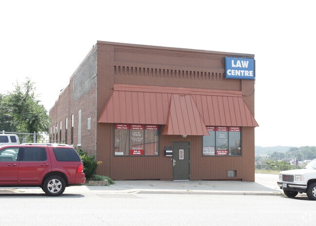
2421 O St, Omaha, NE 68107


NEARBY LISTINGS FOR SALE OR LEASE
Property Detail
2421 O St
Omaha-Council Bluffs, NE-IA
Damrons Sub Div
1692-0000-09
DAMRONS SUB DIV LOT 8 BLOCK 0 E 30 FT LTS 4 TO 30 X 120
Officebuilding
Douglas
X
Nebraska
31153C0080G
8
2024
0.08 AC
2025
Southeast Omaha
003200
Omaha/Council Bluffs
6,000 SF
DEMOGRAPHICS near 2421 O St
1 Mile
3 Mile
5 Mile
2024 Total Population
14,774
93,104
225,741
2029 Population
14,938
95,188
232,603
Pop Growth 2024-2029
+ 1.11%
+ 2.24%
+ 3.04%
Average Age
32
36
37
2024 Total Households
4,433
32,643
90,553
HH Growth 2024-2029
+ 1.11%
+ 2.38%
+ 3.20%
Median Household Inc
$44,652
$54,730
$56,559
Avg Household Size
3.20
2.70
2.30
2024 Avg HH Vehicles
2.00
2.00
2.00
Median Home Value
$114,152
$153,964
$176,478
Median Year Built
1947
1955
1962
Nearby Places
Map Layers
Map Styles
 Street
 Aerial
- Restaurants
- Banks
- Shops
- Fitness
- Groceries
PUBLIC TRANSPORTATION
COMMUTER RAIL
DRIVE
WALK
Distance
7 min
3.6 mi
DRIVE
WALK
Distance
8 min
3.8 mi
AIRPORT
Eppley Airfield
DRIVE
WALK
Distance
Eppley Airfield
17 min
8.5 mi
SALE & LEASE HISTORY
LISTING DATE
SALE/LEASE

Sep 23, 2016
For Sale
May 16, 2017
For Sale
Mar 09, 2017
For Sale
Nearby Properties
Address
Land Use
TOTAL SIZE
Lot Size
Zoning
Address
Land Use
TOTAL SIZE
Lot Size
Zoning
27.38 AC
I-2
Address
Land Use
TOTAL SIZE
Lot Size
Zoning
12.71 AC
Address
Land Use
TOTAL SIZE
Lot Size
Zoning
148,789 SF
2.52 AC
Address
Land Use
TOTAL SIZE
Lot Size
Zoning
1,850 SF
8.14 AC
Address
Land Use
TOTAL SIZE
Lot Size
Zoning
32.10 AC
I-2
Address
Land Use
TOTAL SIZE
Lot Size
Zoning
225,975 SF
1.31 AC
Address
Land Use
TOTAL SIZE
Lot Size
Zoning
193,967 SF
7.27 AC
Address
Land Use
TOTAL SIZE
Lot Size
Zoning
114,130 SF
1.06 AC
Address
Land Use
TOTAL SIZE
Lot Size
Zoning
236,067 SF
10.12 AC
HI
Address
Land Use
TOTAL SIZE
Lot Size
Zoning
33,713 SF
14.39 AC
Address
Land Use
TOTAL SIZE
Lot Size
Zoning
4.53 AC
Address
Land Use
TOTAL SIZE
Lot Size
Zoning
270,446 SF
13.68 AC
R7
Address
Land Use
TOTAL SIZE
Lot Size
Zoning
126,910 SF
13.49 AC
Address
Land Use
TOTAL SIZE
Lot Size
Zoning
173,616 SF
9.30 AC
Address
Land Use
TOTAL SIZE
Lot Size
Zoning
11.55 AC
I-2
Address
Land Use
TOTAL SIZE
Lot Size
Zoning
230,995 SF
11.29 AC
HI
Address
Land Use
TOTAL SIZE
Lot Size
Zoning
3.41 AC
A-P
Address
Land Use
TOTAL SIZE
Lot Size
Zoning
252,694 SF
17.74 AC
HI
Address
Land Use
TOTAL SIZE
Lot Size
Zoning
148,963 SF
9.80 AC
Address
Land Use
TOTAL SIZE
Lot Size
Zoning
116,718 SF
8.28 AC
Address
Land Use
TOTAL SIZE
Lot Size
Zoning
161,765 SF
18.32 AC
Address
Land Use
TOTAL SIZE
Lot Size
Zoning
38,595 SF
2.07 AC
Address
Land Use
TOTAL SIZE
Lot Size
Zoning
74,586 SF
4.24 AC
Address
Land Use
TOTAL SIZE
Lot Size
Zoning
85,320 SF
6.60 AC
HI
Address
Land Use
TOTAL SIZE
Lot Size
Zoning
7.10 AC
R-3
Address
Land Use
TOTAL SIZE
Lot Size
Zoning
81,172 SF
4 AC
Address
Land Use
TOTAL SIZE
Lot Size
Zoning
1,768 SF
14.80 AC
Address
Land Use
TOTAL SIZE
Lot Size
Zoning
100,350 SF
4.77 AC
CC
Address
Land Use
TOTAL SIZE
Lot Size
Zoning
139,236 SF
8.19 AC
Address
Land Use
TOTAL SIZE
Lot Size
Zoning
273,738 SF
16.07 AC
The World's #1 Commercial Real Estate Marketplace
Connect with us
© 2025 CoStar Group
The information above has been obtained from sources believed reliable. While we do not doubt its accuracy we have not verified it and make no guarantee, warranty or representation about it. It is your responsibility to independently confirm its accuracy and completeness. Any projections, opinions, assumptions, or estimates used are for example only and do not represent the current or future performance of the property. The value of this transaction to you depends on tax and other factors which should be evaluated by your tax, financial, and legal advisors. You and your advisors should conduct a careful, independent investigation of the property to determine to your satisfaction the suitability of the property for your needs.