Property Record
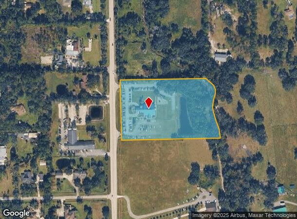
2421 Tomoka Farms Rd, Port Orange, FL 32128
NEARBY LISTINGS FOR SALE OR LEASE
-
-
View all Port Orange listings for sale on LoopNet.com
Property Detail
2421 Tomoka Farms Rd
6226-00-00-0019
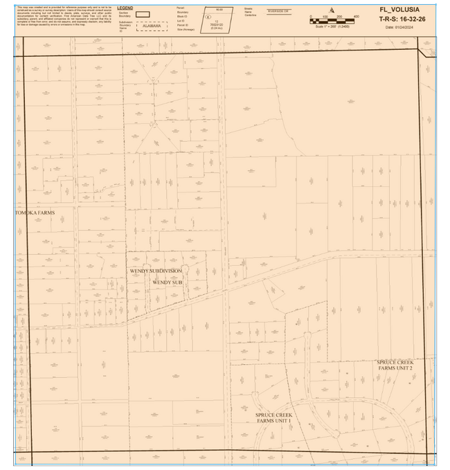
Parcel
Religious
26-16-32 IRREG PARCEL IN S 422 FT OF APPROX N 490.67 FT MEAS ON E/L & LYING E OF TOMOKA RD & MEAS 562.32 FT ON N/L OF W 1/2 OF NE 1/4 PER OR 4467 PGS 3004-3005 PER OR 8547 PG 2434
A
Volusia
12127C0504H
Florida
2025
6.39 AC
2026
South Beach Cities
083207
Deltona/Daytona Beach
8,630 SF
Deltona-Daytona Beach-Ormond Beach, FL
DEMOGRAPHICS near 2421 Tomoka Farms Rd
1 Mile
3 Mile
5 Mile
2024 Total Population
1,355
20,672
66,028
2029 Population
1,488
22,533
72,149
Pop Growth 2024-2029
+ 9.82%
+ 9.00%
+ 9.27%
Average Age
47
46
46
2024 Total Households
591
8,825
28,866
HH Growth 2024-2029
+ 10.15%
+ 9.09%
+ 9.42%
Median Household Inc
$58,631
$77,747
$64,102
Avg Household Size
2.20
2.30
2.20
2024 Avg HH Vehicles
2.00
2.00
2.00
Median Home Value
$287,680
$308,867
$266,771
Median Year Built
2001
2001
1991
Nearby Places
Map Layers
Map Styles
 Street
 Aerial
- Restaurants
- Banks
- Shops
- Fitness
- Groceries
PUBLIC TRANSPORTATION
AIRPORT
Daytona Beach International
DRIVE
WALK
Distance
Daytona Beach International
14 min
7.4 mi
Orlando Sanford International
DRIVE
WALK
Distance
Orlando Sanford International
47 min
29.7 mi
Freight Ports
Port Canaveral
DRIVE
WALK
Distance
Port Canaveral
82 min
68.1 mi
Nearby Properties
Address
Land Use
TOTAL SIZE
Lot Size
Zoning
Address
Land Use
TOTAL SIZE
Lot Size
Zoning
33,958 SF
190.21 AC
A2
Address
Land Use
TOTAL SIZE
Lot Size
Zoning
354,546 SF
24.71 AC
Address
Land Use
TOTAL SIZE
Lot Size
Zoning
448,867 SF
5.54 AC
Address
Land Use
TOTAL SIZE
Lot Size
Zoning
416,320 SF
0.13 AC
Address
Land Use
TOTAL SIZE
Lot Size
Zoning
408,078 SF
50.07 AC
Address
Land Use
TOTAL SIZE
Lot Size
Zoning
481,883 SF
0.10 AC
Address
Land Use
TOTAL SIZE
Lot Size
Zoning
412,064 SF
60 AC
Address
Land Use
TOTAL SIZE
Lot Size
Zoning
60,449 SF
7.14 AC
16PCD
Address
Land Use
TOTAL SIZE
Lot Size
Zoning
165,754 SF
40.54 AC
PUD
Address
Land Use
TOTAL SIZE
Lot Size
Zoning
127,664 SF
15.07 AC
Address
Land Use
TOTAL SIZE
Lot Size
Zoning
171,924 SF
17.61 AC
Address
Land Use
TOTAL SIZE
Lot Size
Zoning
91,967 SF
7.31 AC
16CC
Address
Land Use
TOTAL SIZE
Lot Size
Zoning
184,730 SF
16.46 AC
Address
Land Use
TOTAL SIZE
Lot Size
Zoning
77,386 SF
24.33 AC
16A
Address
Land Use
TOTAL SIZE
Lot Size
Zoning
105,676 SF
11.77 AC
Address
Land Use
TOTAL SIZE
Lot Size
Zoning
154,409 SF
14.10 AC
Address
Land Use
TOTAL SIZE
Lot Size
Zoning
135,061 SF
4.81 AC
Address
Land Use
TOTAL SIZE
Lot Size
Zoning
101,395 SF
12.65 AC
A2
Address
Land Use
TOTAL SIZE
Lot Size
Zoning
122,897 SF
6.82 AC
16A
Address
Land Use
TOTAL SIZE
Lot Size
Zoning
50,541 SF
3.20 AC
Address
Land Use
TOTAL SIZE
Lot Size
Zoning
52,827 SF
4.91 AC
01A2
Address
Land Use
TOTAL SIZE
Lot Size
Zoning
97,729 SF
3.51 AC
Address
Land Use
TOTAL SIZE
Lot Size
Zoning
43,369 SF
3.41 AC
Address
Land Use
TOTAL SIZE
Lot Size
Zoning
69,189 SF
9.67 AC
Address
Land Use
TOTAL SIZE
Lot Size
Zoning
52,978 SF
2.43 AC
Address
Land Use
TOTAL SIZE
Lot Size
Zoning
102,457 SF
11.13 AC
Address
Land Use
TOTAL SIZE
Lot Size
Zoning
85,048 SF
2.26 AC
Address
Land Use
TOTAL SIZE
Lot Size
Zoning
165,907 SF
10.53 AC
Address
Land Use
TOTAL SIZE
Lot Size
Zoning
275 AC
RC
Address
Land Use
TOTAL SIZE
Lot Size
Zoning
26,761 SF
505 AC
P
The World's #1 Commercial Real Estate Marketplace
Connect with us
© 2026 CoStar Group
The information above has been obtained from sources believed reliable. While we do not doubt its accuracy we have not verified it and make no guarantee, warranty or representation about it. It is your responsibility to independently confirm its accuracy and completeness. Any projections, opinions, assumptions, or estimates used are for example only and do not represent the current or future performance of the property. The value of this transaction to you depends on tax and other factors which should be evaluated by your tax, financial, and legal advisors. You and your advisors should conduct a careful, independent investigation of the property to determine to your satisfaction the suitability of the property for your needs.