Property Record
2421 Wadsworth St, Houston, TX 77015

NEARBY LISTINGS FOR SALE OR LEASE
Property Detail
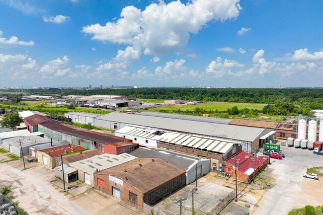
2421 Wadsworth St
0410320010053
Abst 76 R & R Vince
Warehouse
TR 1U-2 ABST 76 R & R VINCE
X
Harris
48201C0720M
Texas
2024
0.13 AC
2025
East I-10 Outer Loop
252500
Houston
1,536 SF
Houston-The Woodlands-Sugar Land, TX
DEMOGRAPHICS near 2421 Wadsworth St
1 Mile
3 Mile
5 Mile
2024 Total Population
2,162
66,089
152,126
2029 Population
2,205
66,825
154,536
Pop Growth 2024-2029
+ 1.99%
+ 1.11%
+ 1.58%
Average Age
34
34
34
2024 Total Households
621
19,446
46,631
HH Growth 2024-2029
+ 2.09%
+ 1.02%
+ 1.54%
Median Household Inc
$61,804
$55,413
$55,503
Avg Household Size
3.40
3.30
3.20
2024 Avg HH Vehicles
2.00
2.00
2.00
Median Home Value
$108,168
$146,566
$148,706
Median Year Built
1980
1980
1980
Nearby Places
Map Layers
Map Styles
 Street
 Aerial
- Restaurants
- Banks
- Shops
- Fitness
- Groceries
PUBLIC TRANSPORTATION
AIRPORT
William P Hobby
DRIVE
WALK
Distance
William P Hobby
34 min
19.2 mi
George Bush Intcntl/Houston
DRIVE
WALK
Distance
George Bush Intcntl/Houston
31 min
23.5 mi
Freight Ports
Port of Houston
DRIVE
WALK
Distance
Port of Houston
21 min
11.1 mi
SALE & LEASE HISTORY
LISTING DATE
SALE/LEASE

Jul 17, 2023
For Sale
Jul 17, 2023
For Sale
Jul 01, 2024
For Sale
Nearby Properties
Address
Land Use
TOTAL SIZE
Lot Size
Zoning
Address
Land Use
TOTAL SIZE
Lot Size
Zoning
16,879,748 SF
228.46 AC
Address
Land Use
TOTAL SIZE
Lot Size
Zoning
5,379,424 SF
145.51 AC
Address
Land Use
TOTAL SIZE
Lot Size
Zoning
10,093,711 SF
30.83 AC
Address
Land Use
TOTAL SIZE
Lot Size
Zoning
8,203,364 SF
183.34 AC
Address
Land Use
TOTAL SIZE
Lot Size
Zoning
9,585,990 SF
122.92 AC
Address
Land Use
TOTAL SIZE
Lot Size
Zoning
2,822,672 SF
33.97 AC
Address
Land Use
TOTAL SIZE
Lot Size
Zoning
167.71 AC
Address
Land Use
TOTAL SIZE
Lot Size
Zoning
153.75 AC
Address
Land Use
TOTAL SIZE
Lot Size
Zoning
486.59 AC
Address
Land Use
TOTAL SIZE
Lot Size
Zoning
2,936,644 SF
59.90 AC
Address
Land Use
TOTAL SIZE
Lot Size
Zoning
1,042,908 SF
28.92 AC
Address
Land Use
TOTAL SIZE
Lot Size
Zoning
680,077 SF
86.92 AC
Address
Land Use
TOTAL SIZE
Lot Size
Zoning
158.48 AC
Address
Land Use
TOTAL SIZE
Lot Size
Zoning
760,851 SF
41.87 AC
Address
Land Use
TOTAL SIZE
Lot Size
Zoning
248.91 AC
Address
Land Use
TOTAL SIZE
Lot Size
Zoning
59.10 AC
Address
Land Use
TOTAL SIZE
Lot Size
Zoning
2,124,914 SF
243.08 AC
Address
Land Use
TOTAL SIZE
Lot Size
Zoning
30.84 AC
Address
Land Use
TOTAL SIZE
Lot Size
Zoning
1,306,874 SF
6.76 AC
Address
Land Use
TOTAL SIZE
Lot Size
Zoning
730,000 SF
11.57 AC
Address
Land Use
TOTAL SIZE
Lot Size
Zoning
176.73 AC
Address
Land Use
TOTAL SIZE
Lot Size
Zoning
2.67 AC
Address
Land Use
TOTAL SIZE
Lot Size
Zoning
398,995 SF
27.39 AC
Address
Land Use
TOTAL SIZE
Lot Size
Zoning
100.21 AC
Address
Land Use
TOTAL SIZE
Lot Size
Zoning
496.18 AC
Address
Land Use
TOTAL SIZE
Lot Size
Zoning
148.36 AC
Address
Land Use
TOTAL SIZE
Lot Size
Zoning
202,544 SF
4.06 AC
Address
Land Use
TOTAL SIZE
Lot Size
Zoning
11,203 SF
5.85 AC
Address
Land Use
TOTAL SIZE
Lot Size
Zoning
17.40 AC
Address
Land Use
TOTAL SIZE
Lot Size
Zoning
166.59 AC
The World's #1 Commercial Real Estate Marketplace
Connect with us
© 2025 CoStar Group
The information above has been obtained from sources believed reliable. While we do not doubt its accuracy we have not verified it and make no guarantee, warranty or representation about it. It is your responsibility to independently confirm its accuracy and completeness. Any projections, opinions, assumptions, or estimates used are for example only and do not represent the current or future performance of the property. The value of this transaction to you depends on tax and other factors which should be evaluated by your tax, financial, and legal advisors. You and your advisors should conduct a careful, independent investigation of the property to determine to your satisfaction the suitability of the property for your needs.