Property Record
2423 E Lincoln Dr, Phoenix, AZ 85016
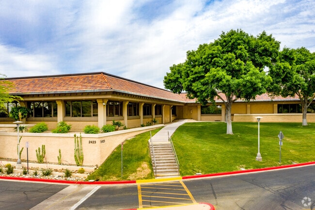

Property Detail
2423 E Lincoln Dr
164-10-002H
BEG W4 COR TH N 671.31 TH SLY ALG R/W TO PT WH IS 1267.80 S OF POB & 95 E OF W LN TH W 95 TH N ALG W LN 1267.80 TO POB 22.48 AC
Officebuilding
Maricopa
C-T
Arizona
C and X Area of minimal flood hazard, usually depicted on FIRMs as above the 500-year flood level.
22.48 AC
2025
Piestewa Peak Corridor
2025
Phoenix
106400
Phoenix-Mesa-Chandler, AZ
341,434 SF
NEARBY LISTINGS FOR SALE OR LEASE
DEMOGRAPHICS near 2423 E Lincoln Dr
1 mile
3 mile
5 mile
2025 Total Population
6,381
99,676
340,388
2030 Population
6,661
104,236
355,040
Pop Growth 2025-2030
+ 4.39%
+ 4.57%
+ 4.30%
Average Age
48
42
40
2025 Total Households
2,956
48,883
149,847
HH Growth 2025-2030
+ 4.63%
+ 4.67%
+ 4.44%
Median Household Inc
$144,086
$95,201
$77,282
Avg Household Size
2.10
2.00
2.20
2025 Avg HH Vehicles
2.00
2.00
2.00
Median Home Value
$881,932
$738,751
$622,229
Median Year Built
1978
1975
1973
Nearby Places
Map Layers
Map Styles
 Street
 Aerial
Transit
 Traffic
 Biking
Places
Listings with unknown addresses are not visible on the map
- Restaurants
- Banks
- Shops
- Fitness
- Groceries
PUBLIC TRANSPORTATION
AIRPORT
Phoenix Sky Harbor International
Drive
Walk
Distance
Phoenix Sky Harbor International
19 min
9.8 mi
Phoenix-Mesa Gateway
Drive
Walk
Distance
Phoenix-Mesa Gateway
51 min
36.6 mi
Freight Ports
Port of San Diego
Drive
Walk
Distance
Port of San Diego
406 min
362.3 mi
Nearby Properties
Address
Land Use
TOTAL SIZE
Lot Size
Zoning
Address
Land Use
TOTAL SIZE
Lot Size
Zoning
71,306 SF
8.93 AC
M-H
Address
Land Use
TOTAL SIZE
Lot Size
Zoning
63,018 SF
4.77 AC
C-T
Address
Land Use
TOTAL SIZE
Lot Size
Zoning
969,844 SF
27.97 AC
PAD
Address
Land Use
TOTAL SIZE
Lot Size
Zoning
953,192 SF
28.99 AC
Address
Land Use
TOTAL SIZE
Lot Size
Zoning
244,924 SF
1.90 AC
C2
Address
Land Use
TOTAL SIZE
Lot Size
Zoning
21,587 SF
3.66 AC
R-10
Address
Land Use
TOTAL SIZE
Lot Size
Zoning
410,000 SF
1.86 AC
C-C
Address
Land Use
TOTAL SIZE
Lot Size
Zoning
386,004 SF
37.82 AC
R-6
Address
Land Use
TOTAL SIZE
Lot Size
Zoning
812,968 SF
7.08 AC
Address
Land Use
TOTAL SIZE
Lot Size
Zoning
517,609 SF
1.67 AC
C-C
Address
Land Use
TOTAL SIZE
Lot Size
Zoning
599,524 SF
5.09 AC
R5
Address
Land Use
TOTAL SIZE
Lot Size
Zoning
656,952 SF
3.58 AC
Address
Land Use
TOTAL SIZE
Lot Size
Zoning
367,399 SF
14.88 AC
C-1
Address
Land Use
TOTAL SIZE
Lot Size
Zoning
567,481 SF
2 AC
Address
Land Use
TOTAL SIZE
Lot Size
Zoning
575,103 SF
2.24 AC
Address
Land Use
TOTAL SIZE
Lot Size
Zoning
312,104 SF
1.08 AC
C-2
Address
Land Use
TOTAL SIZE
Lot Size
Zoning
515,418 SF
19.72 AC
R-3
Address
Land Use
TOTAL SIZE
Lot Size
Zoning
812,214 SF
4.91 AC
C-C
Address
Land Use
TOTAL SIZE
Lot Size
Zoning
266,869 SF
7.55 AC
C-C
Address
Land Use
TOTAL SIZE
Lot Size
Zoning
426,310 SF
1.44 AC
Address
Land Use
TOTAL SIZE
Lot Size
Zoning
536,856 SF
20.27 AC
PSC
Address
Land Use
TOTAL SIZE
Lot Size
Zoning
533,579 SF
1.91 AC
Address
Land Use
TOTAL SIZE
Lot Size
Zoning
515,440 SF
3.02 AC
C-T
Address
Land Use
TOTAL SIZE
Lot Size
Zoning
508,796 SF
4.71 AC
PAD
Address
Land Use
TOTAL SIZE
Lot Size
Zoning
382,687 SF
11.31 AC
C-O
Address
Land Use
TOTAL SIZE
Lot Size
Zoning
51,836 SF
43.32 AC
RE35
Address
Land Use
TOTAL SIZE
Lot Size
Zoning
440,344 SF
4.46 AC
CO
Address
Land Use
TOTAL SIZE
Lot Size
Zoning
462,814 SF
2.54 AC
Address
Land Use
TOTAL SIZE
Lot Size
Zoning
311,121 SF
2.50 AC
C-C
The World's #1 Commercial Real Estate Marketplace
Connect with us
© 2026 CoStar Group
The information above has been obtained from sources believed reliable. While we do not doubt its accuracy we have not verified it and make no guarantee, warranty or representation about it. It is your responsibility to independently confirm its accuracy and completeness. Any projections, opinions, assumptions, or estimates used are for example only and do not represent the current or future performance of the property. The value of this transaction to you depends on tax and other factors which should be evaluated by your tax, financial, and legal advisors. You and your advisors should conduct a careful, independent investigation of the property to determine to your satisfaction the suitability of the property for your needs.