Property Record
2423 State Route 21, Canandaigua, NY 14424
NEARBY LISTINGS FOR SALE OR LEASE
-
-
View all Canandaigua listings for sale on LoopNet.com
Property Detail
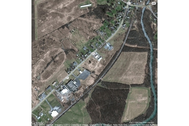
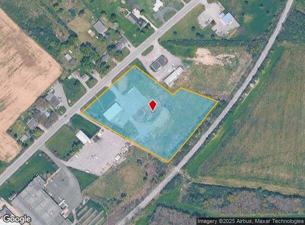
2423 State Route 21
Rochester, NY
4.9 ACRES
323400-072-000-0001-016-200
Ontario
Horticulturegrowinghousesagricultural
New York
2025
16.200
2024
4.90 AC
051102
Outlying Ontario County
5,000 SF
Rochester
DEMOGRAPHICS near 2423 State Route 21
1 Mile
3 Mile
5 Mile
2024 Total Population
436
10,982
25,674
2029 Population
434
10,960
25,684
Pop Growth 2024-2029
(0.46%)
(0.20%)
+ 0.04%
Average Age
45
44
45
2024 Total Households
175
4,871
11,332
HH Growth 2024-2029
(0.57%)
(0.23%)
+ 0.14%
Median Household Inc
$93,214
$70,020
$71,091
Avg Household Size
2.40
2.20
2.10
2024 Avg HH Vehicles
2.00
2.00
2.00
Median Home Value
$177,585
$178,480
$182,532
Median Year Built
1975
1966
1976
Nearby Places
- Restaurants
- Banks
- Shops
- Fitness
- Groceries
PUBLIC TRANSPORTATION
AIRPORT
Frederick Douglass/Greater Rochester International
DRIVE
WALK
Distance
Frederick Douglass/Greater Rochester International
46 min
32.6 mi
Freight Ports
Albany, NY Port
DRIVE
WALK
Distance
Albany, NY Port
242 min
205.3 mi
SALE & LEASE HISTORY
LISTING DATE
SALE/LEASE

Sep 24, 2016
For Sale
Nearby Properties
Address
Land Use
TOTAL SIZE
Lot Size
Zoning
Address
Land Use
TOTAL SIZE
Lot Size
Zoning
56,880 SF
328.70 AC
AR1
Address
Land Use
TOTAL SIZE
Lot Size
Zoning
97.20 AC
R1
Address
Land Use
TOTAL SIZE
Lot Size
Zoning
246,702 SF
30 AC
R1A
Address
Land Use
TOTAL SIZE
Lot Size
Zoning
100,758 SF
5.80 AC
PUD
Address
Land Use
TOTAL SIZE
Lot Size
Zoning
39,480 SF
10.90 AC
PUD
Address
Land Use
TOTAL SIZE
Lot Size
Zoning
130,803 SF
7.20 AC
C1
Address
Land Use
TOTAL SIZE
Lot Size
Zoning
146,058 SF
21.40 AC
R1B
Address
Land Use
TOTAL SIZE
Lot Size
Zoning
194,786 SF
17.90 AC
C1
Address
Land Use
TOTAL SIZE
Lot Size
Zoning
90.40 AC
AG
Address
Land Use
TOTAL SIZE
Lot Size
Zoning
114,533 SF
16.90 AC
C3
Address
Land Use
TOTAL SIZE
Lot Size
Zoning
196,012 SF
17.80 AC
CC
Address
Land Use
TOTAL SIZE
Lot Size
Zoning
Address
Land Use
TOTAL SIZE
Lot Size
Zoning
Address
Land Use
TOTAL SIZE
Lot Size
Zoning
3,053 SF
16.20 AC
M1
Address
Land Use
TOTAL SIZE
Lot Size
Zoning
135,054 SF
11.80 AC
C1
Address
Land Use
TOTAL SIZE
Lot Size
Zoning
5.70 AC
02 - SINGL
Address
Land Use
TOTAL SIZE
Lot Size
Zoning
18,000 SF
2.35 AC
R1B
Address
Land Use
TOTAL SIZE
Lot Size
Zoning
12,052 SF
10.10 AC
R3
Address
Land Use
TOTAL SIZE
Lot Size
Zoning
Address
Land Use
TOTAL SIZE
Lot Size
Zoning
Address
Land Use
TOTAL SIZE
Lot Size
Zoning
Address
Land Use
TOTAL SIZE
Lot Size
Zoning
32,306 SF
16 AC
M1
Address
Land Use
TOTAL SIZE
Lot Size
Zoning
29,444 SF
7.30 AC
R3
Address
Land Use
TOTAL SIZE
Lot Size
Zoning
13,508 SF
2.40 AC
HRI
Address
Land Use
TOTAL SIZE
Lot Size
Zoning
Address
Land Use
TOTAL SIZE
Lot Size
Zoning
95,406 SF
4.80 AC
R3
Address
Land Use
TOTAL SIZE
Lot Size
Zoning
31,442 SF
5.20 AC
C3
Address
Land Use
TOTAL SIZE
Lot Size
Zoning
20,675 SF
55.80 AC
RI
Address
Land Use
TOTAL SIZE
Lot Size
Zoning
3,660 SF
13.60 AC
R3
Address
Land Use
TOTAL SIZE
Lot Size
Zoning
92,532 SF
10.30 AC
PUD
The World's #1 Commercial Real Estate Marketplace
Connect with us
© 2025 CoStar Group
The information above has been obtained from sources believed reliable. While we do not doubt its accuracy we have not verified it and make no guarantee, warranty or representation about it. It is your responsibility to independently confirm its accuracy and completeness. Any projections, opinions, assumptions, or estimates used are for example only and do not represent the current or future performance of the property. The value of this transaction to you depends on tax and other factors which should be evaluated by your tax, financial, and legal advisors. You and your advisors should conduct a careful, independent investigation of the property to determine to your satisfaction the suitability of the property for your needs.