Property Record
24242 Middlebelt Rd, Farmington Hills, MI 48336


NEARBY LISTINGS FOR SALE OR LEASE
Property Detail
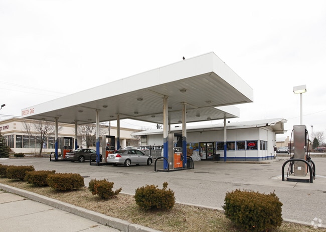
24242 Middlebelt Rd
23-24-352-003
T1N, R9E, SEC 24 S 183 FT OF W 183 FT OF SW 1/4 EXC S 43 FT & W 43 FT TAKEN FOR HWYS 0.45 A
Supermarket
Oakland
X
Michigan
26163C0055E
0.45 AC
2024
Farmington/Farm Hills
2024
Detroit
166800
Detroit-Warren-Dearborn, MI
1,625 SF
DEMOGRAPHICS near 24242 Middlebelt Rd
1 Mile
3 Mile
5 Mile
2024 Total Population
8,966
71,427
202,144
2029 Population
8,851
70,370
197,738
Pop Growth 2024-2029
(1.28%)
(1.48%)
(2.18%)
Average Age
42
43
43
2024 Total Households
3,533
32,450
86,740
HH Growth 2024-2029
(1.25%)
(1.46%)
(2.15%)
Median Household Inc
$80,578
$68,925
$76,172
Avg Household Size
2.40
2.10
2.30
2024 Avg HH Vehicles
2.00
2.00
2.00
Median Home Value
$238,181
$226,491
$250,626
Median Year Built
1970
1969
1969
Nearby Places
Map Layers
Map Styles
 Street
 Aerial
- Restaurants
- Banks
- Shops
- Fitness
- Groceries
PUBLIC TRANSPORTATION
AIRPORT
Detroit Metro Wayne County
DRIVE
WALK
Distance
Detroit Metro Wayne County
40 min
20.7 mi
Windsor International
DRIVE
WALK
Distance
Windsor International
53 min
29.5 mi
SALE & LEASE HISTORY
LISTING DATE
SALE/LEASE

Oct 03, 2016
For Sale
Nearby Properties
Address
Land Use
TOTAL SIZE
Lot Size
Zoning
Address
Land Use
TOTAL SIZE
Lot Size
Zoning
558,088 SF
40.09 AC
AI
Address
Land Use
TOTAL SIZE
Lot Size
Zoning
592,350 SF
23.64 AC
RC
Address
Land Use
TOTAL SIZE
Lot Size
Zoning
406,560 SF
46.04 AC
AI
Address
Land Use
TOTAL SIZE
Lot Size
Zoning
32.44 AC
RC
Address
Land Use
TOTAL SIZE
Lot Size
Zoning
439,171 SF
28.57 AC
RMM
Address
Land Use
TOTAL SIZE
Lot Size
Zoning
301,269 SF
25.47 AC
OS
Address
Land Use
TOTAL SIZE
Lot Size
Zoning
346,647 SF
21.12 AC
AI
Address
Land Use
TOTAL SIZE
Lot Size
Zoning
261,633 SF
12.19 AC
RMM
Address
Land Use
TOTAL SIZE
Lot Size
Zoning
228,544 SF
35.02 AC
BI
Address
Land Use
TOTAL SIZE
Lot Size
Zoning
17.19 AC
RC
Address
Land Use
TOTAL SIZE
Lot Size
Zoning
325,654 SF
7.45 AC
ERO
Address
Land Use
TOTAL SIZE
Lot Size
Zoning
181,954 SF
RC
Address
Land Use
TOTAL SIZE
Lot Size
Zoning
248,911 SF
4.55 AC
RC
Address
Land Use
TOTAL SIZE
Lot Size
Zoning
222,440 SF
11.57 AC
BI
Address
Land Use
TOTAL SIZE
Lot Size
Zoning
306,250 SF
14.60 AC
RC
Address
Land Use
TOTAL SIZE
Lot Size
Zoning
Address
Land Use
TOTAL SIZE
Lot Size
Zoning
Address
Land Use
TOTAL SIZE
Lot Size
Zoning
288,641 SF
13.56 AC
RMM
Address
Land Use
TOTAL SIZE
Lot Size
Zoning
311,298 SF
31.66 AC
BI
Address
Land Use
TOTAL SIZE
Lot Size
Zoning
264,994 SF
19.75 AC
AI
Address
Land Use
TOTAL SIZE
Lot Size
Zoning
216 SF
14.26 AC
RC
Address
Land Use
TOTAL SIZE
Lot Size
Zoning
Address
Land Use
TOTAL SIZE
Lot Size
Zoning
11.12 AC
RC
Address
Land Use
TOTAL SIZE
Lot Size
Zoning
209,000 SF
11.21 AC
ERO
Address
Land Use
TOTAL SIZE
Lot Size
Zoning
213,135 SF
6.17 AC
RC
Address
Land Use
TOTAL SIZE
Lot Size
Zoning
174,127 SF
11.95 AC
AI
Address
Land Use
TOTAL SIZE
Lot Size
Zoning
204 SF
11.31 AC
RM
Address
Land Use
TOTAL SIZE
Lot Size
Zoning
Address
Land Use
TOTAL SIZE
Lot Size
Zoning
650,954 SF
5.75 AC
RC
Address
Land Use
TOTAL SIZE
Lot Size
Zoning
123 SF
5.86 AC
RC
The World's #1 Commercial Real Estate Marketplace
Connect with us
© 2026 CoStar Group
The information above has been obtained from sources believed reliable. While we do not doubt its accuracy we have not verified it and make no guarantee, warranty or representation about it. It is your responsibility to independently confirm its accuracy and completeness. Any projections, opinions, assumptions, or estimates used are for example only and do not represent the current or future performance of the property. The value of this transaction to you depends on tax and other factors which should be evaluated by your tax, financial, and legal advisors. You and your advisors should conduct a careful, independent investigation of the property to determine to your satisfaction the suitability of the property for your needs.