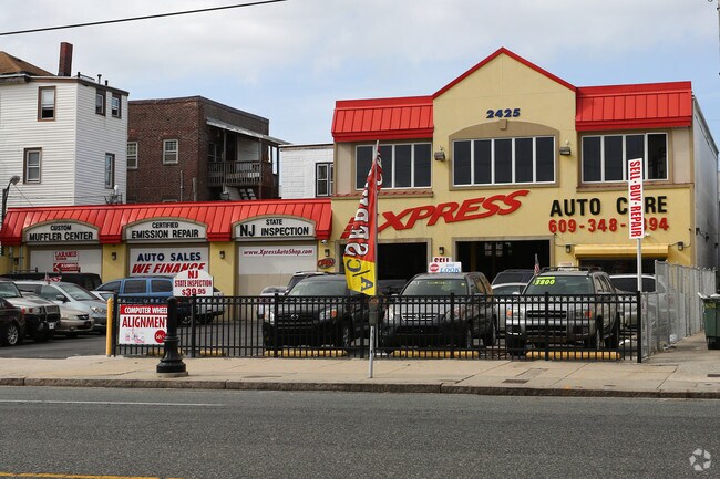
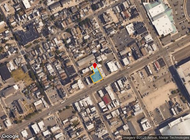
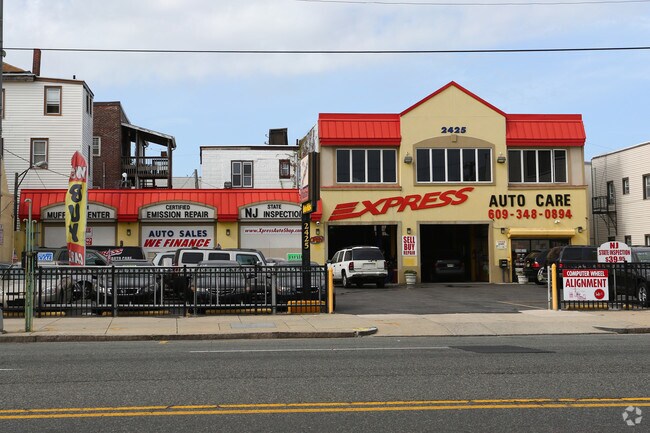
Property Record
2425 Atlantic Ave, Atlantic City, NJ 08401
NEARBY LISTINGS FOR SALE OR LEASE
Property Detail
2425 Atlantic Ave
02-00279-0000-00057
Atlantic
Commercialnec
New Jersey
ARE
57
34001C0452F
0.34 AC
2024
Atlantic City/Hammonton
2025
Philadelphia
002300
Atlantic City-Hammonton, NJ
2,342 SF
DEMOGRAPHICS near 2425 Atlantic Ave
1 Mile
3 Mile
5 Mile
2024 Total Population
20,016
54,288
81,259
2029 Population
20,046
55,435
84,331
Pop Growth 2024-2029
+ 0.15%
+ 2.11%
+ 3.78%
Average Age
38
41
44
2024 Total Households
7,701
22,967
35,503
HH Growth 2024-2029
+ 0.56%
+ 2.16%
+ 4.17%
Median Household Inc
$32,657
$39,013
$50,010
Avg Household Size
2.40
2.20
2.20
2024 Avg HH Vehicles
1.00
1.00
1.00
Median Home Value
$130,585
$237,834
$316,595
Median Year Built
1952
1963
1964
Nearby Places
Map Layers
Map Styles
 Street
 Aerial
- Restaurants
- Banks
- Shops
- Fitness
- Groceries
PUBLIC TRANSPORTATION
COMMUTER RAIL
Atlantic City (Atlantic City Line - NJ Transit Commuter Rail (NJ Transit))
DRIVE
WALK
Distance
Atlantic City (Atlantic City Line - NJ Transit Commuter Rail (NJ Transit))
4 min
16 min
0.9 mi
Absecon (Atlantic City Line - NJ Transit Commuter Rail (NJ Transit))
DRIVE
WALK
Distance
Absecon (Atlantic City Line - NJ Transit Commuter Rail (NJ Transit))
13 min
7.6 mi
AIRPORT
Atlantic City International
DRIVE
WALK
Distance
Atlantic City International
40 min
15.9 mi
Freight Ports
Broadway Terminal - Pier 5
DRIVE
WALK
Distance
Broadway Terminal - Pier 5
71 min
56.2 mi
Nearby Properties
Address
Land Use
TOTAL SIZE
Lot Size
Zoning
Address
Land Use
TOTAL SIZE
Lot Size
Zoning
25.97 AC
HNRA
Address
Land Use
TOTAL SIZE
Lot Size
Zoning
Address
Land Use
TOTAL SIZE
Lot Size
Zoning
2,497,916 SF
6.96 AC
CBD
Address
Land Use
TOTAL SIZE
Lot Size
Zoning
6.20 AC
RS-C
Address
Land Use
TOTAL SIZE
Lot Size
Zoning
11.04 AC
HNRA
Address
Land Use
TOTAL SIZE
Lot Size
Zoning
5,364 SF
142.55 AC
BFRA
Address
Land Use
TOTAL SIZE
Lot Size
Zoning
14.73 AC
RVRA
Address
Land Use
TOTAL SIZE
Lot Size
Zoning
14.71 AC
RS-C
Address
Land Use
TOTAL SIZE
Lot Size
Zoning
69.16 AC
HNRA
Address
Land Use
TOTAL SIZE
Lot Size
Zoning
398,702 SF
4.05 AC
RS-C
Address
Land Use
TOTAL SIZE
Lot Size
Zoning
9.90 AC
RS-C
Address
Land Use
TOTAL SIZE
Lot Size
Zoning
6,552 SF
3.61 AC
RS
Address
Land Use
TOTAL SIZE
Lot Size
Zoning
3.54 AC
HNRA
Address
Land Use
TOTAL SIZE
Lot Size
Zoning
387,249 SF
49.56 AC
HW-C
Address
Land Use
TOTAL SIZE
Lot Size
Zoning
4.33 AC
RS-C
Address
Land Use
TOTAL SIZE
Lot Size
Zoning
Address
Land Use
TOTAL SIZE
Lot Size
Zoning
1.98 AC
RS-C
Address
Land Use
TOTAL SIZE
Lot Size
Zoning
0.78 AC
RS-C
Address
Land Use
TOTAL SIZE
Lot Size
Zoning
2.44 AC
RS-C
Address
Land Use
TOTAL SIZE
Lot Size
Zoning
7.63 AC
RS-C
Address
Land Use
TOTAL SIZE
Lot Size
Zoning
3.01 AC
RS-C
Address
Land Use
TOTAL SIZE
Lot Size
Zoning
2.81 AC
RS-C
Address
Land Use
TOTAL SIZE
Lot Size
Zoning
192,602 SF
5.80 AC
RS-C
Address
Land Use
TOTAL SIZE
Lot Size
Zoning
277,716 SF
5.45 AC
RS-C
Address
Land Use
TOTAL SIZE
Lot Size
Zoning
1.09 AC
RS-C
Address
Land Use
TOTAL SIZE
Lot Size
Zoning
28,520 SF
47.40 AC
M-C
Address
Land Use
TOTAL SIZE
Lot Size
Zoning
2.13 AC
RS-C
Address
Land Use
TOTAL SIZE
Lot Size
Zoning
2.75 AC
Address
Land Use
TOTAL SIZE
Lot Size
Zoning
2.91 AC
RS-C
Address
Land Use
TOTAL SIZE
Lot Size
Zoning
4.30 AC
RS-C
The World's #1 Commercial Real Estate Marketplace
Connect with us
© 2025 CoStar Group
The information above has been obtained from sources believed reliable. While we do not doubt its accuracy we have not verified it and make no guarantee, warranty or representation about it. It is your responsibility to independently confirm its accuracy and completeness. Any projections, opinions, assumptions, or estimates used are for example only and do not represent the current or future performance of the property. The value of this transaction to you depends on tax and other factors which should be evaluated by your tax, financial, and legal advisors. You and your advisors should conduct a careful, independent investigation of the property to determine to your satisfaction the suitability of the property for your needs.