Property Record
2425 N Lapeer Rd, Oxford, MI 48371


NEARBY LISTINGS FOR SALE OR LEASE
-
-
View all Oxford listings for sale on LoopNet.com
Property Detail
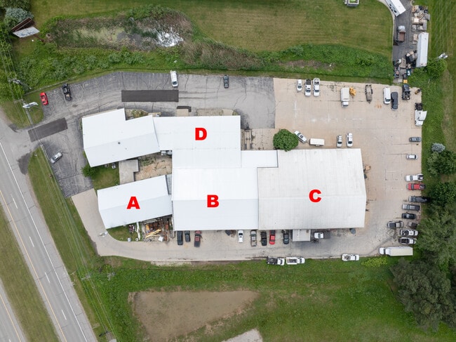
2425 N Lapeer Rd
04-09-300-010
T5N, R10E, SEC 9 PART OF SW 1/4 BEG AT PT DIST S 85-30-03 W 328.10 FT FROM CEN OF SEC, TH S 29-31-57 E 200 FT, TH S 60-28-03
Warehouse
Oakland
X
Michigan
26125C0210F
2.29 AC
2024
Auburn Hills, Pontiac & Rochester
2025
Detroit
121400
Detroit-Warren-Dearborn, MI
31,322 SF
DEMOGRAPHICS near 2425 N Lapeer Rd
1 Mile
3 Mile
5 Mile
2024 Total Population
168
9,640
29,538
2029 Population
165
9,572
29,352
Pop Growth 2024-2029
(1.79%)
(0.71%)
(0.63%)
Average Age
43
41
41
2024 Total Households
62
3,545
10,881
HH Growth 2024-2029
(1.61%)
(0.71%)
(0.64%)
Median Household Inc
$134,868
$115,408
$99,864
Avg Household Size
2.70
2.70
2.70
2024 Avg HH Vehicles
3.00
2.00
2.00
Median Home Value
$328,571
$342,857
$329,071
Median Year Built
1983
1996
1991
Nearby Places
Map Layers
Map Styles
 Street
 Aerial
- Restaurants
- Banks
- Shops
- Fitness
- Groceries
PUBLIC TRANSPORTATION
AIRPORT
Bishop International
DRIVE
WALK
Distance
Bishop International
57 min
39.3 mi
SALE & LEASE HISTORY
LISTING DATE
SALE/LEASE

Jun 06, 2024
For Sale
Jan 30, 2024
For Sale
Feb 20, 2018
For Sale
Nearby Properties
Address
Land Use
TOTAL SIZE
Lot Size
Zoning
Address
Land Use
TOTAL SIZE
Lot Size
Zoning
172,881 SF
16.51 AC
Address
Land Use
TOTAL SIZE
Lot Size
Zoning
148,898 SF
14.55 AC
BI
Address
Land Use
TOTAL SIZE
Lot Size
Zoning
188,367 SF
Address
Land Use
TOTAL SIZE
Lot Size
Zoning
188,367 SF
26.37 AC
Address
Land Use
TOTAL SIZE
Lot Size
Zoning
207,073 SF
19.74 AC
Address
Land Use
TOTAL SIZE
Lot Size
Zoning
78,297 SF
7.53 AC
II
Address
Land Use
TOTAL SIZE
Lot Size
Zoning
70,420 SF
4.49 AC
II
Address
Land Use
TOTAL SIZE
Lot Size
Zoning
61,936 SF
4.71 AC
II
Address
Land Use
TOTAL SIZE
Lot Size
Zoning
51,898 SF
3.56 AC
II
Address
Land Use
TOTAL SIZE
Lot Size
Zoning
60,600 SF
14.31 AC
II
Address
Land Use
TOTAL SIZE
Lot Size
Zoning
49,731 SF
5.75 AC
II
Address
Land Use
TOTAL SIZE
Lot Size
Zoning
26,073 SF
63.54 AC
MM
Address
Land Use
TOTAL SIZE
Lot Size
Zoning
52,000 SF
5.13 AC
II
Address
Land Use
TOTAL SIZE
Lot Size
Zoning
11,483 SF
10.56 AC
BI
Address
Land Use
TOTAL SIZE
Lot Size
Zoning
68,162 SF
4.97 AC
II
Address
Land Use
TOTAL SIZE
Lot Size
Zoning
52,336 SF
5.72 AC
II
Address
Land Use
TOTAL SIZE
Lot Size
Zoning
57,809 SF
6.61 AC
BI
Address
Land Use
TOTAL SIZE
Lot Size
Zoning
21,844 SF
3.82 AC
Address
Land Use
TOTAL SIZE
Lot Size
Zoning
54,826 SF
18.65 AC
II
Address
Land Use
TOTAL SIZE
Lot Size
Zoning
17,936 SF
7.69 AC
IV
Address
Land Use
TOTAL SIZE
Lot Size
Zoning
12,960 SF
5.89 AC
Address
Land Use
TOTAL SIZE
Lot Size
Zoning
45,554 SF
2.74 AC
II
Address
Land Use
TOTAL SIZE
Lot Size
Zoning
10 AC
IV
Address
Land Use
TOTAL SIZE
Lot Size
Zoning
15,390 SF
5.89 AC
Address
Land Use
TOTAL SIZE
Lot Size
Zoning
17,561 SF
0.44 AC
BI
Address
Land Use
TOTAL SIZE
Lot Size
Zoning
46,838 SF
4.56 AC
II
Address
Land Use
TOTAL SIZE
Lot Size
Zoning
22,767 SF
4.60 AC
II
The World's #1 Commercial Real Estate Marketplace
Connect with us
© 2025 CoStar Group
The information above has been obtained from sources believed reliable. While we do not doubt its accuracy we have not verified it and make no guarantee, warranty or representation about it. It is your responsibility to independently confirm its accuracy and completeness. Any projections, opinions, assumptions, or estimates used are for example only and do not represent the current or future performance of the property. The value of this transaction to you depends on tax and other factors which should be evaluated by your tax, financial, and legal advisors. You and your advisors should conduct a careful, independent investigation of the property to determine to your satisfaction the suitability of the property for your needs.