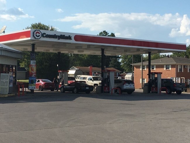
Property Record
2425 S Main St, Madisonville, KY 42431


NEARBY LISTINGS FOR SALE OR LEASE
Property Detail
2425 S Main St
M-24-6-7
Hopkins
Commercialnec
Kentucky
X
1.02 AC
21107C0242D
Kentucky West Area
2025
Other Market Areas
2025
Madisonville, KY
970800
DEMOGRAPHICS near 2425 S Main St
1 Mile
3 Mile
5 Mile
2024 Total Population
1,960
15,962
24,377
2029 Population
1,945
15,864
24,149
Pop Growth 2024-2029
(0.77%)
(0.61%)
(0.94%)
Average Age
40
40
41
2024 Total Households
813
6,769
10,162
HH Growth 2024-2029
(0.86%)
(0.68%)
(0.98%)
Median Household Inc
$49,396
$45,740
$46,639
Avg Household Size
2.30
2.30
2.30
2024 Avg HH Vehicles
2.00
2.00
2.00
Median Home Value
$104,054
$108,697
$123,880
Median Year Built
1971
1970
1973
Nearby Places
Map Layers
Map Styles
 Street
 Aerial
- Restaurants
- Banks
- Shops
- Fitness
- Groceries
SALE & LEASE HISTORY
LISTING DATE
SALE/LEASE

Sep 12, 2017
For Sale
Sep 11, 2017
For Lease
Nearby Properties
Address
Land Use
TOTAL SIZE
Lot Size
Zoning
Address
Land Use
TOTAL SIZE
Lot Size
Zoning
Address
Land Use
TOTAL SIZE
Lot Size
Zoning
25.06 AC
COM
Address
Land Use
TOTAL SIZE
Lot Size
Zoning
19.98 AC
COM
Address
Land Use
TOTAL SIZE
Lot Size
Zoning
3,332 SF
2.57 AC
COM
Address
Land Use
TOTAL SIZE
Lot Size
Zoning
21.19 AC
COM
Address
Land Use
TOTAL SIZE
Lot Size
Zoning
Address
Land Use
TOTAL SIZE
Lot Size
Zoning
1.85 AC
COM
Address
Land Use
TOTAL SIZE
Lot Size
Zoning
5.40 AC
Address
Land Use
TOTAL SIZE
Lot Size
Zoning
2.53 AC
COM
Address
Land Use
TOTAL SIZE
Lot Size
Zoning
3,528 SF
5 AC
COM
Address
Land Use
TOTAL SIZE
Lot Size
Zoning
10.67 AC
COM
Address
Land Use
TOTAL SIZE
Lot Size
Zoning
Address
Land Use
TOTAL SIZE
Lot Size
Zoning
6,570 SF
8.37 AC
COM
Address
Land Use
TOTAL SIZE
Lot Size
Zoning
Address
Land Use
TOTAL SIZE
Lot Size
Zoning
Address
Land Use
TOTAL SIZE
Lot Size
Zoning
185.80 AC
Address
Land Use
TOTAL SIZE
Lot Size
Zoning
2.13 AC
COM
Address
Land Use
TOTAL SIZE
Lot Size
Zoning
197.24 AC
Address
Land Use
TOTAL SIZE
Lot Size
Zoning
Address
Land Use
TOTAL SIZE
Lot Size
Zoning
12.17 AC
Address
Land Use
TOTAL SIZE
Lot Size
Zoning
4.69 AC
COM
Address
Land Use
TOTAL SIZE
Lot Size
Zoning
1.98 AC
Address
Land Use
TOTAL SIZE
Lot Size
Zoning
0.41 AC
COM
Address
Land Use
TOTAL SIZE
Lot Size
Zoning
Address
Land Use
TOTAL SIZE
Lot Size
Zoning
1.61 AC
COM
Address
Land Use
TOTAL SIZE
Lot Size
Zoning
16.32 AC
Address
Land Use
TOTAL SIZE
Lot Size
Zoning
0.78 AC
COM
Address
Land Use
TOTAL SIZE
Lot Size
Zoning
0.86 AC
COM
Address
Land Use
TOTAL SIZE
Lot Size
Zoning
250.86 AC
Address
Land Use
TOTAL SIZE
Lot Size
Zoning
The World's #1 Commercial Real Estate Marketplace
Connect with us
© 2025 CoStar Group
The information above has been obtained from sources believed reliable. While we do not doubt its accuracy we have not verified it and make no guarantee, warranty or representation about it. It is your responsibility to independently confirm its accuracy and completeness. Any projections, opinions, assumptions, or estimates used are for example only and do not represent the current or future performance of the property. The value of this transaction to you depends on tax and other factors which should be evaluated by your tax, financial, and legal advisors. You and your advisors should conduct a careful, independent investigation of the property to determine to your satisfaction the suitability of the property for your needs.