Property Record
2425 State Highway 74, Purcell, OK 73080


NEARBY LISTINGS FOR SALE OR LEASE
Property Detail
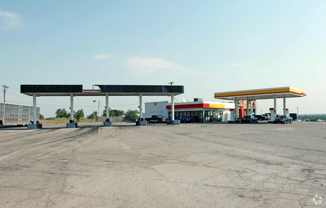
2425 State Highway 74
00002306N02W100600
333 Purcell
Conveniencestore
PT NW SE NE & PT SW NE NE LYING N & W OF HWY 74 (BK 423-PG 491)
X
Mcclain
40087C0300G
Oklahoma
2024
3 AC
2025
Outlying McClain
400203
Oklahoma City
2,805 SF
Oklahoma City, OK
DEMOGRAPHICS near 2425 State Highway 74
1 Mile
3 Mile
5 Mile
2024 Total Population
1,165
5,824
11,853
2029 Population
1,403
6,980
13,852
Pop Growth 2024-2029
+ 20.43%
+ 19.85%
+ 16.86%
Average Age
39
39
40
2024 Total Households
419
2,152
4,384
HH Growth 2024-2029
+ 20.29%
+ 19.89%
+ 16.95%
Median Household Inc
$61,319
$60,668
$60,990
Avg Household Size
2.70
2.60
2.60
2024 Avg HH Vehicles
2.00
2.00
2.00
Median Home Value
$136,000
$156,612
$161,588
Median Year Built
1985
1982
1982
Nearby Places
Map Layers
Map Styles
 Street
 Aerial
- Restaurants
- Banks
- Shops
- Fitness
- Groceries
PUBLIC TRANSPORTATION
COMMUTER RAIL
Purcell Amtrak Station (Heartland Flyer - Amtrak)
DRIVE
WALK
Distance
Purcell Amtrak Station (Heartland Flyer - Amtrak)
5 min
3.0 mi
Freight Ports
Tulsa Port Of Catoosa
DRIVE
WALK
Distance
Tulsa Port Of Catoosa
174 min
158.8 mi
Nearby Properties
Address
Land Use
TOTAL SIZE
Lot Size
Zoning
Address
Land Use
TOTAL SIZE
Lot Size
Zoning
155,763 SF
16.69 AC
NP
Address
Land Use
TOTAL SIZE
Lot Size
Zoning
50,427 SF
4.07 AC
Address
Land Use
TOTAL SIZE
Lot Size
Zoning
24.70 AC
Address
Land Use
TOTAL SIZE
Lot Size
Zoning
3,200 SF
0.96 AC
Address
Land Use
TOTAL SIZE
Lot Size
Zoning
14,050 SF
6.39 AC
Address
Land Use
TOTAL SIZE
Lot Size
Zoning
10 AC
Address
Land Use
TOTAL SIZE
Lot Size
Zoning
14,718 SF
1.62 AC
Address
Land Use
TOTAL SIZE
Lot Size
Zoning
80 AC
Address
Land Use
TOTAL SIZE
Lot Size
Zoning
3,375 SF
0.15 AC
Address
Land Use
TOTAL SIZE
Lot Size
Zoning
1,991 SF
3.50 AC
Address
Land Use
TOTAL SIZE
Lot Size
Zoning
2,320 SF
0.56 AC
Address
Land Use
TOTAL SIZE
Lot Size
Zoning
72,000 SF
11.67 AC
Address
Land Use
TOTAL SIZE
Lot Size
Zoning
25,300 SF
9.50 AC
Address
Land Use
TOTAL SIZE
Lot Size
Zoning
2,473 SF
1.91 AC
Address
Land Use
TOTAL SIZE
Lot Size
Zoning
4,713 SF
1.37 AC
Address
Land Use
TOTAL SIZE
Lot Size
Zoning
3,048 SF
2.42 AC
Address
Land Use
TOTAL SIZE
Lot Size
Zoning
1.50 AC
Address
Land Use
TOTAL SIZE
Lot Size
Zoning
9,000 SF
14 AC
Address
Land Use
TOTAL SIZE
Lot Size
Zoning
1,458 SF
0.80 AC
Address
Land Use
TOTAL SIZE
Lot Size
Zoning
648 SF
3 AC
Address
Land Use
TOTAL SIZE
Lot Size
Zoning
2,360 SF
0.75 AC
Address
Land Use
TOTAL SIZE
Lot Size
Zoning
2,484 SF
0.81 AC
Address
Land Use
TOTAL SIZE
Lot Size
Zoning
7,869 SF
0.45 AC
Address
Land Use
TOTAL SIZE
Lot Size
Zoning
3,296 SF
0.73 AC
Address
Land Use
TOTAL SIZE
Lot Size
Zoning
8,624 SF
1.58 AC
The World's #1 Commercial Real Estate Marketplace
Connect with us
© 2025 CoStar Group
The information above has been obtained from sources believed reliable. While we do not doubt its accuracy we have not verified it and make no guarantee, warranty or representation about it. It is your responsibility to independently confirm its accuracy and completeness. Any projections, opinions, assumptions, or estimates used are for example only and do not represent the current or future performance of the property. The value of this transaction to you depends on tax and other factors which should be evaluated by your tax, financial, and legal advisors. You and your advisors should conduct a careful, independent investigation of the property to determine to your satisfaction the suitability of the property for your needs.