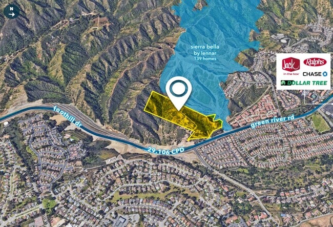
Property Record
2090 Green River Rd, Corona, CA 92882

NEARBY LISTINGS FOR SALE OR LEASE
Property Detail
2090 Green River Rd
101-460-011
15.27 ACRES M/L IN POR SE 1/4 OF SEC 33 T3S R7W FOR TOTAL DESCRIPTION SEE ASSESSORS MAPS
Agriculturalland
Riverside
X
California
06059C0225J
15.27 AC
2024
Corona/Eastvale
2025
Inland Empire (California)
041913
Riverside-San Bernardino-Ontario, CA
DEMOGRAPHICS near 2090 Green River Rd
1 mile
3 mile
5 mile
2024 Total Population
9,726
70,293
139,812
2029 Population
10,207
73,807
146,359
Pop Growth 2024-2029
+ 4.95%
+ 5.00%
+ 4.68%
Average Age
38
37
37
2024 Total Households
3,140
20,629
40,385
HH Growth 2024-2029
+ 4.39%
+ 4.46%
+ 4.15%
Median Household Inc
$99,876
$96,536
$99,546
Avg Household Size
3.00
3.30
3.30
2024 Avg HH Vehicles
2.00
2.00
2.00
Median Home Value
$686,481
$646,331
$653,348
Median Year Built
1986
1984
1986
Nearby Places
Map Layers
Map Styles
 Street
 Aerial
Transit
 Traffic
 Biking
Places
Listings with unknown addresses are not visible on the map
- Restaurants
- Banks
- Shops
- Fitness
- Groceries
PUBLIC TRANSPORTATION
COMMUTER RAIL
West Corona (91 Line - Southern California Regional Rail Authority (Metrolink), Inland Empire-Orange County Line - Southern California Regional Rail Authority (Metrolink))
Drive
Walk
Distance
West Corona (91 Line - Southern California Regional Rail Authority (Metrolink), Inland Empire-Orange County Line - Southern California Regional Rail Authority (Metrolink))
6 min
2.3 mi
North Main Corona (91 Line - Southern California Regional Rail Authority (Metrolink), Inland Empire-Orange County Line - Southern California Regional Rail Authority (Metrolink))
Drive
Walk
Distance
North Main Corona (91 Line - Southern California Regional Rail Authority (Metrolink), Inland Empire-Orange County Line - Southern California Regional Rail Authority (Metrolink))
9 min
4.3 mi
AIRPORT
Ontario International
Drive
Walk
Distance
Ontario International
29 min
19.6 mi
John Wayne/Orange County
Drive
Walk
Distance
John Wayne/Orange County
34 min
26.1 mi
Freight Ports
Port of Long Beach
Drive
Walk
Distance
Port of Long Beach
55 min
40.1 mi
SALE & LEASE HISTORY
LISTING DATE
SALE/LEASE

Nov 10, 2022
For Sale
Nearby Properties
Address
Land Use
TOTAL SIZE
Lot Size
Zoning
Address
Land Use
TOTAL SIZE
Lot Size
Zoning
91,619 SF
12.54 AC
HDR
Address
Land Use
TOTAL SIZE
Lot Size
Zoning
29,695 SF
18.71 AC
R3
Address
Land Use
TOTAL SIZE
Lot Size
Zoning
263,872 SF
12.87 AC
Address
Land Use
TOTAL SIZE
Lot Size
Zoning
245,658 SF
15.38 AC
PD
Address
Land Use
TOTAL SIZE
Lot Size
Zoning
182,066 SF
9.31 AC
Address
Land Use
TOTAL SIZE
Lot Size
Zoning
217,299 SF
7.41 AC
Address
Land Use
TOTAL SIZE
Lot Size
Zoning
141,280 SF
9.31 AC
Address
Land Use
TOTAL SIZE
Lot Size
Zoning
357,900 SF
18.93 AC
Address
Land Use
TOTAL SIZE
Lot Size
Zoning
311,297 SF
13.39 AC
Address
Land Use
TOTAL SIZE
Lot Size
Zoning
482,479 SF
26.14 AC
M2
Address
Land Use
TOTAL SIZE
Lot Size
Zoning
63,130 SF
10.20 AC
R3
Address
Land Use
TOTAL SIZE
Lot Size
Zoning
203,476 SF
10.40 AC
C3
Address
Land Use
TOTAL SIZE
Lot Size
Zoning
110,334 SF
11 AC
NCD
Address
Land Use
TOTAL SIZE
Lot Size
Zoning
95,028 SF
5.44 AC
Address
Land Use
TOTAL SIZE
Lot Size
Zoning
321,700 SF
15.01 AC
M2
Address
Land Use
TOTAL SIZE
Lot Size
Zoning
185,736 SF
9.90 AC
Address
Land Use
TOTAL SIZE
Lot Size
Zoning
98,000 SF
5.17 AC
Address
Land Use
TOTAL SIZE
Lot Size
Zoning
724,238 SF
34.31 AC
Address
Land Use
TOTAL SIZE
Lot Size
Zoning
1,008 SF
41.13 AC
Address
Land Use
TOTAL SIZE
Lot Size
Zoning
150,375 SF
7.11 AC
Address
Land Use
TOTAL SIZE
Lot Size
Zoning
188,875 SF
9.37 AC
Address
Land Use
TOTAL SIZE
Lot Size
Zoning
229,318 SF
10.63 AC
RR
Address
Land Use
TOTAL SIZE
Lot Size
Zoning
242,670 SF
7.71 AC
Address
Land Use
TOTAL SIZE
Lot Size
Zoning
146,339 SF
7.43 AC
RR
Address
Land Use
TOTAL SIZE
Lot Size
Zoning
65,084 SF
3.72 AC
Address
Land Use
TOTAL SIZE
Lot Size
Zoning
57,200 SF
3.48 AC
Address
Land Use
TOTAL SIZE
Lot Size
Zoning
48,560 SF
9.74 AC
Address
Land Use
TOTAL SIZE
Lot Size
Zoning
139,078 SF
1.67 AC
M1
The World's #1 Commercial Real Estate Marketplace
Connect with us
© 2026 CoStar Group
The information above has been obtained from sources believed reliable. While we do not doubt its accuracy we have not verified it and make no guarantee, warranty or representation about it. It is your responsibility to independently confirm its accuracy and completeness. Any projections, opinions, assumptions, or estimates used are for example only and do not represent the current or future performance of the property. The value of this transaction to you depends on tax and other factors which should be evaluated by your tax, financial, and legal advisors. You and your advisors should conduct a careful, independent investigation of the property to determine to your satisfaction the suitability of the property for your needs.