Property Record
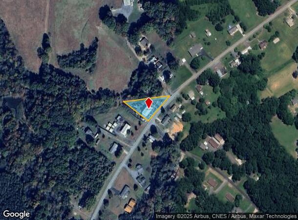
24267 Old Aquadale Rd, Albemarle, NC 28001

NEARBY LISTINGS FOR SALE OR LEASE
Property Detail
24267 Old Aquadale Rd
6547-03-03-7064
W W Hudson Estate Lands
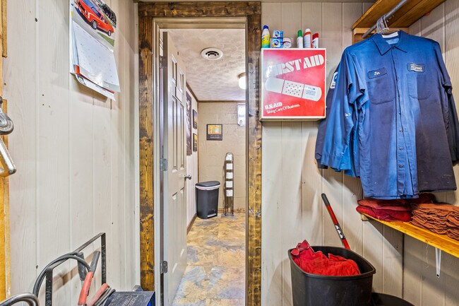
Autorepair
BLDG 24267 OLD AQUADALE 654700020
X
Stanly
3710654700J
North Carolina
2025
0.54 AC
2025
Stanly County
931002
Charlotte
2,088 SF
Albemarle, NC
DEMOGRAPHICS near 24267 Old Aquadale Rd
1 Mile
3 Mile
5 Mile
2024 Total Population
731
12,045
23,807
2029 Population
804
13,089
25,823
Pop Growth 2024-2029
+ 9.99%
+ 8.67%
+ 8.47%
Average Age
42
41
42
2024 Total Households
298
5,080
9,845
HH Growth 2024-2029
+ 9.73%
+ 8.60%
+ 8.43%
Median Household Inc
$55,714
$42,744
$47,903
Avg Household Size
2.30
2.30
2.30
2024 Avg HH Vehicles
3.00
2.00
2.00
Median Home Value
$133,006
$140,841
$159,879
Median Year Built
1970
1963
1968
Nearby Places
Map Layers
Map Styles
 Street
 Aerial
- Restaurants
- Banks
- Shops
- Fitness
- Groceries
PUBLIC TRANSPORTATION
AIRPORT
Concord-Padgett Regional
DRIVE
WALK
Distance
Concord-Padgett Regional
61 min
37.9 mi
SALE & LEASE HISTORY
LISTING DATE
SALE/LEASE

Dec 01, 2022
For Sale
Nearby Properties
Address
Land Use
TOTAL SIZE
Lot Size
Zoning
Address
Land Use
TOTAL SIZE
Lot Size
Zoning
123,879 SF
24.13 AC
Address
Land Use
TOTAL SIZE
Lot Size
Zoning
70,906 SF
4.22 AC
CBD
Address
Land Use
TOTAL SIZE
Lot Size
Zoning
187,271 SF
20.52 AC
GHBD
Address
Land Use
TOTAL SIZE
Lot Size
Zoning
87,267 SF
16.91 AC
MUSCD
Address
Land Use
TOTAL SIZE
Lot Size
Zoning
39,000 SF
44.71 AC
MULTIPLE
Address
Land Use
TOTAL SIZE
Lot Size
Zoning
97,596 SF
6.07 AC
R-8A
Address
Land Use
TOTAL SIZE
Lot Size
Zoning
151,681 SF
14.43 AC
GHBD
Address
Land Use
TOTAL SIZE
Lot Size
Zoning
277,547 SF
25 AC
HID
Address
Land Use
TOTAL SIZE
Lot Size
Zoning
37,670 SF
31.56 AC
Address
Land Use
TOTAL SIZE
Lot Size
Zoning
41,184 SF
0.99 AC
CBD
Address
Land Use
TOTAL SIZE
Lot Size
Zoning
282.74 AC
MULTIPLE
Address
Land Use
TOTAL SIZE
Lot Size
Zoning
9,212 SF
27.04 AC
MULTIPLE
Address
Land Use
TOTAL SIZE
Lot Size
Zoning
140,459 SF
11.62 AC
MULTIPLE
Address
Land Use
TOTAL SIZE
Lot Size
Zoning
30,831 SF
2.32 AC
CBD
Address
Land Use
TOTAL SIZE
Lot Size
Zoning
104,384 SF
11.68 AC
MULTIPLE
Address
Land Use
TOTAL SIZE
Lot Size
Zoning
92,896 SF
7.92 AC
GHBD
Address
Land Use
TOTAL SIZE
Lot Size
Zoning
57,086 SF
1.10 AC
RO
Address
Land Use
TOTAL SIZE
Lot Size
Zoning
56,294 SF
8.80 AC
RO
Address
Land Use
TOTAL SIZE
Lot Size
Zoning
34,624 SF
4.42 AC
Address
Land Use
TOTAL SIZE
Lot Size
Zoning
28,491 SF
4.94 AC
R-10
Address
Land Use
TOTAL SIZE
Lot Size
Zoning
33,200 SF
10.53 AC
MULTIPLE
Address
Land Use
TOTAL SIZE
Lot Size
Zoning
29,124 SF
2.45 AC
MULTIPLE
Address
Land Use
TOTAL SIZE
Lot Size
Zoning
156.13 AC
Address
Land Use
TOTAL SIZE
Lot Size
Zoning
24,802 SF
54.67 AC
R-A
Address
Land Use
TOTAL SIZE
Lot Size
Zoning
7,380 SF
221.39 AC
MULTIPLE
Address
Land Use
TOTAL SIZE
Lot Size
Zoning
4,484 SF
7 AC
R-8A
Address
Land Use
TOTAL SIZE
Lot Size
Zoning
30,945 SF
0.47 AC
CBD
Address
Land Use
TOTAL SIZE
Lot Size
Zoning
35,920 SF
3.36 AC
GHBD
Address
Land Use
TOTAL SIZE
Lot Size
Zoning
21,991 SF
4.16 AC
GHBD
Address
Land Use
TOTAL SIZE
Lot Size
Zoning
36,348 SF
2.13 AC
MULTIPLE
The World's #1 Commercial Real Estate Marketplace
Connect with us
© 2025 CoStar Group
The information above has been obtained from sources believed reliable. While we do not doubt its accuracy we have not verified it and make no guarantee, warranty or representation about it. It is your responsibility to independently confirm its accuracy and completeness. Any projections, opinions, assumptions, or estimates used are for example only and do not represent the current or future performance of the property. The value of this transaction to you depends on tax and other factors which should be evaluated by your tax, financial, and legal advisors. You and your advisors should conduct a careful, independent investigation of the property to determine to your satisfaction the suitability of the property for your needs.