Property Record
2427 Hampton St, Walterboro, SC 29488


Property Detail
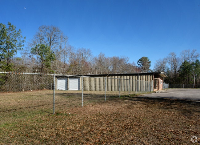
2427 Hampton St
Storebuilding
TRACT FKA COOKS MARINE MAPPLATB 23 MAPPLATP 50
UD
COLLETON
B and X Area of moderate flood hazard, usually the area between the limits of the 100-year and 500-year floods.
South Carolina
2025
1.90 AC
2025
I-95 Walterboro/Hardeeville
970601
Other Market Areas
3,750 SF
164-00-00-109
NEARBY LISTINGS FOR SALE OR LEASE
-
-
View all Walterboro listings for sale on LoopNet.com
DEMOGRAPHICS near 2427 Hampton St
1 mile
3 mile
5 mile
2025 Total Population
1,321
7,712
14,517
2030 Population
1,342
7,814
14,644
Pop Growth 2025-2030
+ 1.59%
+ 1.32%
+ 0.87%
Average Age
39
41
41
2025 Total Households
508
3,089
5,854
HH Growth 2025-2030
+ 1.38%
+ 1.20%
+ 0.73%
Median Household Inc
$29,386
$42,144
$46,796
Avg Household Size
2.50
2.40
2.40
2025 Avg HH Vehicles
2.00
2.00
2.00
Median Home Value
$152,702
$156,335
$169,215
Median Year Built
1986
1979
1981
Nearby Places
Map Layers
Map Styles
 Street
 Aerial
Layers
 Traffic
 Biking
Places
Listings with unknown addresses are not visible on the map
- Restaurants
- Banks
- Shops
- Fitness
- Groceries
PUBLIC TRANSPORTATION
AIRPORT
Charleston AFB/International
Drive
Walk
Distance
Charleston AFB/International
63 min
40.6 mi
Freight Ports
North Charleston Terminal
Drive
Walk
Distance
North Charleston Terminal
70 min
45.4 mi
Nearby Properties
Address
Land Use
TOTAL SIZE
Lot Size
Zoning
Address
Land Use
TOTAL SIZE
Lot Size
Zoning
200,549 SF
2.90 AC
Address
Land Use
TOTAL SIZE
Lot Size
Zoning
3,189 SF
7 AC
UD
Address
Land Use
TOTAL SIZE
Lot Size
Zoning
14,628 SF
2.20 AC
UD
Address
Land Use
TOTAL SIZE
Lot Size
Zoning
1,577 SF
5.60 AC
UD
Address
Land Use
TOTAL SIZE
Lot Size
Zoning
3,273 SF
1,539 AC
ID
Address
Land Use
TOTAL SIZE
Lot Size
Zoning
10,616 SF
1.73 AC
UD
Address
Land Use
TOTAL SIZE
Lot Size
Zoning
15,811 SF
3.30 AC
UD
Address
Land Use
TOTAL SIZE
Lot Size
Zoning
33,376 SF
2.10 AC
UD
Address
Land Use
TOTAL SIZE
Lot Size
Zoning
34,695 SF
1.48 AC
UD
Address
Land Use
TOTAL SIZE
Lot Size
Zoning
33,034 SF
2.75 AC
UD
Address
Land Use
TOTAL SIZE
Lot Size
Zoning
35,316 SF
15 AC
UD
Address
Land Use
TOTAL SIZE
Lot Size
Zoning
58,973 SF
3.43 AC
UD
Address
Land Use
TOTAL SIZE
Lot Size
Zoning
10,223 SF
3.42 AC
UD
Address
Land Use
TOTAL SIZE
Lot Size
Zoning
86,169 SF
9 AC
UD
Address
Land Use
TOTAL SIZE
Lot Size
Zoning
5,384 SF
2.84 AC
UD
Address
Land Use
TOTAL SIZE
Lot Size
Zoning
1,858 SF
3.40 AC
UD
Address
Land Use
TOTAL SIZE
Lot Size
Zoning
23,093 SF
3.13 AC
UD
Address
Land Use
TOTAL SIZE
Lot Size
Zoning
200,549 SF
11.50 AC
UD
Address
Land Use
TOTAL SIZE
Lot Size
Zoning
2,800 SF
1.13 AC
UD
Address
Land Use
TOTAL SIZE
Lot Size
Zoning
14,700 SF
12.80 AC
UD
Address
Land Use
TOTAL SIZE
Lot Size
Zoning
1,126 SF
1.26 AC
UD
Address
Land Use
TOTAL SIZE
Lot Size
Zoning
6,964 SF
1.41 AC
UD
Address
Land Use
TOTAL SIZE
Lot Size
Zoning
34,893 SF
15.50 AC
UD
Address
Land Use
TOTAL SIZE
Lot Size
Zoning
4,243 SF
1.03 AC
UD
Address
Land Use
TOTAL SIZE
Lot Size
Zoning
5,405 SF
0.41 AC
UD
Address
Land Use
TOTAL SIZE
Lot Size
Zoning
11,000 SF
6.60 AC
UD
Address
Land Use
TOTAL SIZE
Lot Size
Zoning
10,209 SF
2.10 AC
UD
Address
Land Use
TOTAL SIZE
Lot Size
Zoning
2,692 SF
0.61 AC
UD
Address
Land Use
TOTAL SIZE
Lot Size
Zoning
14,014 SF
9 AC
UD
The World's #1 Commercial Real Estate Marketplace
Connect with us
© 2026 CoStar Group
The information above has been obtained from sources believed reliable. While we do not doubt its accuracy we have not verified it and make no guarantee, warranty or representation about it. It is your responsibility to independently confirm its accuracy and completeness. Any projections, opinions, assumptions, or estimates used are for example only and do not represent the current or future performance of the property. The value of this transaction to you depends on tax and other factors which should be evaluated by your tax, financial, and legal advisors. You and your advisors should conduct a careful, independent investigation of the property to determine to your satisfaction the suitability of the property for your needs.