Property Record
2428 Falls Dr, Dallas, TX 75211
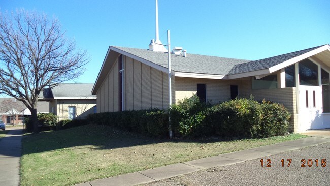

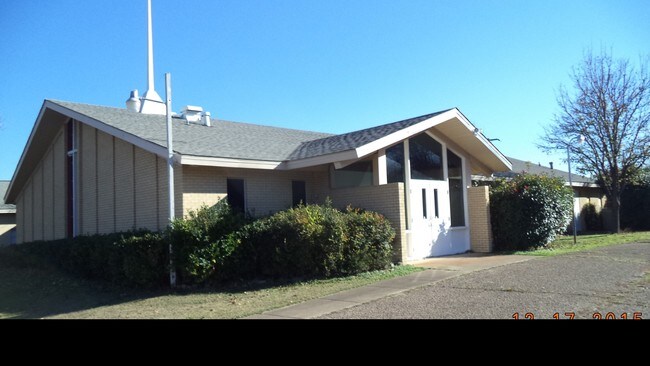
Property Detail
2428 Falls Dr
00000466870000000
BLK 5969 TR 2 ACS 2.517 INT201600098298 DD04142016 CO-DC 5969 000 00200 2005969 000
Religious
Dallas
Z298
Texas
B and X Area of moderate flood hazard, usually the area between the limits of the 100-year and 500-year floods.
2
0
2.52 AC
2025
Southwest Dallas
006401
Dallas/Ft Worth
14,558 SF
Dallas-Fort Worth-Arlington, TX
NEARBY LISTINGS FOR SALE OR LEASE
-
-
View all Dallas listings for sale on LoopNet.com
DEMOGRAPHICS near 2428 Falls Dr
1 mile
3 mile
5 mile
2025 Total Population
21,504
157,490
299,801
2030 Population
21,922
162,118
309,564
Pop Growth 2025-2030
+ 1.94%
+ 2.94%
+ 3.26%
Average Age
37
36
36
2025 Total Households
6,346
51,407
100,004
HH Growth 2025-2030
+ 1.99%
+ 3.12%
+ 3.50%
Median Household Inc
$66,538
$61,957
$59,020
Avg Household Size
3.30
3.00
2.90
2025 Avg HH Vehicles
2.00
2.00
2.00
Median Home Value
$264,426
$277,071
$253,117
Median Year Built
1950
1960
1967
Nearby Places
Map Layers
Map Styles
 Street
 Aerial
Layers
 Traffic
 Biking
Places
Listings with unknown addresses are not visible on the map
- Restaurants
- Banks
- Shops
- Fitness
- Groceries
PUBLIC TRANSPORTATION
TRANSIT/SUBWAY
Hampton Station (DART LIGHT RAIL - RED LINE - Dallas Area Rapid Transit (DART))
Drive
Walk
Distance
Hampton Station (DART LIGHT RAIL - RED LINE - Dallas Area Rapid Transit (DART))
1 min
6 min
0.3 mi
Westmoreland Station (DART LIGHT RAIL - RED LINE - Dallas Area Rapid Transit (DART))
Drive
Walk
Distance
Westmoreland Station (DART LIGHT RAIL - RED LINE - Dallas Area Rapid Transit (DART))
4 min
17 min
0.9 mi
COMMUTER RAIL
Victory Station (DART LIGHT RAIL - GREEN LINE - Dallas Area Rapid Transit (DART), DART LIGHT RAIL - ORANGE LINE - Dallas Area Rapid Transit (DART), TRINITY RAILWAY - Dallas Area Rapid Transit (DART))
Drive
Walk
Distance
Victory Station (DART LIGHT RAIL - GREEN LINE - Dallas Area Rapid Transit (DART), DART LIGHT RAIL - ORANGE LINE - Dallas Area Rapid Transit (DART), TRINITY RAILWAY - Dallas Area Rapid Transit (DART))
11 min
6.7 mi
Medical/Market Ctr Station (TRINITY RAILWAY - Dallas Area Rapid Transit (DART))
Drive
Walk
Distance
Medical/Market Ctr Station (TRINITY RAILWAY - Dallas Area Rapid Transit (DART))
14 min
6.8 mi
AIRPORT
Dallas Love Field
Drive
Walk
Distance
Dallas Love Field
20 min
9.3 mi
Dallas-Fort Worth International
Drive
Walk
Distance
Dallas-Fort Worth International
33 min
22.5 mi
Freight Ports
Port of Shreveport
Drive
Walk
Distance
Port of Shreveport
220 min
202.6 mi
Nearby Properties
Address
Land Use
TOTAL SIZE
Lot Size
Zoning
Address
Land Use
TOTAL SIZE
Lot Size
Zoning
316,447 SF
12.61 AC
Z164
Address
Land Use
TOTAL SIZE
Lot Size
Zoning
1,010,500 SF
45.40 AC
Z116
Address
Land Use
TOTAL SIZE
Lot Size
Zoning
344,801 SF
7.24 AC
Z125
Address
Land Use
TOTAL SIZE
Lot Size
Zoning
283,359 SF
16.25 AC
Z116
Address
Land Use
TOTAL SIZE
Lot Size
Zoning
512,628 SF
2.72 AC
Z239
Address
Land Use
TOTAL SIZE
Lot Size
Zoning
192,086 SF
27.05 AC
Z125
Address
Land Use
TOTAL SIZE
Lot Size
Zoning
343,006 SF
0.53 AC
Z239
Address
Land Use
TOTAL SIZE
Lot Size
Zoning
223,496 SF
3.94 AC
Z164
Address
Land Use
TOTAL SIZE
Lot Size
Zoning
8,727 SF
28.76 AC
Z298
Address
Land Use
TOTAL SIZE
Lot Size
Zoning
248,285 SF
16.59 AC
Z248
Address
Land Use
TOTAL SIZE
Lot Size
Zoning
260,602 SF
6.64 AC
Address
Land Use
TOTAL SIZE
Lot Size
Zoning
333,215 SF
3.04 AC
Address
Land Use
TOTAL SIZE
Lot Size
Zoning
552,991 SF
34.27 AC
Z164
Address
Land Use
TOTAL SIZE
Lot Size
Zoning
292,099 SF
11.08 AC
Z163
Address
Land Use
TOTAL SIZE
Lot Size
Zoning
286,203 SF
1.37 AC
Z239
Address
Land Use
TOTAL SIZE
Lot Size
Zoning
532,726 SF
64.28 AC
Z248
Address
Land Use
TOTAL SIZE
Lot Size
Zoning
291,174 SF
9.49 AC
Z239
Address
Land Use
TOTAL SIZE
Lot Size
Zoning
164,120 SF
15.85 AC
Z163
Address
Land Use
TOTAL SIZE
Lot Size
Zoning
323,000 SF
10 AC
Z164
Address
Land Use
TOTAL SIZE
Lot Size
Zoning
472,800 SF
27.19 AC
Z116
Address
Land Use
TOTAL SIZE
Lot Size
Zoning
238,957 SF
23.50 AC
Z164
Address
Land Use
TOTAL SIZE
Lot Size
Zoning
236,300 SF
4.76 AC
Z239
Address
Land Use
TOTAL SIZE
Lot Size
Zoning
441,328 SF
20.05 AC
Z116
Address
Land Use
TOTAL SIZE
Lot Size
Zoning
138,645 SF
195.45 AC
Z298
Address
Land Use
TOTAL SIZE
Lot Size
Zoning
376,601 SF
28.66 AC
Z116
Address
Land Use
TOTAL SIZE
Lot Size
Zoning
312,118 SF
8.26 AC
Z166
Address
Land Use
TOTAL SIZE
Lot Size
Zoning
131,904 SF
11.99 AC
Z297
Address
Land Use
TOTAL SIZE
Lot Size
Zoning
414,118 SF
49.01 AC
Z294
Address
Land Use
TOTAL SIZE
Lot Size
Zoning
73,485 SF
3.29 AC
Z297
Address
Land Use
TOTAL SIZE
Lot Size
Zoning
146,912 SF
2.74 AC
Z239
The World's #1 Commercial Real Estate Marketplace
Connect with us
© 2026 CoStar Group
The information above has been obtained from sources believed reliable. While we do not doubt its accuracy we have not verified it and make no guarantee, warranty or representation about it. It is your responsibility to independently confirm its accuracy and completeness. Any projections, opinions, assumptions, or estimates used are for example only and do not represent the current or future performance of the property. The value of this transaction to you depends on tax and other factors which should be evaluated by your tax, financial, and legal advisors. You and your advisors should conduct a careful, independent investigation of the property to determine to your satisfaction the suitability of the property for your needs.