Property Record
2430 E 28Th St, Lorain, OH 44055
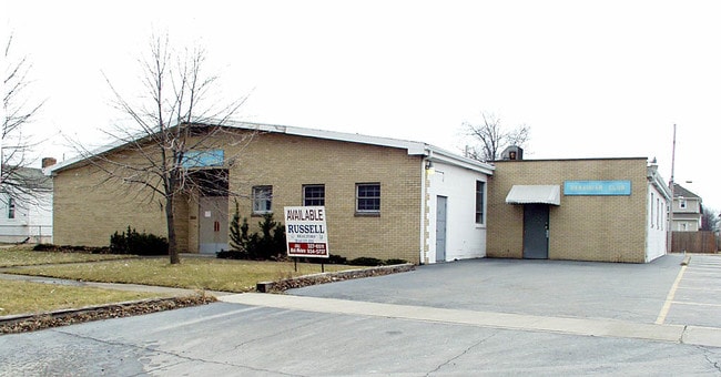

Property Detail
2430 E 28Th St
Cleveland-Elyria, OH
SHEFFIELD LAND CO 100 X 125
03-00-083-109-008
Lorain
Restaurantbuilding
Ohio
B and X Area of moderate flood hazard, usually the area between the limits of the 100-year and 500-year floods.
2037
2024
0.28 AC
2024
Lorain County
023600
Cleveland
6,360 SF
NEARBY LISTINGS FOR SALE OR LEASE
DEMOGRAPHICS near 2430 E 28Th St
1 mile
3 mile
5 mile
2025 Total Population
5,798
47,029
124,056
2030 Population
5,929
48,276
127,063
Pop Growth 2025-2030
+ 2.26%
+ 2.65%
+ 2.42%
Average Age
39
40
41
2025 Total Households
2,214
18,842
51,289
HH Growth 2025-2030
+ 2.30%
+ 2.66%
+ 2.48%
Median Household Inc
$45,993
$54,290
$61,651
Avg Household Size
2.50
2.40
2.30
2025 Avg HH Vehicles
2.00
2.00
2.00
Median Home Value
$116,091
$151,354
$163,950
Median Year Built
1953
1962
1964
Nearby Places
Map Layers
Map Styles
 Street
 Aerial
Transit
 Traffic
 Biking
Places
Listings with unknown addresses are not visible on the map
- Restaurants
- Banks
- Shops
- Fitness
- Groceries
PUBLIC TRANSPORTATION
COMMUTER RAIL
Drive
Walk
Distance
12 min
6.8 mi
AIRPORT
Cleveland-Hopkins International
Drive
Walk
Distance
Cleveland-Hopkins International
32 min
21.0 mi
Nearby Properties
Address
Land Use
TOTAL SIZE
Lot Size
Zoning
Address
Land Use
TOTAL SIZE
Lot Size
Zoning
17,669 SF
22.09 AC
Address
Land Use
TOTAL SIZE
Lot Size
Zoning
85,502 SF
15.47 AC
Address
Land Use
TOTAL SIZE
Lot Size
Zoning
67,074 SF
8.08 AC
Address
Land Use
TOTAL SIZE
Lot Size
Zoning
83,865 SF
6.94 AC
Address
Land Use
TOTAL SIZE
Lot Size
Zoning
66,474 SF
43.04 AC
Address
Land Use
TOTAL SIZE
Lot Size
Zoning
41,842 SF
10.38 AC
Address
Land Use
TOTAL SIZE
Lot Size
Zoning
41,684 SF
3.51 AC
Address
Land Use
TOTAL SIZE
Lot Size
Zoning
53,266 SF
13.30 AC
Address
Land Use
TOTAL SIZE
Lot Size
Zoning
52,392 SF
2.71 AC
Address
Land Use
TOTAL SIZE
Lot Size
Zoning
41,372 SF
2.42 AC
Address
Land Use
TOTAL SIZE
Lot Size
Zoning
48,951 SF
15.71 AC
Address
Land Use
TOTAL SIZE
Lot Size
Zoning
94,519 SF
15.32 AC
Address
Land Use
TOTAL SIZE
Lot Size
Zoning
44,646 SF
6.46 AC
Address
Land Use
TOTAL SIZE
Lot Size
Zoning
159,052 SF
36.16 AC
Address
Land Use
TOTAL SIZE
Lot Size
Zoning
90,319 SF
10.88 AC
Address
Land Use
TOTAL SIZE
Lot Size
Zoning
89,540 SF
4.62 AC
Address
Land Use
TOTAL SIZE
Lot Size
Zoning
60,452 SF
0.61 AC
Address
Land Use
TOTAL SIZE
Lot Size
Zoning
1,887 SF
435.37 AC
Address
Land Use
TOTAL SIZE
Lot Size
Zoning
42,138 SF
24.78 AC
Address
Land Use
TOTAL SIZE
Lot Size
Zoning
18,827 SF
1.68 AC
Address
Land Use
TOTAL SIZE
Lot Size
Zoning
79,705 SF
1.60 AC
Address
Land Use
TOTAL SIZE
Lot Size
Zoning
99,979 SF
3.54 AC
Address
Land Use
TOTAL SIZE
Lot Size
Zoning
42,138 SF
25.24 AC
Address
Land Use
TOTAL SIZE
Lot Size
Zoning
25,923 SF
5.16 AC
Address
Land Use
TOTAL SIZE
Lot Size
Zoning
235,786 SF
12.06 AC
Address
Land Use
TOTAL SIZE
Lot Size
Zoning
33,624 SF
13.17 AC
Address
Land Use
TOTAL SIZE
Lot Size
Zoning
81,720 SF
5.71 AC
Address
Land Use
TOTAL SIZE
Lot Size
Zoning
29,029 SF
6.71 AC
Address
Land Use
TOTAL SIZE
Lot Size
Zoning
59.47 AC
Address
Land Use
TOTAL SIZE
Lot Size
Zoning
104,280 SF
9.18 AC
The World's #1 Commercial Real Estate Marketplace
Connect with us
© 2026 CoStar Group
The information above has been obtained from sources believed reliable. While we do not doubt its accuracy we have not verified it and make no guarantee, warranty or representation about it. It is your responsibility to independently confirm its accuracy and completeness. Any projections, opinions, assumptions, or estimates used are for example only and do not represent the current or future performance of the property. The value of this transaction to you depends on tax and other factors which should be evaluated by your tax, financial, and legal advisors. You and your advisors should conduct a careful, independent investigation of the property to determine to your satisfaction the suitability of the property for your needs.