Property Record
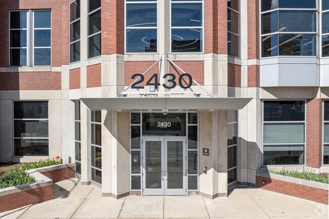
2430 N Halsted St, Chicago, IL 60614

NEARBY LISTINGS FOR SALE OR LEASE
Property Detail
2430 N Halsted St
Chicago-Naperville-Elgin, IL-IN-WI
Goodes
14-29-424-030-0000
Cook
Commercialnec
Illinois
X
1-4
17031C0417K
0.10 AC
2023
Lincoln Park
2024
Chicago
070300
DEMOGRAPHICS near 2430 N Halsted St
1 Mile
3 Mile
5 Mile
2024 Total Population
93,986
501,039
995,991
2029 Population
91,921
489,268
963,759
Pop Growth 2024-2029
(2.20%)
(2.35%)
(3.24%)
Average Age
35
37
37
2024 Total Households
49,993
269,334
492,369
HH Growth 2024-2029
(2.43%)
(2.44%)
(3.13%)
Median Household Inc
$107,790
$109,243
$93,399
Avg Household Size
1.80
1.80
1.90
2024 Avg HH Vehicles
1.00
1.00
1.00
Median Home Value
$668,143
$546,249
$459,761
Median Year Built
1964
1970
1963
Nearby Places
Map Layers
Map Styles
 Street
 Aerial
- Restaurants
- Banks
- Shops
- Fitness
- Groceries
PUBLIC TRANSPORTATION
COMMUTER RAIL
Clybourn Station (Union Pacific North Line - Northeast Illinois Regional Commuter Railroad (Metra), Union Pacific Northwest Line - Northeast Illinois Regional Commuter Railroad (Metra))
DRIVE
WALK
Distance
Clybourn Station (Union Pacific North Line - Northeast Illinois Regional Commuter Railroad (Metra), Union Pacific Northwest Line - Northeast Illinois Regional Commuter Railroad (Metra))
4 min
1.7 mi
Chicago Ogilvie Transportation Center (Union Pacific North Line - Northeast Illinois Regional Commuter Railroad (Metra), Union Pacific Northwest Line - Northeast Illinois Regional Commuter Railroad (Metra), Union Pacific West Line - Northeast Illinois Regional Commuter Railroad (Metra))
DRIVE
WALK
Distance
Chicago Ogilvie Transportation Center (Union Pacific North Line - Northeast Illinois Regional Commuter Railroad (Metra), Union Pacific Northwest Line - Northeast Illinois Regional Commuter Railroad (Metra), Union Pacific West Line - Northeast Illinois Regional Commuter Railroad (Metra))
7 min
3.3 mi
AIRPORT
Chicago Midway International
DRIVE
WALK
Distance
Chicago Midway International
23 min
13.5 mi
Chicago O'Hare International
DRIVE
WALK
Distance
Chicago O'Hare International
24 min
15.0 mi
SALE & LEASE HISTORY
LISTING DATE
SALE/LEASE

Sep 24, 2021
For Lease
Oct 27, 2023
For Lease
Jan 27, 2023
For Lease
Nearby Properties
Address
Land Use
TOTAL SIZE
Lot Size
Zoning
Address
Land Use
TOTAL SIZE
Lot Size
Zoning
1,362,475 SF
1.97 AC
PD 1226
Address
Land Use
TOTAL SIZE
Lot Size
Zoning
1,396,750 SF
4.09 AC
PD 98
Address
Land Use
TOTAL SIZE
Lot Size
Zoning
0.82 AC
PD 1115
Address
Land Use
TOTAL SIZE
Lot Size
Zoning
0.88 AC
DC-16,PD 9
Address
Land Use
TOTAL SIZE
Lot Size
Zoning
4,296,046 SF
6.15 AC
DC-16
Address
Land Use
TOTAL SIZE
Lot Size
Zoning
3,914,400 SF
5.70 AC
DC-16
Address
Land Use
TOTAL SIZE
Lot Size
Zoning
831,084 SF
2.05 AC
PD 316
Address
Land Use
TOTAL SIZE
Lot Size
Zoning
1,316,385 SF
0.76 AC
PD 381
Address
Land Use
TOTAL SIZE
Lot Size
Zoning
1,051,000 SF
0.93 AC
PD 325
Address
Land Use
TOTAL SIZE
Lot Size
Zoning
1,502,279 SF
3.79 AC
PD 98
Address
Land Use
TOTAL SIZE
Lot Size
Zoning
1.09 AC
B1-3
Address
Land Use
TOTAL SIZE
Lot Size
Zoning
1,376,978 SF
0.59 AC
PD 1060
Address
Land Use
TOTAL SIZE
Lot Size
Zoning
959,129 SF
1.32 AC
DC-16
Address
Land Use
TOTAL SIZE
Lot Size
Zoning
1.02 AC
PD 325
Address
Land Use
TOTAL SIZE
Lot Size
Zoning
0.35 AC
PD 325
Address
Land Use
TOTAL SIZE
Lot Size
Zoning
559,589 SF
1.72 AC
C3-5
Address
Land Use
TOTAL SIZE
Lot Size
Zoning
821,186 SF
PD 368
Address
Land Use
TOTAL SIZE
Lot Size
Zoning
0.72 AC
PD 1403
Address
Land Use
TOTAL SIZE
Lot Size
Zoning
1,857,394 SF
3.13 AC
PD 447
Address
Land Use
TOTAL SIZE
Lot Size
Zoning
1,109,372 SF
1.66 AC
PD 368
Address
Land Use
TOTAL SIZE
Lot Size
Zoning
491,382 SF
2.05 AC
PD 316
Address
Land Use
TOTAL SIZE
Lot Size
Zoning
1,284,706 SF
4.40 AC
Address
Land Use
TOTAL SIZE
Lot Size
Zoning
1,300,110 SF
1.52 AC
PD 70
Address
Land Use
TOTAL SIZE
Lot Size
Zoning
835,475 SF
0.58 AC
PD 486
Address
Land Use
TOTAL SIZE
Lot Size
Zoning
1,101,926 SF
0.69 AC
DC-16
Address
Land Use
TOTAL SIZE
Lot Size
Zoning
948,900 SF
0.74 AC
DC-16
Address
Land Use
TOTAL SIZE
Lot Size
Zoning
861,476 SF
0.74 AC
PD 231
Address
Land Use
TOTAL SIZE
Lot Size
Zoning
403,219 SF
1.42 AC
DX-12,DX-1
Address
Land Use
TOTAL SIZE
Lot Size
Zoning
1,587,810 SF
0.33 AC
PD 996,DC-
Address
Land Use
TOTAL SIZE
Lot Size
Zoning
533,325 SF
1.16 AC
PD 381
The World's #1 Commercial Real Estate Marketplace
Connect with us
© 2025 CoStar Group
The information above has been obtained from sources believed reliable. While we do not doubt its accuracy we have not verified it and make no guarantee, warranty or representation about it. It is your responsibility to independently confirm its accuracy and completeness. Any projections, opinions, assumptions, or estimates used are for example only and do not represent the current or future performance of the property. The value of this transaction to you depends on tax and other factors which should be evaluated by your tax, financial, and legal advisors. You and your advisors should conduct a careful, independent investigation of the property to determine to your satisfaction the suitability of the property for your needs.