Property Record
2430 Shorecrest Dr, Dallas, TX 75235

NEARBY LISTINGS FOR SALE OR LEASE
Property Detail
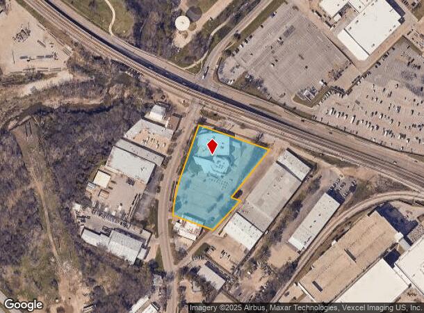
2430 Shorecrest Dr
Dallas-Fort Worth-Arlington, TX
Southwest Airlines Ph 1
00577300010030000
SOUTHWEST AIRLINES PH 1 BLK 1/5773 LT 3 ACS 2.9355 VOL2000066/5941 DD03312000 CO-DC 5773 001 003 2005773 001
Officebuilding
Dallas
X
Texas
48113C0330J
3
2024
2.94 AC
2025
East Brookhollow
000410
Dallas/Ft Worth
42,914 SF
DEMOGRAPHICS near 2430 Shorecrest Dr
1 Mile
3 Mile
5 Mile
2024 Total Population
5,983
74,504
279,388
2029 Population
5,927
74,865
279,882
Pop Growth 2024-2029
(0.94%)
+ 0.48%
+ 0.18%
Average Age
33
35
37
2024 Total Households
1,969
28,717
118,313
HH Growth 2024-2029
(1.12%)
+ 0.52%
+ 0.27%
Median Household Inc
$38,747
$53,983
$74,527
Avg Household Size
2.90
2.50
2.30
2024 Avg HH Vehicles
1.00
2.00
2.00
Median Home Value
$294,906
$374,208
$435,281
Median Year Built
1966
1976
1986
Nearby Places
Map Layers
Map Styles
 Street
 Aerial
- Restaurants
- Banks
- Shops
- Fitness
- Groceries
PUBLIC TRANSPORTATION
TRANSIT/SUBWAY
Burbank Station (Green Line - Dallas Area Rapid Transit (DART), Orange Line - Dallas Area Rapid Transit (DART))
DRIVE
WALK
Distance
Burbank Station (Green Line - Dallas Area Rapid Transit (DART), Orange Line - Dallas Area Rapid Transit (DART))
1 min
10 min
0.5 mi
Bachman Station (DART LIGHT RAIL - GREEN LINE - Dallas Area Rapid Transit (DART), DART LIGHT RAIL - ORANGE LINE - Dallas Area Rapid Transit (DART), Green Line - Dallas Area Rapid Transit (DART), Orange Line - Dallas Area Rapid Transit (DART))
DRIVE
WALK
Distance
Bachman Station (DART LIGHT RAIL - GREEN LINE - Dallas Area Rapid Transit (DART), DART LIGHT RAIL - ORANGE LINE - Dallas Area Rapid Transit (DART), Green Line - Dallas Area Rapid Transit (DART), Orange Line - Dallas Area Rapid Transit (DART))
3 min
16 min
0.8 mi
COMMUTER RAIL
Medical/Market Ctr Station (TRINITY RAILWAY - Dallas Area Rapid Transit (DART))
DRIVE
WALK
Distance
Medical/Market Ctr Station (TRINITY RAILWAY - Dallas Area Rapid Transit (DART))
7 min
3.7 mi
Medical/Market Center (Trinity Railway Express - Dallas Area Rapid Transit (DART))
DRIVE
WALK
Distance
Medical/Market Center (Trinity Railway Express - Dallas Area Rapid Transit (DART))
7 min
3.7 mi
AIRPORT
Dallas Love Field
DRIVE
WALK
Distance
Dallas Love Field
7 min
3.3 mi
Dallas-Fort Worth International
DRIVE
WALK
Distance
Dallas-Fort Worth International
22 min
16.0 mi
Freight Ports
Port of Shreveport
DRIVE
WALK
Distance
Port of Shreveport
224 min
205.2 mi
Nearby Properties
Address
Land Use
TOTAL SIZE
Lot Size
Zoning
Address
Land Use
TOTAL SIZE
Lot Size
Zoning
2,476 SF
1,203.03 AC
Z116
Address
Land Use
TOTAL SIZE
Lot Size
Zoning
2,271,924 SF
Address
Land Use
TOTAL SIZE
Lot Size
Zoning
4,407,366 SF
1,300 AC
IR
Address
Land Use
TOTAL SIZE
Lot Size
Zoning
1,003,498 SF
22.15 AC
Z116
Address
Land Use
TOTAL SIZE
Lot Size
Zoning
1,228,418 SF
24.51 AC
Z151
Address
Land Use
TOTAL SIZE
Lot Size
Zoning
450,131 SF
39.95 AC
Z296
Address
Land Use
TOTAL SIZE
Lot Size
Zoning
1,870,348 SF
12.70 AC
Z151
Address
Land Use
TOTAL SIZE
Lot Size
Zoning
584,652 SF
22.90 AC
Z150
Address
Land Use
TOTAL SIZE
Lot Size
Zoning
30,000 SF
78.01 AC
Z392
Address
Land Use
TOTAL SIZE
Lot Size
Zoning
1,898,977 SF
42.38 AC
Z239
Address
Land Use
TOTAL SIZE
Lot Size
Zoning
729,266 SF
10.20 AC
Z239
Address
Land Use
TOTAL SIZE
Lot Size
Zoning
618,535 SF
1,300 AC
IR
Address
Land Use
TOTAL SIZE
Lot Size
Zoning
641,711 SF
5.38 AC
Z239
Address
Land Use
TOTAL SIZE
Lot Size
Zoning
260,521 SF
30.07 AC
Z150
Address
Land Use
TOTAL SIZE
Lot Size
Zoning
152,036 SF
3.23 AC
Z239
Address
Land Use
TOTAL SIZE
Lot Size
Zoning
253,580 SF
188.04 AC
Z393
Address
Land Use
TOTAL SIZE
Lot Size
Zoning
507,008 SF
5.07 AC
Z239
Address
Land Use
TOTAL SIZE
Lot Size
Zoning
533,342 SF
5.86 AC
Z239
Address
Land Use
TOTAL SIZE
Lot Size
Zoning
1,478,720 SF
6.79 AC
Z239
Address
Land Use
TOTAL SIZE
Lot Size
Zoning
411,043 SF
9.60 AC
Z164
Address
Land Use
TOTAL SIZE
Lot Size
Zoning
1,333,090 SF
19.81 AC
Z150
Address
Land Use
TOTAL SIZE
Lot Size
Zoning
586,073 SF
6 AC
Z239
Address
Land Use
TOTAL SIZE
Lot Size
Zoning
621,941 SF
10.53 AC
Z239
Address
Land Use
TOTAL SIZE
Lot Size
Zoning
272,424 SF
3.69 AC
Z151
Address
Land Use
TOTAL SIZE
Lot Size
Zoning
174,728 SF
223.82 AC
Z298
Address
Land Use
TOTAL SIZE
Lot Size
Zoning
399,655 SF
6.01 AC
Z116
Address
Land Use
TOTAL SIZE
Lot Size
Zoning
100 SF
33.22 AC
Z151
Address
Land Use
TOTAL SIZE
Lot Size
Zoning
100 SF
29.74 AC
Z150
Address
Land Use
TOTAL SIZE
Lot Size
Zoning
343,192 SF
14.99 AC
Z151
Address
Land Use
TOTAL SIZE
Lot Size
Zoning
231,893 SF
14.50 AC
Z239
The World's #1 Commercial Real Estate Marketplace
Connect with us
© 2025 CoStar Group
The information above has been obtained from sources believed reliable. While we do not doubt its accuracy we have not verified it and make no guarantee, warranty or representation about it. It is your responsibility to independently confirm its accuracy and completeness. Any projections, opinions, assumptions, or estimates used are for example only and do not represent the current or future performance of the property. The value of this transaction to you depends on tax and other factors which should be evaluated by your tax, financial, and legal advisors. You and your advisors should conduct a careful, independent investigation of the property to determine to your satisfaction the suitability of the property for your needs.