Property Record
2497 Se Burnside Rd, Gresham, OR 97080
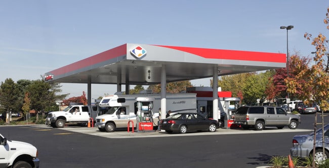

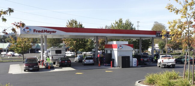
Property Detail
2497 Se Burnside Rd
R709697
PARTITION PLAT 2021-27, LOT 1
Commercialacreage
Multnomah
CC
Oregon
B and X Area of moderate flood hazard, usually the area between the limits of the 100-year and 500-year floods.
1
2025
17.13 AC
2025
Gresham
010411
Portland
188,870 SF
Portland-Vancouver-Hillsboro, OR-WA
NEARBY LISTINGS FOR SALE OR LEASE
DEMOGRAPHICS near 2497 Se Burnside Rd
1 mile
3 mile
5 mile
2025 Total Population
21,576
93,029
171,488
2030 Population
21,128
91,526
168,795
Pop Growth 2025-2030
(2.08%)
(1.62%)
(1.57%)
Average Age
39
40
40
2025 Total Households
7,787
33,691
60,558
HH Growth 2025-2030
(2.47%)
(1.90%)
(1.88%)
Median Household Inc
$71,327
$78,710
$74,969
Avg Household Size
2.60
2.70
2.70
2025 Avg HH Vehicles
2.00
2.00
2.00
Median Home Value
$420,275
$458,024
$453,018
Median Year Built
1980
1984
1982
Nearby Places
Map Layers
Map Styles
 Street
 Aerial
Transit
 Traffic
 Biking
Places
Listings with unknown addresses are not visible on the map
- Restaurants
- Banks
- Shops
- Fitness
- Groceries
Nearby Properties
Address
Land Use
TOTAL SIZE
Lot Size
Zoning
Address
Land Use
TOTAL SIZE
Lot Size
Zoning
40.81 AC
LDR-5
Address
Land Use
TOTAL SIZE
Lot Size
Zoning
Address
Land Use
TOTAL SIZE
Lot Size
Zoning
3.20 AC
DEM
Address
Land Use
TOTAL SIZE
Lot Size
Zoning
137.54 AC
GI
Address
Land Use
TOTAL SIZE
Lot Size
Zoning
300,843 SF
37.27 AC
MUA20
Address
Land Use
TOTAL SIZE
Lot Size
Zoning
302,114 SF
31.69 AC
R-5
Address
Land Use
TOTAL SIZE
Lot Size
Zoning
75,850 SF
11.55 AC
LDR-5
Address
Land Use
TOTAL SIZE
Lot Size
Zoning
8.69 AC
NULL
Address
Land Use
TOTAL SIZE
Lot Size
Zoning
836,366 SF
38.86 AC
LI
Address
Land Use
TOTAL SIZE
Lot Size
Zoning
197,834 SF
8.67 AC
R5
Address
Land Use
TOTAL SIZE
Lot Size
Zoning
237,815 SF
22.70 AC
TLDR
Address
Land Use
TOTAL SIZE
Lot Size
Zoning
118,460 SF
28.10 AC
BP
Address
Land Use
TOTAL SIZE
Lot Size
Zoning
213,544 SF
6.64 AC
A2
Address
Land Use
TOTAL SIZE
Lot Size
Zoning
273,264 SF
11.39 AC
CMF
Address
Land Use
TOTAL SIZE
Lot Size
Zoning
85,380 SF
5.04 AC
TD
Address
Land Use
TOTAL SIZE
Lot Size
Zoning
238,492 SF
13.10 AC
CMF
Address
Land Use
TOTAL SIZE
Lot Size
Zoning
254,580 SF
4.76 AC
TDHC
Address
Land Use
TOTAL SIZE
Lot Size
Zoning
733,232 SF
37.41 AC
NULL
Address
Land Use
TOTAL SIZE
Lot Size
Zoning
222,022 SF
11.64 AC
CMF
Address
Land Use
TOTAL SIZE
Lot Size
Zoning
83,072 SF
9.58 AC
LDR-5
Address
Land Use
TOTAL SIZE
Lot Size
Zoning
95,642 SF
5.30 AC
HI
Address
Land Use
TOTAL SIZE
Lot Size
Zoning
115,600 SF
28.24 AC
LDR-5
Address
Land Use
TOTAL SIZE
Lot Size
Zoning
61,524 SF
7.31 AC
LDR-5
Address
Land Use
TOTAL SIZE
Lot Size
Zoning
235,728 SF
6.64 AC
MDR-24
Address
Land Use
TOTAL SIZE
Lot Size
Zoning
141,899 SF
13.51 AC
DMU
Address
Land Use
TOTAL SIZE
Lot Size
Zoning
19.55 AC
GI
Address
Land Use
TOTAL SIZE
Lot Size
Zoning
87,429 SF
0.95 AC
DTM
Address
Land Use
TOTAL SIZE
Lot Size
Zoning
208,905 SF
10.17 AC
CMF
Address
Land Use
TOTAL SIZE
Lot Size
Zoning
97,430 SF
13.91 AC
HI
Address
Land Use
TOTAL SIZE
Lot Size
Zoning
95,901 SF
4.91 AC
CC
The World's #1 Commercial Real Estate Marketplace
Connect with us
© 2026 CoStar Group
The information above has been obtained from sources believed reliable. While we do not doubt its accuracy we have not verified it and make no guarantee, warranty or representation about it. It is your responsibility to independently confirm its accuracy and completeness. Any projections, opinions, assumptions, or estimates used are for example only and do not represent the current or future performance of the property. The value of this transaction to you depends on tax and other factors which should be evaluated by your tax, financial, and legal advisors. You and your advisors should conduct a careful, independent investigation of the property to determine to your satisfaction the suitability of the property for your needs.